Report on Bagana (Papua New Guinea) — 25 March-31 March 2015
Smithsonian Institution / US Geological Survey
Weekly Volcanic Activity Report, 25 March-31 March 2015
Managing Editor: Sally Sennert.
Please cite this report as:
Global Volcanism Program, 2015. Report on Bagana (Papua New Guinea) (Sennert, S, ed.). Weekly Volcanic Activity Report, 25 March-31 March 2015. Smithsonian Institution and US Geological Survey.
Bagana
Papua New Guinea
6.137°S, 155.196°E; summit elev. 1855 m
All times are local (unless otherwise noted)
Based on analyses of satellite imagery and wind data, the Darwin VAAC reported that on 26 March a low-level ash plume from Bagana drifted 37 km NE. During 27-29 March ash plumes rose to an altitude of 3 km (10,000 ft) a.s.l. and drifted 55 km NE and N. On 1 April an ash plume drifted 75 km SE.
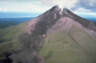
Geological Summary. Bagana volcano, in a remote portion of central Bougainville Island, is frequently active. This massive symmetrical cone was largely constructed by an accumulation of viscous andesitic lava flows. The entire edifice could have been constructed in about 300 years at its present rate of lava production. Eruptive activity is characterized by non-explosive effusion of viscous lava that maintains a small lava dome in the summit crater, although occasional explosive activity produces pyroclastic flows. Lava flows with tongue-shaped lobes up to 50 m thick and prominent levees descend the flanks on all sides.

