Report on Pavlof (United States) — 29 June-5 July 2016
Smithsonian Institution / US Geological Survey
Weekly Volcanic Activity Report, 29 June-5 July 2016
Managing Editor: Sally Sennert.
Please cite this report as:
Global Volcanism Program, 2016. Report on Pavlof (United States) (Sennert, S, ed.). Weekly Volcanic Activity Report, 29 June-5 July 2016. Smithsonian Institution and US Geological Survey.
Pavlof
United States
55.417°N, 161.894°W; summit elev. 2493 m
All times are local (unless otherwise noted)
On 1 July AVO reported that seismicity at Pavlof had increased during the previous 24 hours and minor steam emissions had been recorded by the webcam in the morning. The Aviation Color Code was raised to Yellow and Volcano Alert Level was raised to Advisory. Seismicity on 2 July was lower but remained elevated. Tremor ceased on 3 July but was again detected during 4-5 July.
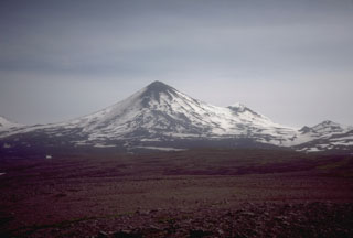
Geological Summary. The most active volcano of the Aleutian arc, Pavlof is a Holocene stratovolcano that was constructed along a line of vents extending NE from the Emmons Lake caldera. Pavlof and Pavlof Sister to the NE form a dramatic pair of symmetrical, glacier-covered stratovolcanoes that overlook Pavlof and Volcano bays. Little Pavlof is a smaller cone on the SW flank of Pavlof volcano, near the rim of Emmons Lake caldera. Unlike Pavlof Sister, eruptions have frequently been reported from Pavlof, typically Strombolian to Vulcanian explosive eruptions from the summit vents and occasional lava flows. The active vents lie near the summit on the north and east sides. The largest recorded eruption took place in 1911, at the end of a 5-year-long eruptive episode, when a fissure opened on the N flank, ejecting large blocks and issuing lava flows.
Source: US Geological Survey Alaska Volcano Observatory (AVO)

