Report on Kanlaon (Philippines) — 20 July-26 July 2016
Smithsonian Institution / US Geological Survey
Weekly Volcanic Activity Report, 20 July-26 July 2016
Managing Editor: Sally Sennert.
Please cite this report as:
Global Volcanism Program, 2016. Report on Kanlaon (Philippines) (Sennert, S, ed.). Weekly Volcanic Activity Report, 20 July-26 July 2016. Smithsonian Institution and US Geological Survey.
Kanlaon
Philippines
10.4096°N, 123.13°E; summit elev. 2422 m
All times are local (unless otherwise noted)
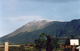
PHIVOLCS reported that during 20-25 July diffuse white plumes rose above Kanlaon; On 20 July plumes were a dirty-white color, and on 25 July they rose 200 m and drifted NW and SW. The Alert Level remained at 1 (on a scale of 0-5).
Geological Summary. Kanlaon volcano (also spelled Canlaon) forms the highest point on the Philippine island of Negros. The massive andesitic stratovolcano is covered with fissure-controlled pyroclastic cones and craters, many of which are filled by lakes. The largest debris avalanche known in the Philippines traveled 33 km SW from Kanlaon. The summit contains a 2-km-wide, elongated northern caldera with a crater lake and a smaller but higher active vent, Lugud crater, to the south. Eruptions recorded since 1866 have typically consisted of phreatic explosions of small-to-moderate size that produce minor local ashfall.
Source: Philippine Institute of Volcanology and Seismology (PHIVOLCS)

