Report on Taal (Philippines) — 30 June-6 July 2021
Smithsonian Institution / US Geological Survey
Weekly Volcanic Activity Report, 30 June-6 July 2021
Managing Editor: Sally Sennert.
Please cite this report as:
Global Volcanism Program, 2021. Report on Taal (Philippines) (Sennert, S, ed.). Weekly Volcanic Activity Report, 30 June-6 July 2021. Smithsonian Institution and US Geological Survey.
Taal
Philippines
14.0106°N, 120.9975°E; summit elev. 311 m
All times are local (unless otherwise noted)
PHIVOLCS reported that anomalously high sulfur dioxide emissions were recorded at Taal, averaging 14,241 and 13,287 tonnes/day on 28 June and 1 July, respectively. Upwelling of hot volcanic fluids in the crater lake produced steam-and-gas plumes that rose as high as 3 km. Vog in the vicinity of the volcano persisted.
At 1516 on 1 July a phreatomagmatic eruption generated a dark, 5-minute-long, Surtseyan plume that rose 1 km above the lake. The Alert Level was raised to 3 (on a scale of 0-5) at 1537. According to news articles and the Philippine Coast Guard, authorities began evacuating residents in Banyaga, Bilibinwang, Gulod, Boso-boso, and Lakeshore Bugaan East around 1700. Four additional short eruptions (less than two minutes) were recorded at 1826, 1921, 1941, and 2020, each ejecting material as high as 200 m. PHIVOLCS noted that TVI is a Permanent Danger Zone (PDZ), and entry into the island as well as high-risk barangays of Agoncillo and Laurel is prohibited.
More phreatomagmatic eruptions on 2 July, at 1025, 1047, and 1101, jetted material 100 m above the lake. Sulfur dioxide emissions averaged 10,254 tonnes/day. Vigorous upwelling in the lake was visible in the afternoon, and steam-and-gas plumes that rose as high as 3 km drifted SW and NW. On 3 July steam-and-gas plumes rose 2.5-3 km and drifted SW and NW. Sulfur dioxide emissions averaged 14,699 tonnes/day, the highest ever measured from Taal. The high emissions and weather conditions again created vog in the area. A news article noted that about 10 children showed signs of illness from the vog.
On 4 July PHIVOLCS issued a special advisory noting, again, a new record-breaking high of sulfur dioxide emissions at 22,628 tonnes/day. A total of 26 strong and very shallow low-frequency volcanic earthquakes below the E part of TVI had been recorded since the beginning of the day. Some of the earthquakes were accompanied by rumbling and weakly felt by fish cage caretakers off the NE shore. Lake upwelling persisted during 5-6 July with steam-and-gas plumes rising 2.5-3 km. Sulfur dioxide emissions averaged 5,299 tonnes/day on 5 July. The DROMIC report stated that 3,027 people were in 20 evacuation centers, and 2,759 people were in private residences by 6 July.
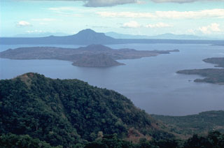
Geological Summary. Taal is one of the most active volcanoes in the Philippines and has produced some powerful eruptions. The 15 x 20 km Talisay (Taal) caldera is largely filled by Lake Taal, whose 267 km2 surface lies only 3 m above sea level. The maximum depth of the lake is 160 m, with several submerged eruptive centers. The 5-km-wide Volcano Island in north-central Lake Taal is the location of all observed eruptions. The island is composed of coalescing small stratovolcanoes, tuff rings, and scoria cones. Powerful pyroclastic flows and surges have caused many fatalities.
Sources: Philippine Institute of Volcanology and Seismology (PHIVOLCS), Disaster Response Operations Monitoring and Information Center (DROMIC), ABS-CBN News, Philippine Coast Guard (PCG)

