Report on La Palma (Spain) — 8 December-14 December 2021
Smithsonian Institution / US Geological Survey
Weekly Volcanic Activity Report, 8 December-14 December 2021
Managing Editor: Sally Sennert.
Please cite this report as:
Global Volcanism Program, 2021. Report on La Palma (Spain) (Sennert, S, ed.). Weekly Volcanic Activity Report, 8 December-14 December 2021. Smithsonian Institution and US Geological Survey.
La Palma
Spain
28.57°N, 17.83°W; summit elev. 2426 m
All times are local (unless otherwise noted)
The eruption at La Palma continued during 8-13 December, characterized by sporadic Strombolian activity, occasional lava jetting, advancing and sometimes branching lava flows, and daily ash-and-gas emissions. Seismicity was low at depths of 10-15 km and very low at depths of 30-40 km. Volcanic tremor levels were also generally low, though they fluctuated near the end of the week concurrent with explosive activity.
During 8-12 December activity at several vents in the central and SE part of the main cone was low, with only sporadic pulses of Strombolian activity and ash emissions. Ash-and-gas plumes rose as high as 3.7 km a.s.l. and drifted SSE, SSW, SW, and W. Very intense gas emissions were recorded during 9-11 December. Small landslides from fractured areas in the upper part of the secondary cone (on the E flank) descended the interior part of the crater as well as the flanks. Lava from the vents moved through tubes towards the western part of the flow field, though two main breakout flows traveled W over older flows. The most active area was along the S margin of flow 9, where 9 and 11 had joined, as lava continued to descend the sea cliff and widen in the area of Las Hoyas. During 11-12 December lobes from the S margins of the flow traveled S over new ground in the Las Norias area.
On 12 December several strong pulses of tremor were accompanied by intense Strombolian activity, with the most intense events at 1200 and 1730 and decreased activity during 1300-1700. A small overflow of lava from one of the vents traveled N over older flows. One of the more intense periods produced dense dark ash plumes that rose 6 km a.s.l. and ejected bombs (some several meters in diameter) as far as 500 m away from the vent. New collapses were visible in the main cone, enlarging the crater, and at the secondary cone. During 12-13 December lava continued to travel W through tubes in the central part of the flow field. At the S margins lava filled in uncovered areas between flows 9 and 11. On 13 December tremor levels fluctuated with pulses of intense signals. A period of major explosive activity during 1745-1900 ejected bombs towards the N flank and produced ash-and-gas plumes. At 1820 video showed lava jetting above the vent and incandescent material falling onto the flanks. Activity at the vents quieted afterwards; tremor decreased at 2000 and by 2200 had reached background levels. Gas emissions from the vents were at high levels through 14 December. Lava continued to advance from the W base of the main cone on 14 December, though at a much lower rate compared to the day before. Small breakouts were visible near Montaña Cogote and Las Norias.
Gas and ash emissions continued to impact island residents. Daily measurements indicated that sulfur dioxide emissions persisted at “high” levels (between 1,000 and 29,999 tons per day). Suspended ash and high concentrations of volcanic gases, specifically sulfur dioxide, triggered periodic air-quality alerts mostly affecting the W part of the island including Los Llanos de Aridane, El Paso, and Tazacorte; authorities warned residents of affected areas to stay indoors. Residents and essential personnel were often barred from entering the exclusion zones to irrigate crops, gather belongings, and remove ash from streets and buildings, especially in Las Manchas, Las Norias, and La Bombilla. During 12-13 December diffuse carbon dioxide emissions were 6.9-7.2 times average background levels, specifically impacting the La Bombilla area where dead birds were observed.
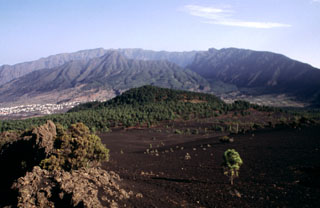
Geological Summary. The 47-km-long wedge-shaped island of La Palma, the NW-most of the Canary Islands, is composed of two large volcanic centers. The older northern one is cut by the steep-walled Caldera Taburiente, one of several massive collapse scarps produced by edifice failure to the SW. On the south, the younger Cumbre Vieja volcano is one of the most active in the Canaries. The elongated volcano dates back to about 125,000 years ago and is oriented N-S. Eruptions during the past 7,000 years have formed abundant cinder cones and craters along the axis, producing fissure-fed lava flows that descend steeply to the sea. Eruptions recorded since the 15th century have produced mild explosive activity and lava flows that damaged populated areas. The southern tip of the island is mantled by a broad lava field emplaced during the 1677-1678 eruption. Lava flows also reached the sea in 1585, 1646, 1712, 1949, 1971, and 2021.
Sources: Instituto Volcanológico de Canarias (INVOLCAN), Instituto Geográfico Nacional (IGN), Gobierno de Canaries