Report on Grimsvotn (Iceland) — 3 August-9 August 2022
Smithsonian Institution / US Geological Survey
Weekly Volcanic Activity Report, 3 August-9 August 2022
Managing Editor: Sally Sennert.
Please cite this report as:
Global Volcanism Program, 2022. Report on Grimsvotn (Iceland) (Sennert, S, ed.). Weekly Volcanic Activity Report, 3 August-9 August 2022. Smithsonian Institution and US Geological Survey.
Grimsvotn
Iceland
64.416°N, 17.316°W; summit elev. 1719 m
All times are local (unless otherwise noted)
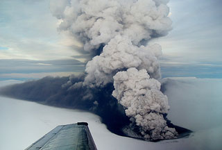
The Icelandic Meteorological Office (IMO) reported that seismicity at Grímsvötn had declined to normal levels during the past few days, and no significant variations from background levels were observed in geochemical or deformation data. On 9 August the Aviation Color Code was lowered to Green.
Geological Summary. Grímsvötn, Iceland's most frequently active volcano in recent history, lies largely beneath the vast Vatnajökull icecap. The caldera lake is covered by a 200-m-thick ice shelf, and only the southern rim of the 6 x 8 km caldera is exposed. The geothermal area in the caldera causes frequent jökulhlaups (glacier outburst floods) when melting raises the water level high enough to lift its ice dam. Long NE-SW-trending fissure systems extend from the central volcano. The most prominent of these is the noted Laki (Skaftar) fissure, which extends to the SW and produced the world's largest known historical lava flow in 1783. The 15 km3 basaltic Laki lavas were erupted over 7 months from a 27-km-long fissure system. Extensive crop damage and livestock losses caused a severe famine that resulted in the loss of one-fifth of the population of Iceland.