Report on Ofu-Olosega (United States) — 24 August-30 August 2022
Smithsonian Institution / US Geological Survey
Weekly Volcanic Activity Report, 24 August-30 August 2022
Managing Editor: Sally Sennert.
Please cite this report as:
Global Volcanism Program, 2022. Report on Ofu-Olosega (United States) (Sennert, S, ed.). Weekly Volcanic Activity Report, 24 August-30 August 2022. Smithsonian Institution and US Geological Survey.
Ofu-Olosega
United States
14.175°S, 169.618°W; summit elev. 639 m
All times are local (unless otherwise noted)
Data from seismometers recently installed on Tutuila, Ta’u, and Ofu-Olosega islands of American Samoa to monitor an ongoing seismic swarm indicated that the events were related to Ta’u Island and not Ofu-Olosega. HVO lowered the Volcano Alert Level to Normal and the Aviation Color Code to Green on 26 August. The report warned residents of Ofu-Olosega that they could still be significantly affected by events that may take place on or around Ta’u Island.
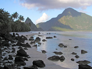
Geological Summary. The two triangle-shaped islands of Ofu and Olosega in eastern Samoa, with a combined length of 6 km, are separated by a narrow strait. The islands are formed by two eroded, coalescing basaltic shield volcanoes whose slopes dip to the east and west. Steep cliffs up to 600-m high truncate the northern and southern sides of the islands. The narrow, steep-sided ridge forming the eastern tip of Ofu Island consists of a dike complex. The shield volcano on Ofu is cut on the north by the A'ofa caldera; bathymetry suggests that a caldera may also exist on the Sili shield volcano of Olosega. The Nu'utele tuff cone, forming a small crescent-shaped island immediately off the west end of Ofu Island, is Holocene in age. A submarine eruption took place in 1866 at the opposite end of the two islands, 3 km SE of Olosega, along the ridge connecting Olosega with Ta'u Island.
Source: US Geological Survey Hawaiian Volcano Observatory (HVO)

