Report on Mauna Loa (United States) — 12 October-18 October 2022
Smithsonian Institution / US Geological Survey
Weekly Volcanic Activity Report, 12 October-18 October 2022
Managing Editor: Sally Sennert.
Please cite this report as:
Global Volcanism Program, 2022. Report on Mauna Loa (United States) (Sennert, S, ed.). Weekly Volcanic Activity Report, 12 October-18 October 2022. Smithsonian Institution and US Geological Survey.
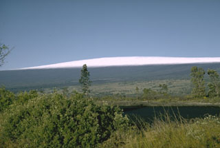
Mauna Loa
United States
19.475°N, 155.608°W; summit elev. 4170 m
All times are local (unless otherwise noted)
HVO reported continuing unrest at Mauna Loa during 12-18 October. The seismic network detected 22-65 daily small-magnitude (below M 3) earthquakes 3-5 km beneath Mokua?weoweo caldera and 6-8 km beneath the upper NW flank of Mauna Loa. Data from Global Positioning System (GPS) instruments at the summit and flanks showed continuing inflation, though data from tiltmeters at the summit did not show significant surface deformation over the past week. A pair of earthquakes, M 4.6 and M 5, were recorded at 0907 on 14 October. The first one was located S of Pahala, just offshore, at a depth of about 13 km. The second earthquake followed 24 seconds later and was located S of Pahala (beneath Highway 11) at a depth of 7.4 km. The earthquakes were followed by more than 150 aftershocks in the Pahala region over the next two days. Twenty of the aftershocks were greater than M 2.5 and four were M 3-4. HVO noted that the unrest was likely driven by accumulation of new magma 3-8 km beneath the summit. The Volcano Alert Level remained at Advisory (the second lowest level on a four-level scale) and the Aviation Color Code remained at Yellow (the second lowest level on a four-color scale).
Geological Summary. Massive Mauna Loa is a basaltic shield volcano that rises almost 9 km from the ocean floor to form the world's largest Holocene volcano. Flank eruptions typically occur from the lengthy NE and SW rift zones, and from the Moku'aweoweo summit is caldera, which is within an older and larger 6 x 8 km caldera. Two of the youngest large debris avalanches documented in Hawaii traveled nearly 100 km from Mauna Loa; the second of the Alika avalanches was emplaced about 105,000 years ago (Moore et al., 1989). Almost 90% of the surface of the volcano is covered by lavas less than 4,000 years old (Lockwood and Lipman, 1987). Beginning about 1,500 years ago, a series of voluminous overflows from a summit lava lake covered about 25% of the volcano's surface. Over the last 750 years, from shortly after the formation of Moku'aweoweo caldera until the present, an additional 25% of the volcano has been covered with lava flows, mainly from summit and NW rift zone vents.
Source: US Geological Survey Hawaiian Volcano Observatory (HVO)