Report on Sabancaya (Peru) — 13 November-19 November 2024
Smithsonian Institution / US Geological Survey
Weekly Volcanic Activity Report, 13 November-19 November 2024
Managing Editor: Sally Sennert.
Please cite this report as:
Global Volcanism Program, 2024. Report on Sabancaya (Peru) (Sennert, S, ed.). Weekly Volcanic Activity Report, 13 November-19 November 2024. Smithsonian Institution and US Geological Survey.
Sabancaya
Peru
15.787°S, 71.857°W; summit elev. 5960 m
All times are local (unless otherwise noted)
Instituto Geofísico del Perú (IGP) reported that the eruption at Sabancaya continued during 11-17 November with a daily average of nine explosions. Gas-and-ash plumes rose as high as 1.4 km above the summit and drifted less than 10 km NW, W, and SW. Thermal anomalies over the lava dome in the summit crater were identified in satellite data. Slight inflation was detected N of Hualca Hualca (7 km N). Sulfur dioxide emissions were at moderate levels, averaging 551 tons per day. The Alert Level remained at Orange (the third level on a four-color scale) and the public was warned to stay outside of a 12 km radius from the summit.
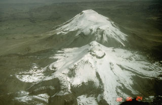
Geological Summary. Sabancaya, located in the saddle NE of Ampato and SE of Hualca Hualca volcanoes, is the youngest of these volcanic centers and the only one to have erupted in historical time. The oldest of the three, Nevado Hualca Hualca, is of probable late-Pliocene to early Pleistocene age. The name Sabancaya (meaning "tongue of fire" in the Quechua language) first appeared in records in 1595 CE, suggesting activity prior to that date. Holocene activity has consisted of Plinian eruptions followed by emission of voluminous andesitic and dacitic lava flows, which form an extensive apron around the volcano on all sides but the south. Records of observed eruptions date back to 1750 CE.

