Report on Raoul Island (New Zealand) — March 1990
Bulletin of the Global Volcanism Network, vol. 15, no. 3 (March 1990)
Managing Editor: Lindsay McClelland.
Raoul Island (New Zealand) Increased microseismicity but no changes in thermal activity
Please cite this report as:
Global Volcanism Program, 1990. Report on Raoul Island (New Zealand) (McClelland, L., ed.). Bulletin of the Global Volcanism Network, 15:3. Smithsonian Institution. https://doi.org/10.5479/si.GVP.BGVN199003-242030
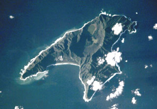
Raoul Island
New Zealand
29.27°S, 177.92°W; summit elev. 516 m
All times are local (unless otherwise noted)
The following observations, made by scientists from the USSR and New Zealand during a cruise of the RV Vulkanolog, were reported by W.F. Giggenbach and I. Menyailov. The island was visited on 30 January 1990.
"A considerable increase in microseismic activity to ~180 events/day, starting at the beginning of January 1990, was recorded by the Raoul Island seismic station. A similar swarm of minor shocks (Adams and Dibble, 1967) and an increase in hydrothermal activity (Healy et al., 1965) preceded the 1964 eruption. There were, however, no significant changes in the appearance and emission rate of thermal fluids from the main area of geothermal discharge along the W shore of Green Lake since the last visit of RV Vulkanolog in March 1988. Water and steam samples were collected in 1988 and 1990. The compositions of the 1988 samples are compared in table 1 with those reported by Weissberg and Sarbutt (1966) for samples collected shortly after the 1964 eruption. Gas compositions point to an essentially hydrothermal origin with insignificant contributions from high-temperature magmatic gases. Heavy seas prevented landing on Curtis Island, the other island in the Kermadecs showing thermal activity."
Table 1. Chemical composition (in mmol/mol of dry gas) of steam samples collected from the main fumarolic vents on Raoul Island in December 1964 (shortly after the 1964 eruption; Weissberg and Sarbutt, 1966) and during the March 1988 cruise of the RV Vulkanolog.
| Dry Gas (mmol/mol) | 08 Dec 1964 | 10 Mar 1988 | ||
| Sample 1 | Sample 2 | Sample 1 | Sample 2 | |
| C | 100 | 83 | 96 | 96 |
| CO2 | 855 | 912 | 984 | 969 |
| H2S | 12.2 | -- | 0.9 | 0.9 |
| He | -- | -- | 0.005 | -- |
| Ne | -- | -- | 0.00008 | -- |
| Ar | -- | -- | 0.07 | 0.28 |
| H2 | -- | 0.7 | 0.3 | 0.2 |
| O2 | 19.2 | 7.3 | <0.1 | 5.0 |
| N2 | 113 | 78 | 14 | 25 |
| CH4 | 0.50 | 1.70 | 0.11 | 0.07 |
References. Adams, R.D., and Dibble, R.R., 1967, Seismological studies of the Raoul Island eruption, 1964: New Zealand Journal of Geology and Geophysics, v. 10, p. 1,348-1,361.
Weissberg, B.G., and Sarbutt, J., 1966, Chemistry of the hydrothermal waters of the volcanic eruption on Raoul Island, November 1964: New Zealand Journal of Science; v. 9, p. 426-432.
Geological Summary. Anvil-shaped Raoul Island is the largest and northernmost of the Kermadec Islands. During the past several thousand years volcanism has been dominated by dacitic explosive eruptions. Two Holocene calderas exist, the older of which cuts the center the island and is about 2.5 x 3.5 km wide. Denham caldera, formed during a major dacitic explosive eruption about 2200 years ago, truncated the W side of the island and is 6.5 x 4 km wide. Its long axis is parallel to the tectonic fabric of the Havre Trough that lies W of the volcanic arc. Historical eruptions during the 19th and 20th centuries have sometimes occurred simultaneously from both calderas, and have consisted of small-to-moderate phreatic eruptions, some of which formed ephemeral islands in Denham caldera. An unnamed submarine cone, one of several located along a fissure on the lower NNE flank, has also erupted during historical time, and satellitic vents are concentrated along two parallel NNE-trending lineaments.
Information Contacts: I. Nairn, P. Otway, B. Scott, and C. Wood, NZGS Rotorua; W. Giggenbach, DSIR Chemistry, Petone.