Report on Ruang (Indonesia) — February 2004
Bulletin of the Global Volcanism Network, vol. 29, no. 2 (February 2004)
Managing Editor: Edward Venzke.
Ruang (Indonesia) Eruption on 25 September 2002 is the largest in Indonesia in many years
Please cite this report as:
Global Volcanism Program, 2004. Report on Ruang (Indonesia) (Venzke, E., ed.). Bulletin of the Global Volcanism Network, 29:2. Smithsonian Institution. https://doi.org/10.5479/si.GVP.BGVN200402-267010
Ruang
Indonesia
2.3058°N, 125.3671°E; summit elev. 703 m
All times are local (unless otherwise noted)
The 25 September 2002 eruption of Ruang (BGVN 27:10 and 28:08) was, according to the Darwin Volcanic Ash Advisory Center (VAAC), the largest in Indonesia for many years and was well observed by satellite sensors. The eruption cloud reached a height of ~ 20 km, and a pyroclastic flow toward the SE damaged an area 1.6 km². Although no village was hit by the pyroclastic flow, two were heavily damaged by very thick ash material.
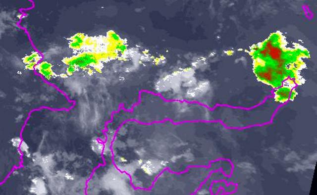
The Darwin VAAC and Bureau of Meteorology have published images and animations of the eruption clouds (figure 2). The satellites and images included those from Aqua/MODIS, GMS Java Animation, and AVHRR sensors. Some ash clouds dispersed towards Singapore and Jakarta. A higher level cloud remained nearly stationary near the tropopause (the top of the troposphere, where most of the Earth's weather occurs). The highest cloud moved eastwards in the stratosphere. The color/shading reflects the strength of the detected ash signal.
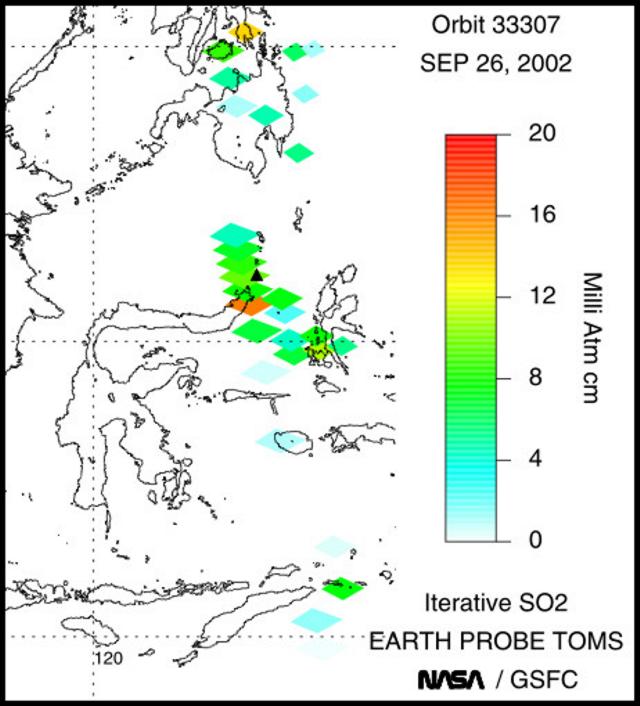
The TOMS scientists published an image on their website (figure 3), described as follows: "The TOMS overpass on September 25 was too early to capture the fresh eruption cloud, but ash and SO2 were evident on the following day. The aerosol signal over S Borneo is at least partly due to smoke from biomass burning; the ash cloud from Ruang can be seen over NE Borneo. A data gap may be obscuring any SO2 or ash immediately W of Ruang."
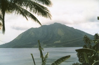
Geological Summary. Ruang volcano is the southernmost volcano in the Sangihe Island arc, north of Sulawesi Island; it is not the better known Raung volcano on Java. The 4 x 5 km island volcano is across a narrow strait SW of the larger Tagulandang Island. The summit contains a crater partially filled by a lava dome initially emplaced in 1904. Explosive eruptions recorded since 1808 have often been accompanied by lava dome formation and pyroclastic flows that have damaged inhabited areas.
Information Contacts: Darwin Volcanic Ash Advisory Center (VAAC), Commonwealth Bureau of Meteorology, Northern Territory Regional Office, PO Box 40050, Casuarina, NT 0811, Australia (URL: http://www.bom.gov.au/info/vaac/); Nia Haerani, Directorate of Volcanology and Geological Hazards (formerly VSI), Jalan Diponegoro No 57, Bandung 40122, Indonesia (URL: http://www.vsi.esdm.go.id/); Simon A. Carn and Arlin Krueger, Joint Center for Earth Systems Technology (NASA/UMBC), University of Maryland, Baltimore County, 1000 Hilltop Circle, Baltimore, MD 21250, USA (URL: https://so2.gsfc.nasa.gov/).


