Report on Soputan (Indonesia) — January 2007
Bulletin of the Global Volcanism Network, vol. 32, no. 1 (January 2007)
Managing Editor: Richard Wunderman.
Soputan (Indonesia) December 2006 lava dome still venting ash
Please cite this report as:
Global Volcanism Program, 2007. Report on Soputan (Indonesia) (Wunderman, R., ed.). Bulletin of the Global Volcanism Network, 32:1. Smithsonian Institution. https://doi.org/10.5479/si.GVP.BGVN200701-266030
Soputan
Indonesia
1.112°N, 124.737°E; summit elev. 1785 m
All times are local (unless otherwise noted)
Growth of the lava dome at Soputan began in 1991 (BGVN 16:06), eventually overtopping the crater rim and generating rockfalls to distances of 2-4 km downslope. Phreatic eruptions since that time have been triggered during the rainy season, and ash explosions have been frequent since 2000. An eruption and dome collapse in July 2005 sent a pyroclastic flow to a distance of 3 km from the summit. The nearest residents are at a distance of 8 km, so none of these events created hazards to the local population. Following pyroclastic avalanches and Strombolian activity in late December 2005 (BGVN 31:04), the Centre of Volcanology and Geological Hazard Mitigation (CVGHM) did not report further activity at Soputan until December 2006.
Lava dome volume in early December 2006 was reported to be 34 million cubic meters. Rockfall signals from the lava dome typically occur at a rate of about 75 per day, but the number of these events increased to 153 on 11 December, and remained high over the next two days: 120 on 12 December and 126 on the 13th. Volcanic tremor amplitude also increased on 11 December. Although thick fog hampered observations, "white smoke" was seen rising 25-30 m above the summit. At 1400 on 14 December a "thunderous" eruption was heard at the CVGHM observation post 8 km from the summit. Gray ash plumes rising 250 m above the summit caused ashfall within a 15-km radius. On 15 December the Alert Level was raised from 2 to 3 (on a scale of 1-4) due to this increase in activity.
A precautionary aviation advisory was issued by the Darwin VAAC on 18 December based on information from the CVGHM. A few hours later a plume was detected on an MTSAT image taken at 1933. The high-level eruption may have reached an altitude of 12 km altitude with the plume extending 37 km to the W.
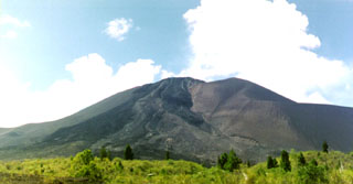
Geological Summary. The Soputan stratovolcano on the southern rim of the Quaternary Tondano caldera on the northern arm of Sulawesi Island is one of Sulawesi's most active volcanoes. The youthful, largely unvegetated volcano is the only active cone in the Sempu-Soputan volcanic complex, which includes the Soputan caldera, Rindengan, and Manimporok (3.5 km ESE). Kawah Masem maar was formed in the W part of the caldera and contains a crater lake; sulfur has been extracted from fumarolic areas in the maar since 1938. Recent eruptions have originated at both the summit crater and Aeseput, a prominent NE-flank vent that formed in 1906 and was the source of intermittent major lava flows until 1924.
Information Contacts: Center of Volcanology and Geological Hazard Mitigation (CVGHM), Diponegoro 57, Bandung, Jawa Barat 40122, Indonesia (URL: http://vsi.esdm.go.id/); Jenny Farlow, Darwin Volcanic Ash Advisory Centre, Bureau of Meteorology, Australia (URL: http://www.bom.gov.au/info/vaac/).

