Report on Batu Tara (Indonesia) — February 2008
Bulletin of the Global Volcanism Network, vol. 33, no. 2 (February 2008)
Managing Editor: Richard Wunderman.
Batu Tara (Indonesia) Satellite thermal anomalies indicate that near-daily eruptions continue
Please cite this report as:
Global Volcanism Program, 2008. Report on Batu Tara (Indonesia) (Wunderman, R., ed.). Bulletin of the Global Volcanism Network, 33:2. Smithsonian Institution. https://doi.org/10.5479/si.GVP.BGVN200802-264260
Batu Tara
Indonesia
7.791°S, 123.585°E; summit elev. 633 m
All times are local (unless otherwise noted)
Our last report (the first ever for this volcano) covered eruptive activity through 13 October 2007 (BGVN 32:12). This report continues coverage through early April 2008.
Thermal anomalies were first measured by the MODIS satellites on 17 January 2007 (1420 UTC). According to the Hawai'i Institute of Geophysics and Planetology (HIGP) Thermal Alerts System, through the end of 2007 anomalies were measured every 1 to 7 days. This trend of nearly daily anomalies continued up to 9 April 2008, with the following exceptions: a 10-day gap beginning 21 December 2007, a 10-day gap beginning 8 January 2008, and a 21-day gap beginning 2 February 2008.
The regularity and repeating character of the thermal anomalies suggest ongoing venting of hot fragmental material or lava flows, similar to March and April 2007 (BGVN 32:12). However, the late 2007 and early 2008 behavior and deposits have not been observed.
On 4 February 2008, the Center of Volcanology and Geological Hazard Mitigation (CVGHM) reported that since 9 October 2007, white plumes were a daily occurrence. On 8 January 2008, gray plumes rose to 1.5 km altitude and drifted E. On 26 January, white plumes rose to altitudes of 1.7 km and drifted E. On 30 January, white plumes rose to altitudes of 1.5 km. and drifted E. The Darwin VAAC reported that eruption plumes were observed from a ship on 31 January, but ash was not seen in satellite imagery. The Alert level remained at 1 (on a scale of 1-4).
On 11 March the Darwin VAAC reported that satellite imagery that day revealed an ash-and-steam plume from Batu Tara that rose to an altitude of 3 km and drifted SW. On 12 March satellite imagery revealed an ash-and-steam plume at an altitude of 2.1 km moving SE.
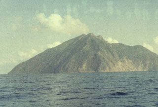
Geological Summary. The small isolated island of Batu Tara in the Flores Sea ~50 km N of Lembata (fomerly Lomblen) Island and the main volcanic arc. A scarp on the eastern side reaches the sea, and vegetation covers the other flanks to within 50 m of the summit. This volcano is noted for its potassic leucite-bearing basanitic and tephritic rocks. The first recorded eruption, during 1847-52, produced explosions and a lava flow.
Information Contacts: Darwin Volcanic Ash Advisory Centre, Bureau of Meteorology, Commonwealth of Australia (URL: http://www.bom.gov.au/info/vaac); Center of Volcanology and Geological Hazard Mitigation (CVGHM), Jalan Diponegoro 57, Bandung 40122, Indonesia (URL: http://www.vsi.esdm.go.id/); Hawai'i Institute of Geophysics and Planetology (HIGP) Thermal Alerts System, School of Ocean and Earth Science and Technology (SOEST), Univ. of Hawai'i, 2525 Correa Road, Honolulu, HI 96822, USA (URL: http://modis.higp.hawaii.edu/).