Report on Soputan (Indonesia) — September 2008
Bulletin of the Global Volcanism Network, vol. 33, no. 9 (September 2008)
Managing Editor: Richard Wunderman.
Soputan (Indonesia) Eruptions with ash plumes in June and October 2008
Please cite this report as:
Global Volcanism Program, 2008. Report on Soputan (Indonesia) (Wunderman, R., ed.). Bulletin of the Global Volcanism Network, 33:9. Smithsonian Institution. https://doi.org/10.5479/si.GVP.BGVN200809-266030
Soputan
Indonesia
1.112°N, 124.737°E; summit elev. 1785 m
All times are local (unless otherwise noted)
Activity at Soputan stratovolcano was characterized in an October 2008 report by the Centre of Volcanology and Geological Hazard Mitigation (CVGHM) as ongoing growth of a lava dome since 1991. This growth has often been accompanied by ash eruptions.
Activity through 23 November 2007 included an eruption in August 2007 and several ash plumes, a lava flow, and rock avalanches (BGVN 32:11). Ash from an event in October remained in the area for about two days, affecting important flight routes. No further information was available until CVGHM reported deformation in May 2008.
According to the CVGHM, seismicity increased during 1-6 June. On 6 June, the volcano erupted, causing part of the crater wall to collapse, creating an opening to the W and increasing the diameter of the crater. A pyroclastic flow, possibly generated by a rockfall avalanche, traveled down the E flank about 1.5 km; a number of nearby villages were covered with tephra. Based on observations of satellite imagery, the Darwin Volcanic Ash Advisory Centre (VAAC) reported that an ash plume rose to an altitude of 13.7 km on 6 June and drifted SW. Ash deposits were about 4 cm thick in an area 5 km NW, and a nearby coconut plantation reported damage to trees. The Alert Level was raised to 3 (on a scale of 1-4). Residents and tourists were advised not go within a 6 km radius of the summit.
During 7-18 June, seismicity decreased and white plumes at altitudes at or less than 1.8 km were spotted when clouds did not inhibit observations. On 18 June, the Alert Level was decreased to 2.
The next episode of seismic activity was on 6 October. Loud noises were heard and observers noted Strombolian activity that ejected incandescent material 100-150 m from the crater. CVGHM noted that a thick gray ash plume rose 2.8 km in altitude. (According to the Darwin VAAC, analysis of satellite imagery suggested that the ash plume rose to the much greater altitude of 7.6 km and drifted W.)
Based on these visual observations and on earthquake and tiltmeter deformation data, the volcano alert level was raised from 2 to 3. Residents and tourists were again advised not go within a 6 km radius of the summit.
On 7 October 2008, CVGHM reported that white plumes rose to altitudes of 2.3-3.3 km. Incandescent material was ejected 50-150 m from the crater, and incandescent rockfalls traveled 500 m W. The following day, plumes rose to an altitude of 2 km.
After 9 October, seismic activity decreased. On 20 October 2008, white and gray smoke rose from the crater to a height of 200 m above the peak. On 21 October, the Alert level was lowered from 3 to 2.
Thermal anomalies. Coinciding with the observed eruptions, MODVOLC thermal alerts were measured during 6-20 October 2008 (table 7). The set begins with 24 pixels measured at 1355 UTC (2155 local) on 6 October 2008. (If each pixel represented an area of 1-2 km2, the resulting area of thermal sources, including lava flows or other material ejected from the volcano, and possible fires, would be on the order of 25-50 km2.) After a second set of 11 alerts measured 3 hours later on 6 October, the alerts dropped to 1-2 on several days through 20 October.
[The last thermal alert detected in 2008 was at 0130 on 2 November (local time).]
Table 7. MODIS/MODVOLC satellite thermal anomalies measured at Soputan during October 2008. No anomalies were measured from the beginning of the year 2008 to 5 October. Courtesy of HIGP Thermal Alerts System.
| Date | Time (UTC) | Pixels | Satellite |
| 06 Oct 2008 | 1355 | 24 | Terra |
| 06 Oct 2008 | 1655 | 11 | Aqua |
| 13 Oct 2008 | 1405 | 1 | Terra |
| 13 Oct 2008 | 1700 | 1 | Aqua |
| 16 Oct 2008 | 1435 | 1 | Terra |
| 16 Oct 2008 | 1730 | 2 | Aqua |
| 20 Oct 2008 | 1410 | 1 | Terra |
| 20 Oct 2008 | 1705 | 1 | Aqua |
Reference. International Civil Aviation Organization (ICAO), 2008, Twelfth Meeting of the Communications/Navigation/Surveillance and Meteorology Sub-Group of APANPIRG (CNS/MET/SG/12): VAAC Darwin Report July 2007-June 2008, Bangkok, Indonesia, 21-25 July 2008.
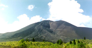
Geological Summary. The Soputan stratovolcano on the southern rim of the Quaternary Tondano caldera on the northern arm of Sulawesi Island is one of Sulawesi's most active volcanoes. The youthful, largely unvegetated volcano is the only active cone in the Sempu-Soputan volcanic complex, which includes the Soputan caldera, Rindengan, and Manimporok (3.5 km ESE). Kawah Masem maar was formed in the W part of the caldera and contains a crater lake; sulfur has been extracted from fumarolic areas in the maar since 1938. Recent eruptions have originated at both the summit crater and Aeseput, a prominent NE-flank vent that formed in 1906 and was the source of intermittent major lava flows until 1924.
Information Contacts: Hawai'i Institute of Geophysics and Planetology (HIGP) Thermal Alerts System, School of Ocean and Earth Science and Technology (SOEST), Univ. of Hawai'i, 2525 Correa Road, Honolulu, HI 96822, USA (URL: http://modis.higp.hawaii.edu/); Center of Volcanology and Geological Hazard Mitigation (CVGHM), Diponegoro 57, Bandung, Jawa Barat 40122, Indonesia (URL: http://vsi.esdm.go.id/); Darwin Volcanic Ash Advisory Center (VAAC), Bureau of Meteorology, Northern Territory Regional Office, PO Box 40050, Casuarina, Northern Territory 0811, Australia (URL: http://www.bom.gov.au/info/vaac/).

