Report on Nyiragongo (DR Congo) — March 1977

Natural Science Event Bulletin, vol. 2, no. 3 (March 1977)
Managing Editor: David Squires.
Nyiragongo (DR Congo) Investigation shows that lava lake drained through flank fissures
Please cite this report as:
Global Volcanism Program, 1977. Report on Nyiragongo (DR Congo) (Squires, D., ed.). Natural Science Event Bulletin, 2:3. Smithsonian Institution. https://doi.org/10.5479/si.GVP.NSEB197703-223030
Nyiragongo
DR Congo
1.52°S, 29.25°E; summit elev. 3470 m
All times are local (unless otherwise noted)
At 1015 on 10 January, Nyiragongo's lava lake, present in the main crater since 1928, began to drain rapidly through a system of parallel fissures that opened simultaneously on the N (Baruta) and S (Shaheru and Djoga) flanks of the volcano (figure 1). Within 1 hour, 20-22 x 106 m3 of melilite nephelinite lava poured from the fissures. The flows, which moved downslope at up to 60 km/hour, were pahoehoe type for most of their length, but changed to aa at their distal ends. Mean flow thickness was about 1 m, ranging from a few mm near the fissures to about 2 m at flow fronts (figures 2 and 3). No spatter ramparts or hornitos were observed. About 70 persons were killed and 800 left homeless by the lava, which destroyed about 1,200 hectares of agricultural land.
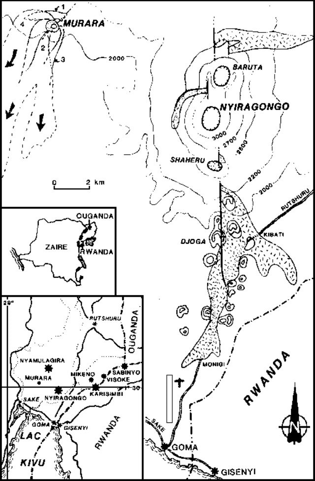 |
Figure 1. Map of eruption sites and lava flows at Nyiragongo and Nyamuragira's 1977 Murara vent. The location of the stippled flow on Nyiragongo was provided by M. Krafft. Courtesy of Y. Pottier. |
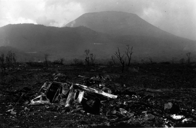 |
Figure 2. Nyiragongo (background) and the 10 January lava flow with destroyed vehicle (VW Combi) in foreground. Photograph by M. Krafft. |
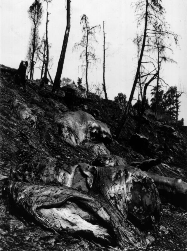 |
Figure 3. January 1977 Nyiragongo pahoehoe lava, with flow texture showing its extreme fluidity. Photograph by M. Krafft. |
Five days before the eruption, the lava lake had risen to its highest recorded level, partially covering the terraces which had surrounded it. The rapid draining of the lava lake caused the partial collapse of the terraces, where groundwater flashed to steam, producing a dark gray cloud that rose more than 1 km before being blown towards Goma. Goma was plunged into semi-darkness and most of its residents fled to neighboring Rwanda.
Seven hours after the eruption began, lava effusion had completely ended, but fumarolic activity continued. At 1500 on 16 January, a strong gas eruption from the main crater projected a cloud containing little or no solid material to about 1 km above the volcano. At 1550, earthquakes felt on the crater rim preceded the collapse of what remained of the terraces, terminating major gas emission. Weak fumarolic activity persisted. The crater, with a bottom filled with debris, was ~1,200 m in diameter and l,000 m deep after the 16 January events.
Further References. Nakamura, Y., and Aoki, K., 1980, The 1977 eruption of Nyiragongo volcano, eastern Africa, and chemical composition of the ejecta: Bulletin of the Volcanological Society of Japan, v. 25, no. 2, p. 17-32.
Pottier, Y., 1978, Première eruption historique du Nyiragongo et manifestations adventives simultanées du Volcan Nyamulagira (Chaine des Virunga-Kivu-Zaire: Decembre 76-Juin 77): Musée Royal de l'Afrique Centrale (Tervuren, Belgium): Rapport Annual du Département de Géologie et de Minéralogie (1977), p. 157-175.
Tazieff, H., 1976/7, An exceptional eruption: Mt. Nyiragongo, January 10th, 1977: BV, v. 40, p. 189-200.
Geological Summary. The Nyiragongo stratovolcano contained a lava lake in its deep summit crater that was active for half a century before draining catastrophically through its outer flanks in 1977. The steep slopes contrast to the low profile of its neighboring shield volcano, Nyamuragira. Benches in the steep-walled, 1.2-km-wide summit crater mark levels of former lava lakes, which have been observed since the late-19th century. Two older stratovolcanoes, Baruta and Shaheru, are partially overlapped by Nyiragongo on the north and south. About 100 cones are located primarily along radial fissures south of Shaheru, east of the summit, and along a NE-SW zone extending as far as Lake Kivu. Many cones are buried by voluminous lava flows that extend long distances down the flanks, which is characterized by the eruption of foiditic rocks. The extremely fluid 1977 lava flows caused many fatalities, as did lava flows that inundated portions of the major city of Goma in January 2002.
Information Contacts: H. Tazieff, Paris; M. Krafft, Ensisheim; Y. Pottier, IRS.