Report on Taal (Philippines) — 3 March-9 March 2021
Smithsonian Institution / US Geological Survey
Weekly Volcanic Activity Report, 3 March-9 March 2021
Managing Editor: Sally Sennert.
Please cite this report as:
Global Volcanism Program, 2021. Report on Taal (Philippines) (Sennert, S, ed.). Weekly Volcanic Activity Report, 3 March-9 March 2021. Smithsonian Institution and US Geological Survey.
Taal
Philippines
14.0106°N, 120.9975°E; summit elev. 311 m
All times are local (unless otherwise noted)
PHIVOLCS raised the Alert Level for Taal to 2 (on a scale of 0-5) on 9 March based on increased activity recorded since 13 February. During 8-9 March the seismic network recorded a total of 28 volcanic tremor events, four low-frequency volcanic earthquakes, and one hybrid event at depths of less than 1.5 km. These events added to the totals of 866 volcanic tremor events and 141 low-frequency volcanic earthquakes recorded during 13 February-9 March. Overall, seismicity over the past month indicated increased magmatic and hydrothermal activity at shallow depths beneath Taal Volcano Island (TVI).
Over the past month minor deformation centered at a source beneath the SE part of TVI was evident in monitoring data, including integrated real-time ground tilt and continuous GPS, daily Electronic Distance Measurement (EDM) monitoring, and InSAR. The data also showed slow and steady inflation across the Taal region after the 2020 eruption. Geochemical data collected from Taal’s Main Crater lake indicated a continuous acidification of the water from pH 2.79 to 1.59 between January 2020 and mid-February 2021. Microgravity data was consistent with magma migration. PHIVOLCS strongly recommended no entry onto the island, and access to the Main Crater and Daang Kastila fissure (along the walking trail) was strictly prohibited.
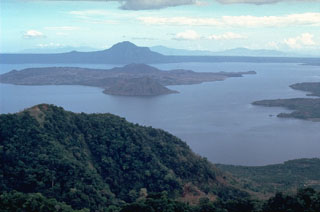
Geological Summary. Taal is one of the most active volcanoes in the Philippines and has produced some powerful eruptions. The 15 x 20 km Talisay (Taal) caldera is largely filled by Lake Taal, whose 267 km2 surface lies only 3 m above sea level. The maximum depth of the lake is 160 m, with several submerged eruptive centers. The 5-km-wide Volcano Island in north-central Lake Taal is the location of all observed eruptions. The island is composed of coalescing small stratovolcanoes, tuff rings, and scoria cones. Powerful pyroclastic flows and surges have caused many fatalities.
Source: Philippine Institute of Volcanology and Seismology (PHIVOLCS)

