Global Volcanism Program | Image GVP-02901
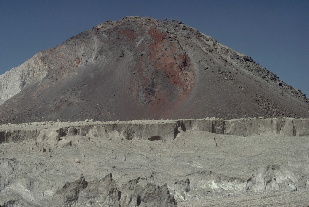
The hill in the background is one of many hummocks forming the surface of the massive debris avalanche deposit produced by collapse of the summit of Mount St. Helens on 18 May 1980. The different colored rocks represent portions of the volcano that were transported relatively intact over great distances. The avalanche traveled 25 km, filling the upper North Fork Toutle River to a maximum depth of nearly 200 m. The lighter-colored rocks in the foreground are pyroclastic flow deposits.
Photo by Lee Siebert, 1982 (Smithsonian Institution).
![]() This image is made available under the Public Domain Dedication CC0 license, but proper attribution is appreciated.
This image is made available under the Public Domain Dedication CC0 license, but proper attribution is appreciated.
Galleries: Debris Avalanches / Landslides
Keywords: debris avalanche deposit | deposit | hummock

St. Helens