Global Volcanism Program | Image GVP-02970
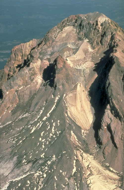
This aerial view of Mount Hood from the south shows the Crater Rock lava dome remnants in the center of the photo. The 400-m-wide, 170-m-high Crater Rock dome erupted around 1780 CE and produced block-and-ash flows and resulted in lahars during episodic dome growth. Deposits are distributed along the Sandy River and White River drainages.
Photo by Willie Scott, 1990 (U.S. Geological Survey).
![]() This image is made available as a Public Domain Work, but proper attribution is appreciated.
This image is made available as a Public Domain Work, but proper attribution is appreciated.
Keywords: lava dome | stratovolcano | deposit | erosion
Hood