Global Volcanism Program | Image GVP-05312
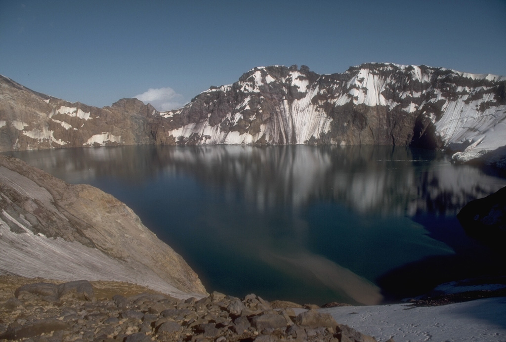
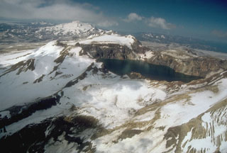
The 3 x 4.5 km Katmai caldera, seen here from its western rim, formed in 1912 by the hydraulic draining of magma away from Katmai to Novarupta 10 km W. Little if any eruptive activity took place at Katmai itself, which prior to collapse was a complex of four small overlapping stratovolcanoes. The 250-m-deep caldera lake covers a small lava dome and tuff ring that erupted on the caldera floor.
Photo by Game McGimsey, 1990 (Alaska Volcano Observatory, U.S. Geological Survey).
![]() This image is made available as a Public Domain Work, but proper attribution is appreciated.
This image is made available as a Public Domain Work, but proper attribution is appreciated.
Galleries: Stratovolcanoes | Calderas
Keywords: caldera | stratovolcano | crater lake
Katmai