Image GVP-05382
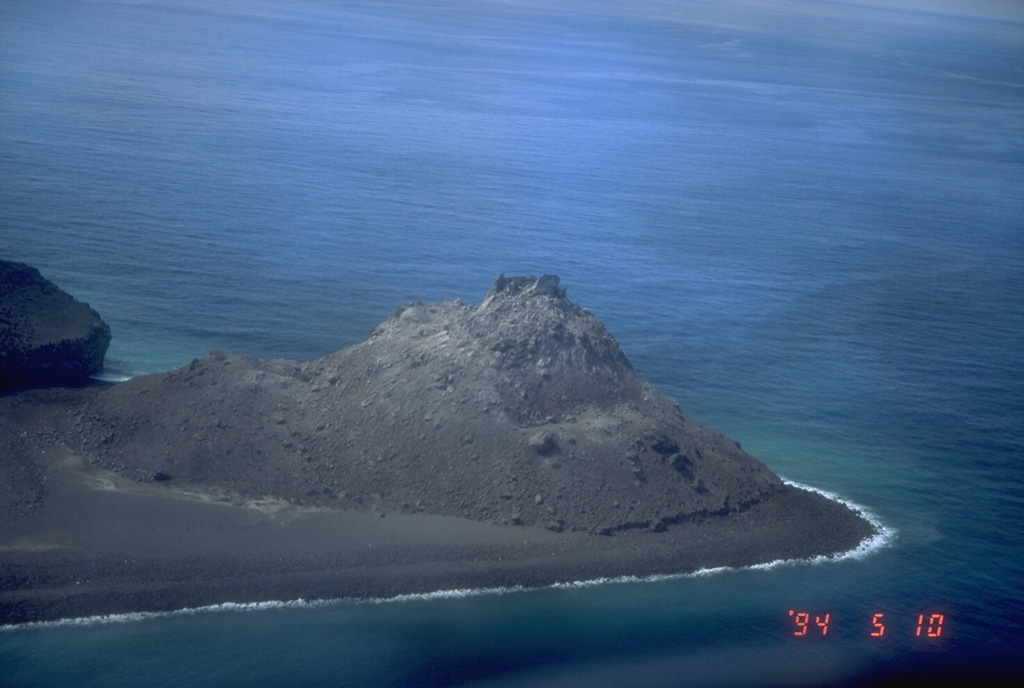
An aerial view shows the 1992 lava dome of Bogoslof Island, the summit of a largely submarine located in the Bering Sea 50 km behind the main Aleutian arc. The 1992 lava dome grew to a height of 100 m in July at the northern tip of the island. In May 1994, when this photograph was taken, the island was about 1.5 x 0.6 km wide, and due to frequent eruptive activity and energetic wave action, has changed shape dramatically since first mapped in the late 1700's.
Photo by Tom Miller, 1994 (Alaska Volcano Observatory, U.S. Geological Survey).
![]() This image is made available as a Public Domain Work, but proper attribution is appreciated.
This image is made available as a Public Domain Work, but proper attribution is appreciated.
Galleries: Lava Domes
Keywords: lava dome

Bogoslof