Global Volcanism Program | Image GVP-07603
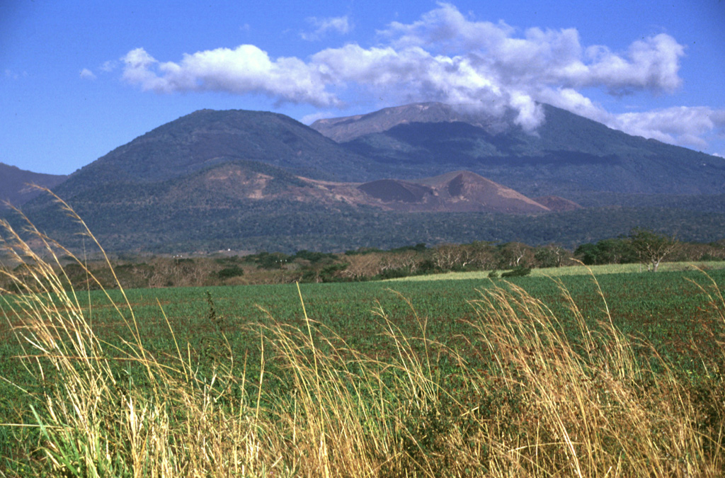
The rounded vegetated peak in the background and to the left is Cerro Verde on the SSE flank of Santa Ana, to the right. The broad edifice in front of them is the Cerro la Olla-Cerro Marcelino scoria cone complex on the Santa Ana flank. Cerro Marcelino at the right side of the cone complex formed during the 1722 eruption, when the Teixcal lava flow traveled 13 km E and destroyed San Juan Tecpan village.
Photo by Lee Siebert, 1999 (Smithsonian Institution).
![]() This image is made available under the Public Domain Dedication CC0 license, but proper attribution is appreciated.
This image is made available under the Public Domain Dedication CC0 license, but proper attribution is appreciated.
Keywords: stratovolcano

Santa Ana