Global Volcanism Program | Image GVP-08136
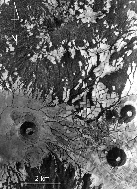
Ashfall from Hoyo el Huanillo scoria cone (lower left) was radiocarbon dated to have formed about 9,300 years ago within the Michoacan-Guanajuato volcanic field. A small ash-covered lava flow extends a short distance to the NW of the cone, which is located 35 km NE of Parícutin. The Cerro Cucundicata scoria cone is to the lower right, and the Cerro Borrego and Cerro Tarucun cones are to the N, NE of the town of Cherán. The eroded Cerro Pacaracua edifice forms much of the upper part of the photo.
Aerial photo by Comisión de Estudios del Territorio Nacional (CETENAL).
![]() This image is made available under the Public Domain Dedication CC0 license, but proper attribution is appreciated.
This image is made available under the Public Domain Dedication CC0 license, but proper attribution is appreciated.
Galleries: Craters | Scoria Cones
Keywords: lava flow | scoria cone | crater | volcanic field
Michoacán-Guanajuato