Global Volcanism Program | Image GVP-08140
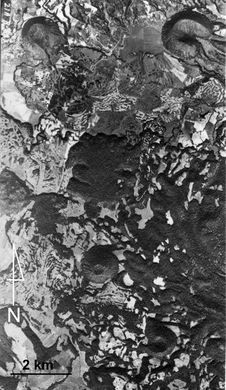
This aerial photo shows part of the Michoacan-Guanajuato volcanic field. Cerro el Pueblito (upper left), radiocarbon dated to about 29,000 years ago, produced the lava flow that extends eastward across the photo that flowed around the older Cerro las Cabras cone to the right. South of this lava flow is the La Vibor lava flow. Cerro Arena is the cone near the center of the photo.
Aerial photo by Comisión de Estudios del Territorio Nacional (CETENAL).
![]() This image is made available under the Public Domain Dedication CC0 license, but proper attribution is appreciated.
This image is made available under the Public Domain Dedication CC0 license, but proper attribution is appreciated.
Keywords: lava flow | scoria cone | crater | volcanic field
Michoacán-Guanajuato