Global Volcanism Program | Image GVP-08276
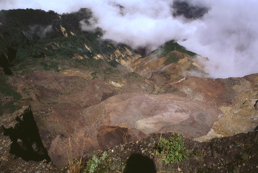
This area was impacted by an 8 December 1994 phreatic explosion is visible from the NW rim of Irazú's summit crater, seen here in 1998. The explosion originated from a geothermal area (lower right) on the upper NW flank and destroyed vegetation down to 2,500 m elevation. The explosion, which produced no juvenile material, created an irregular crater 60-80 m in diameter and sent ashfall to about 30 km distance. Landslides and lahars traveled down the Río Sucio drainage (right center).
Photo by Lee Siebert, 1998 (Smithsonian Institution).
![]() This image is made available under the Public Domain Dedication CC0 license, but proper attribution is appreciated.
This image is made available under the Public Domain Dedication CC0 license, but proper attribution is appreciated.
Keywords: environmental impact | vegetation

Irazú