Global Volcanism Program | Image GVP-08294
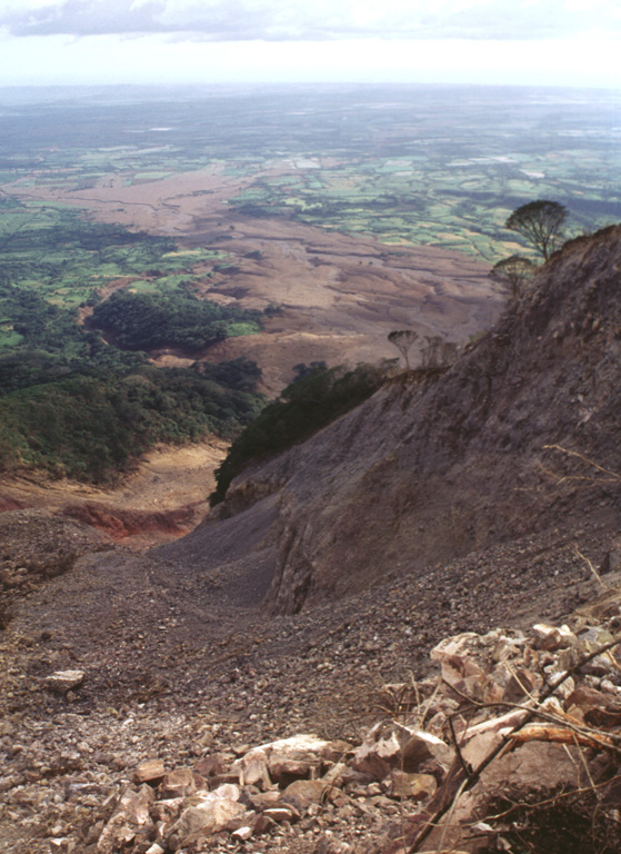
The course of the devastating debris avalanche and mudflow of October 30, 1998, is seen here from the top of the headwall scarp. Collapse of a relatively small area in the foreground (the western collapse scarp is the bare ridge at the right center) near the summit of Casita volcano produced an avalanche that transformed into a devastating mudflow and inundated lowland areas in the distance. The lahar overran two towns, which were located at the area in the sunlight at the upper left. The Pacific Ocean forms the horizon.
Photo by Lee Siebert, 1998 (Smithsonian Institution).
![]() This image is made available under the Public Domain Dedication CC0 license, but proper attribution is appreciated.
This image is made available under the Public Domain Dedication CC0 license, but proper attribution is appreciated.

San Cristóbal