Image GVP-08425
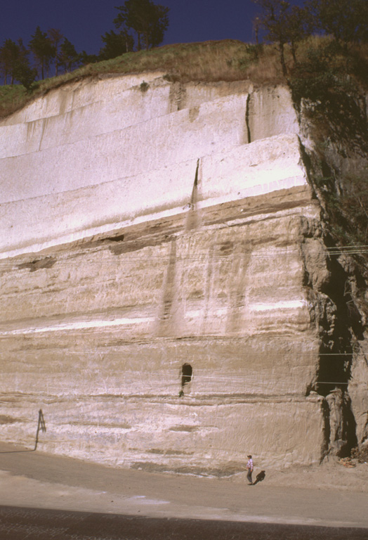
Thick sequences of tephra from Amatitlán caldera are exposed in roadcuts in the Guatemala City area, note INSIVUMEH geologist Otoniel Matías for scale at the lower right. This exposure is located south of the capital city, along the road to Palin. Major explosive eruptions from Amatitlán caldera have been dated to between about 300,000 to less than 23,000 years ago. The northern caldera rim is buried by thick pyroclastic deposits and underlies portions of Guatemala City.
Photo by Lee Siebert, 1999 (Smithsonian Institution).
![]() This image is made available under the Public Domain Dedication CC0 license, but proper attribution is appreciated.
This image is made available under the Public Domain Dedication CC0 license, but proper attribution is appreciated.
Keywords: stratigraphy | geology | outcrop | tephra | deposit | field work

Pacaya