Keyword Collections | Keyword "stratigraphy"
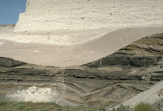 This outcrop shows light-colored deposits from the 3,500-year-old Minoan eruption of Santorini filling a valley that eroded into darker tephra layers of Pleistocene age. The lower beige-colored unit filling the valley is a pumice-fall deposit from early in the eruption. It is overlain by laminated pyroclastic surge deposits that were produced when water came into contact with the magma reservoir as the volcano collapsed into the sea. The upper lighter-colored layer truncating both these deposits is a pyroclastic flow deposit.
Photo by Lee Siebert, 1994 (Smithsonian Institution).
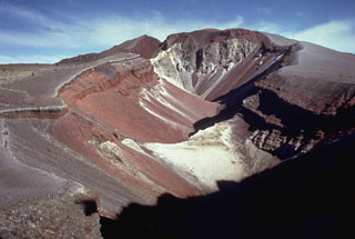 The 1886 Tarawera eruptive fissure, seen from the N, formed across lava domes of the 800-year-old Kaharoa eruption. The red and black rocks of the 1886 eruption, 20-30 m thick here, overlie white rhyolitic Kaharoa eruption deposits. This view shows a 2-km-long section of the 8-km en-echelon fissure with gray rocks of the Ruawahia lava dome appearing at the far end.
Photo by Bruce Houghton (Wairakei Research Center).
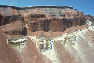 The SE part of the fissure within Ruawahia crater reveals stratigraphy from the circa 700 BP Kaharoa and 1886 CE eruptions. The 35-m-thick light-colored Kaharoa Plinian deposits at the base are largely obscured by talus fans of scoria from above. The thick overlying bright red scoria is from phase 2 of the 1886 eruption. Above it is a thin black zone (phase 3) consisting of very widespread scoria. Phase 4 (at the top) consists of white rhyolitic blocks ripped off the walls during the vent widening in the last half hour of the 10 June 1886 eruption.
Photo by Bruce Houghton (Wairakei Research Center).
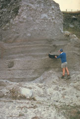 The Kaharoa eruption about 700 years ago was the first Holocene eruption of the Tarawera lava dome complex in the Okataina Volcanic Centre. It produced an extensive rhyolitic tephra deposit that extended to the E coast of North Island. Geologist Pat Brown examines a charcoalized log within a pyroclastic flow deposit from this eruption. The upper part of the section consists of blocky debris from collapse of a rhyolitic lava dome at the end of the eruption.
Photo by Jim Cole (University of Canterbury).
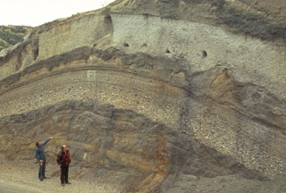 Volcanologists Colin Wilson and Peter Ballance examine a roadcut that dissects deposits of major eruptions from the Taupo volcanic center. The bottom visible unit is an exposure of an unwelded pyroclastic flow deposit from the Oruanui eruption, which formed Taupo's initial caldera about 22,600 years ago. Light-colored pumice fall deposits from other major eruptions are between it and the deposits of the 1,800-year-old Taupo eruption (upper right), which were responsible for Taupo's second caldera.
Photo by Bruce Houghton (Wairakei Research Center).
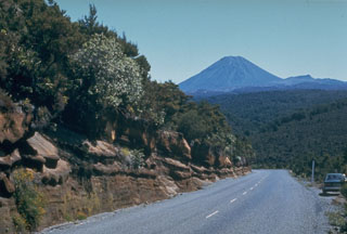 A roadcut along the desert road between Waiouru and Turangi exposes some of the tephra layers erupted from the Tongariro volcanic complex during its early stage of development. Ngāuruhoe is the visible cone in the background.
Photo by Jim Cole (University of Canterbury).
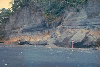 An outcrop on the W coast of Long Island reveals deposits from the last caldera-forming eruption. This catastrophic eruption in the mid-17th century deposited ash across the New Guinea highlands and prompted legends of a "Time of Darkness." This outcrop shows pyroclastic surge and Plinian airfall deposits of the Matapun formation, which is exposed at the top of the section beginning about 4 m above the geologists.
Photo by Russell Blong, 1975 (Macquarie University).
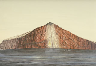 The noted Dutch geologist R.D.M. Verbeek conducted a comprehensive study of the 1883 Krakatau eruption. This chromolithograph from his 1885 monograph shows the remnant of Krakatau Island seven weeks after the eruption. The exposed outcrop revealed the stratigraphy of Rakata volcano and marked the margin of the newly-formed Krakatau caldera. Lighter-colored materials capping the outer flanks are pyroclastic-flow deposits from the 1883 eruption.
Chromolithograph published in Verbeek (1885) and Simkin and Fiske (1993).
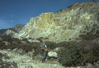 The hydrothermally altered rocks of Welirang Ridge in the background is the NE scarp resulting from the partial flank collapse of Papandayan volcano in 1772. The extensive alteration of rocks within the volcano contributed to the collapse that produced a debris avalanche that traveled 11 km from the volcano, destroying 40 villages.
Photo by Tom Casadevall, 1986 (U.S. Geological Survey).
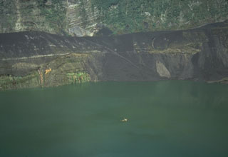 This 28 August 1986 photo from the SE rim of Warirang crater shows the small tip of the January 1983 scoria cone in the center of the lake, just before the cone was completely covered by rising lake waters. Black scoria from the 1982-83 eruption caps the rim of the crater.
Photo by Tom Casadevall, 1986 (U.S. Geological Survey).
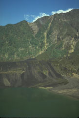 More than three years after the end of the major eruption that began in 1982 the crater had partially been filled by a lake. The dark streaks are lahar deposits that swept into the lake as a result of remobilization of tephra deposits from the eruption. Vegetation has recovered on the steep background wall, which is the SW scarp of the 1-km-deep scar resulting from flank collapse.
Photo by Tom Casadevall, 1986 (U.S. Geological Survey).
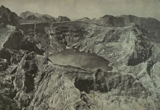 This August 1922 photo from the NW shows the still vegetation-free summit of Kelud volcano following the powerful May 1919 eruption and the relatively mild December 1920 eruption. The 1919 eruption produced devastating pyroclastic flows and lahars that killed over 5,110 people. This prompted an engineering project to construct tunnels to lower the level of the crater lake, which was completed in 1926. A milder explosive eruption in 1920 was accompanied by extrusion of a small lava dome beneath the crater lake.
Photo published in Taverne, 1926 "Vulkaanstudien op Java," (courtesy of Volcanological Survey of Indonesia).
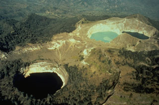 Kelimutu, a small volcano on Flores Island, is noted for its three crater lakes of different colors. This aerial view from the SW shows Tiwu Ata Mbupu at the lower left, and the two craters of Tiwu Nua Muri Kooh Taiand Tiwu and Ata Polo at the upper right. Water color varies periodically with variations of blue, green, and red. Phreatic eruptions have occurred from the middle lake in historical time.
Photo by Tom Casadevall (U.S. Geological Survey).
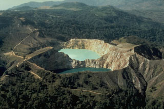 The SE-most pair of Kelimutu's crater lakes, Tiwu Ata Polo and Tiwu Nua Muri Kooh Tai, are seen here in an aerial view from the SE. A light-colored area of upwelling can be seen in the upper lake and this also occurs in the lower one. All three lakes are close to saturation with gypsum/anhydrite, contributing to color variations.
Photo by Tom Casadevall, (U.S. Geological Survey).
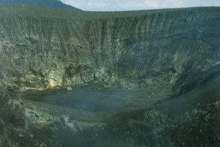 The 325-m-wide Kepundan Bongsu, one of several historically active craters at the summit of Sumatra's Marapi volcano, is the largest and westernmost of a chain of craters covering a 1.2-km-long E-W line. Marapi is one of Sumatra's most active volcanoes, producing numerous small-to-moderate explosive eruptions since the end of the 18th century.
Photo by Gede Suantika, 1992 (Volcanological Survey of Indonesia).
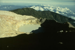 The youngest crater of Dempo volcano, at the WNW end of a series of six partially overlapping craters at the summit, contains a 400-m-wide crater lake that has been the source of frequent phreatic eruptions during historical time. A seventh smaller crater is located on the upper N flank. Dempo is one of Sumatra's most active volcanoes, frequently producing small-to-moderate explosive eruptions.
Photo by Ruska Hadian, 1989 (Volcanological Survey of Indonesia).
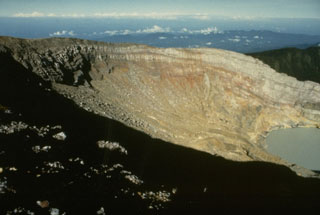 The crater wall of Kawah Merapi, the youngest and NW-most of the craters along the summit of Dempo volcano, is capped by thin lava flows. A crater lake is seen at the lower right in this view from the NE. Gunung Merapi, the high point of the summit region of Dempo volcano, occurs at the extreme left at the SE part of the crater rim.
Photo by Ruska Hadian, 1989 (Volcanological Survey of Indonesia).
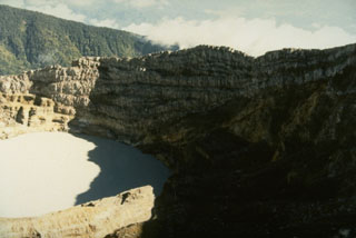 The crater wall above the historically active crater lake within Kawah Merapi crater at the summit of Dempo volcano shows a series of alternating lava flows and pyroclastic deposits.
Photo by Ruska Hadian, 1989 (Volcanological Survey of Indonesia).
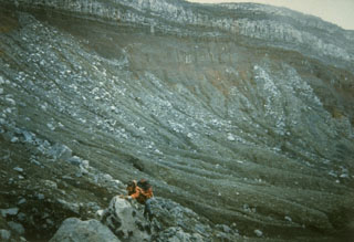 A scientist from the Volcanological Survey of Indonesia investigates rocks in the summit crater of Dempo volcano. The Kawah Merapi crater exposes bedded pyroclastic material that is overlain by a series of light-colored lava flows.
Photo by R. Whandyo, 1992 (Volcanological Survey of Indonesia).
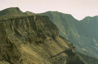 Tambora's serrated NE caldera rim towers 1,250 m above the caldera floor. The 6-km-wide caldera was formed in 1815, during one of the world's most powerful eruptions of the past 10,000 years. Since 1815 only a few minor eruptions have occurred on the caldera floor.
Photo by Rizal Dasoeki, 1986 (Volcanological Survey of Indonesia).
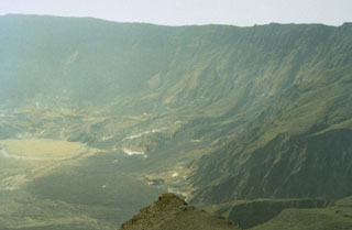 Tambora's caldera, seen here from the western rim, was formed during the eruption of 1815 following the ejection of about 30-50 km3 DRE (dense rock equivalent) of ashfall and pyroclastic flows. This was history's largest explosive eruption and followed low-level eruptive activity that began in 1812. Only a few minor eruptions have taken place since formation of the 6-km-wide and 1,250-m-deep caldera. The last eruption produced a lava flow on the caldera floor and is known only to have occurred sometime between 1947 and 1968.
Photo by Rizal Dasoeki, 1986 (Volcanological Survey of Indonesia).
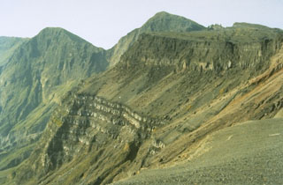 The bottom portion of this cliff section in the W wall of the Tambora caldera shows a thick sequence of bedded lava flows that filled an earlier caldera that formed 43,000 years ago. The sloping surface above it consists of pyroclastic material erupted between about 5,900 and 1,210 years ago. This is overlain by unit about 200 m thick that was produced during the 1815 eruption. These upper cliffs expose pumice deposits that originated from the eruption plume at the base, overlain by a thick sequence of pyroclastic flow deposits.
Photo by Rizal Dasoeki, 1986 (Volcanological Survey of Indonesia).
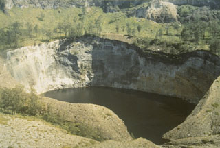 Tiwu Ata Mbupu is the NW-most of three craters on Kelimutu. It is 850 x 600 m wide and contains a 67-m-deep crater lake. The shoreline of the lake is coated with red/yellow minerals and gypsum crystals. Lake color tends to vary seasonally.
Photo by L.D. Reksowirogo, 1972 (Volcanological Survey of Indonesia).
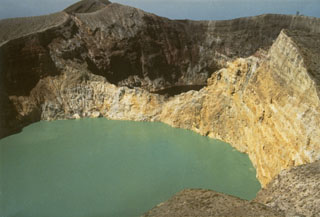 The walls of Tiwu Nua Muri Kooh Tai, the middle of Kelimutu's three crater lakes, expose bedded hydrothermally altered rocks. Tiwu Ata Polo, the darker-colored crater lake to the SE, is visible beyond the far wall. Constant upwelling occurs at these two lakes, probably as a result of subaqueous fumaroles, directing floating sulfur in Tiwu Nua Muri Kooh Tai toward the crater walls.
Photo by L.D. Reksowirogo, 1972 (Volcanological Survey of Indonesia).
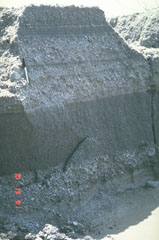 These relatively fine-grained layers are lahar deposits produced by successive overflows of dikes along the Bambam River, about 35 km NE of Pinatubo volcano in the Philippines. The photo was taken on 13 October 1991, a little more than a month after the end of the devastating 1991 eruption. Note the pen at the upper left for scale. By the end of 1991, rainfall-induced lahars had traveled 50 km down the Bambam River.
Photo by Chris Newhall, 1991 (U.S. Geological Survey).
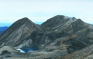 Kengamine (left) and Gozengamine (right) peaks are seen from Onanjimine, another of the summit peaks of Hakusan volcano. The Kengamine lava dome and the Shiramizutaki lava flow extending from its base originated during an explosive eruption about 2,300 years ago. A pond fills the Midorgaike crater in the left foreground, which formed during an explosive eruption in 1042 CE.
Photo by Toshio Higashino (Haku-san Nature Conservation Center).
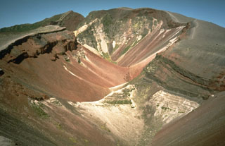 This large fissure produced during a major explosive eruption at Tarawera in 1886 is one of the youngest eruption features of the Okataina Volcanic Centre. Okataina is surrounded by extensive ignimbrite and pyroclastic deposits produced during caldera-forming eruptions. The subparallel NE-SW-trending Haroharo and Tarawera complexes consist of rhyolitic lava domes and associated lava flows that formed between about 15,000 and 800 years ago and impounded lakes against the margins of the Okataina ring structure.
Photo by Richard Waitt, 1986 (U.S. Geological Survey).
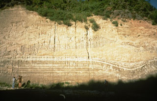 This thick outcrop exposes deposits of the 1,800-year-old Taupo eruption, one of the world's largest during the past 10,000 years. The Taupo eruption produced phreatomagmatic surge deposits, Plinian tephra deposits, and the overlying Taupo ignimbrite, seen at the upper half of this photo above the thin, light-colored layers. The eruption occurred from a vent at Horomatangi Reefs, now submerged beneath Lake Taupo.
Photo by Richard Waitt, 1986 (U.S. Geological Survey).
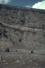 A helicopter on the floor of the inner caldera of Karkar volcano with the 300-m-high caldera wall behind it. The wall was stripped of vegetation by a powerful phreatic explosion on 8 March, revealing the stratigraphy of lighter-colored lava flows and darker pyroclastic deposits that form the edifice. This location is covered by ash and blocks from the March 8 explosion that occurred one month earlier.
Photo by William Melson, 1979 (Smithsonian Institution)
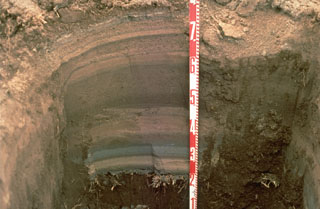 Tephra layers from the 1994 eruption of Rabaul volcano are exposed in this pit dug at the eastern end of Rabaul town in Papua New Guinea. Individual layers are ashfall deposits from discrete explosive eruptions that occurred over three weeks. The light-colored layer near the bottom was produced by an eruption from Vulcan cone at the western end of the caldera. Most other layers originated from periodic explosions at the Tavurvur cone, closer to this site. The numbers on the scale mark 10-cm increments.
Photo by Andy Lockhart, 1994 (U.S. Geological Survey).
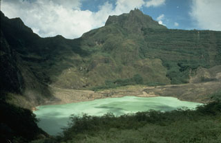 The broad, irregular summit of Kelud volcano contains several lava domes and a crater lake that has been the source of frequent violent and sometimes devastating eruptions. Construction of outlet tunnels following an eruption in 1919 that killed 5,110 people has reduced the number of fatalities from pyroclastic flows and lahars during subsequent eruptions.
Photo by Dan Dzurisin, 1980 (U.S. Geological Survey).
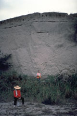 Geologists investigate a thick pyroclastic flow deposit on the ENE side of Parker volcano in southern Mindanao. Preliminary investigation of the eruptive deposits of this volcano revealed many similarities to those of Pinatubo. The flanks of both volcanoes are blanketed with thick pyroclastic flow deposits produced by powerful explosive eruptions.
Photo courtesy of Chris Newhall (U.S. Geological Survey).
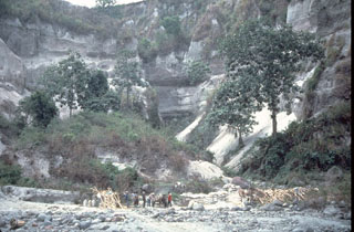 A thick stack of pre-1991 pyroclastic flow and lahar deposits outside Clark Air Base is testimony to the long history of explosive eruptions at Pinatubo. Six major eruptive periods took place in the past 35,000 years, each separated by long periods of quiescence. Most of the previous eruptive periods produced explosions that were even larger than the 1991 eruption. The last major eruption prior to 1991 occurred about 500 years ago.
Photo by Chris Newhall (U.S. Geological Survey).
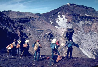 Hikers peer into the 700-m-wide summit crater of Mount Fuji from its E rim. More than 100,000 people ascend its slopes yearly during the 2-month summer climbing season. A white meteorological observatory (upper right) sits at the summit, which is 240 m above the crater floor. A red oxidized scoria layer across the summit crater rim was emplaced about 2,100 years ago.
Photo by Lee Siebert, 1963 (Smithsonian Institution).
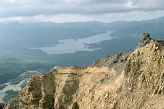 Lake Hibara in the distance was created in 1888 when the partial collapse of Ko-Bandai volcano produced a large debris avalanche that traveled 11 km, nearly to the far end of the lake. The area in front of the lake and the islands in the lake are part of the debris avalanche deposit. The steep wall in the foreground is part of the back headwall of the avalanche scarp.
Photo by Lee Siebert, 1988 (Smithsonian Institution).
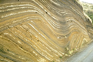 This outcrop at Oshima volcano, in the Izu Islands south of Tokyo, shows more than 100 individual tephra layers. They were produced by eruptions of Oshima at fairly regular intervals over a period of about 10,000 years. The lower layers follow the older preexisting topography. A prominent unconformity in the center of the outcrop is an erosional surface that truncated the earlier eruption deposits. The upper layers mantled this uneven surface.
Photo by Richard Fiske, 1961 (Smithsonian Institution).
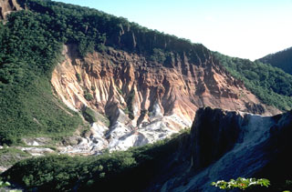 This view shows large areas of hydrothermally altered ground at the Jigokudani ("Valley of Hell") thermal area of Kuttara volcano. Jigokudani is a 300-500 m crater that formed on the W flank of Kuttara.
Photo by Tom Simkin, 1981 (Smithsonian Institution).
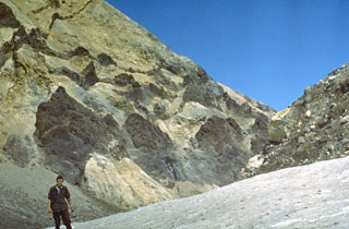 Dark-colored linear volcanic dikes, previous magma pathways, cut across altered pyroclastic rocks that are now exposed in the crater wall of northern Mutnovsky.
Photo by Oleg Volynets, 1971 (Institute of Volcanology, Petropavlovsk).
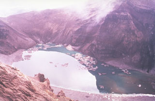 The lake in this photo is within the central of three large craters across the summit of the Gorely. Stratified deposits are exposed in the walls of the crater, which drains to the SW (lower right) through a small valley. Small icebergs float on the surface in this July 1992 view.
Photo by Phil Austin, University of Southern Florida, 1992 (courtesy of Pavel Kepezhinskas).
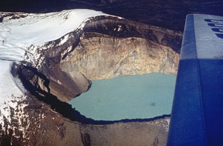 The currently active Troitsky crater of Maly Semiachik formed during an explosive eruption about 400 years ago. The eastern crater wall shows light-colored hydrothermally altered rocks of the vent complex that are overlain by darker lava flows and fall deposits from eruptions that followed formation of the crater. A hot, acidic lake now fills the crater, which has been the source of historical eruptions.
Photo by Oleg Volynets (Institute of Volcanology, Petropavlovsk).
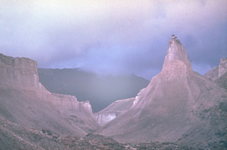 Following the 1964 eruption and debris avalanche, erosional canyons formed in the pyroclastic flow deposits that overlie debris avalanche deposits. The pyroclastic flows were produced during the explosive Plinian phase that followed catastrophic flank collapse.
Photo by Yuri Doubik (Institute of Volcanology, Petropavlovsk).
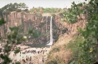 A waterfall plunging over a trachytic lava flow is a popular tourist destination on Cheju Island. An extensive lava plateau underlies the Halla shield volcano and extends to the coast of the 40 x 80 km island. The volcano dominates the center of the island and has been active from the Pleistocene until historical time.
Photo by Norm Banks, 1980 (U.S. Geological Survey).
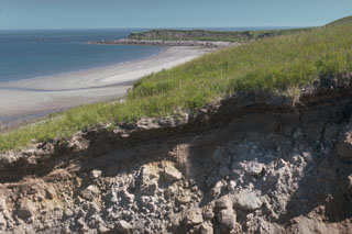 The recent history of Augustine has been characterized by repetitive collapse of the summit area, producing debris avalanches that often reached the sea on all sides of the island, forming rocky deposits. This gully near the east shoreline exposes one such debris avalanche deposit. The Northeast Point debris avalanche deposit forms the headland in the distance.
Photo by Lee Siebert, 1990 (Smithsonian Institution).
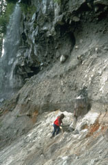 The tree trunk next to the geologist was buried by ash deposits from the Bridge River eruption of the Meager volcanic complex about 2,350 years ago, which was then covered by a pyroclastic flow. The deposit has an unwelded base and a darker, more massive welded layer at the top of this photo.
Photo by Willie Scott, 1990 (U.S. Geological Survey).
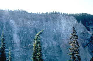 The cliff along Rubble Creek is the margin of the early Holocene lava flows that formed Garibaldi Lake. The steep lava flow margin formed when the flow ponded against the retreating continental glacier filling the Cheakamus River valley. This has been the source of several landslides down Rubble Creek, leaving a scarp known as The Barrier.
Photo by Lee Siebert, 1983 (Smithsonian Institution).
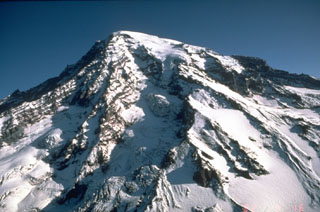 Stratovolcanoes, also referred to as composite volcanoes, are constructed of sequential layers of resistant lava flows and fragmented rock produced by explosive eruptions. An aerial view of the glacially dissected SW flank of Mount Rainier shows the layered interior of a stratovolcano.
Photo by Dan Dzurisin, 1982 (U.S. Geological Survey).
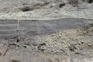 The fine-grained gray layer behind the ruler was produced by the 18 May 1980 lateral blast of Mount St. Helens. The deposit is about 50 cm thick at this location, 13 km NE of the volcano. The blast deposit is overlain by airfall pumice that was erupted later on 18 May and underlain by a pumice deposit from an eruption in 1482 CE.
Photo by Lee Siebert, 1982 (Smithsonian Institution).
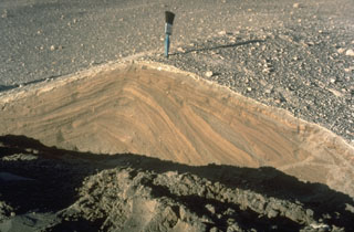 Pyroclastic surges are dilute pyroclastic flows with a high proportion of gas. They originated from secondary phreatic explosions at Mount St. Helens in 1980 and produced these cross-bedded layers. They were deposited from successive, rapidly moving horizontal clouds of gas, ash, and rock fragments that resulted from the interaction of hot pyroclastic flow deposits from the May 18 eruption with melt water produced by glacial ice carried down by the collapse of the summit.
Photo by Norm Banks, 1980 (U.S. Geological Survey).
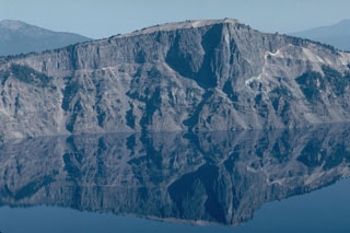 The massive Llao Rock lava flow, exposed in the NW wall of Crater Lake caldera, was emplaced at the end of a major eruption about 200 years prior to the formation of the caldera. The thin, light-colored unit at the base of the lava flow, seen prominently on the right, is a Plinian pumice deposit from that major explosive eruption. The lava flow is more than 350 m thick and is overlain by tephra from the caldera-forming eruption of Crater Lake.
Photo by Lee Siebert, 1981 (Smithsonian Institution).
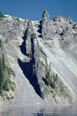 Devil's Backbone is a segmented dike that rises nearly 400 m from the shore of Crater Lake in the western rim of the caldera. The andesite dike was a feeder for a vent that was near Mount Hillman but has since been removed by glacial erosion.
Photo by Lee Siebert, 1981 (Smithsonian Institution)
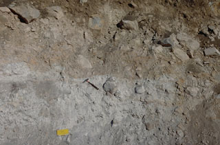 A roadcut exposes the internal structure of the debris avalanche deposit that formed during collapse of Mount Shasta during the Pleistocene. This deposit contains large angular sections composed of rock and crushed matrix of similar material (like the light-gray area in this photo), in direct contact with other lithologies (brown) from other areas of the pre-collapse volcano. This is due to different sections mixing as the debris avalanche traveled across the landscape.
Photo by Lee Siebert, 1981 (Smithsonian Institution).
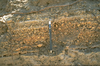 The Mono-Inyo craters produced explosive eruptions and effusive lava flows. The pumice layers above the bottom of the pen originated from the South Deadman vent of Inyo Craters about 600 years ago. Interbedded finer layers record brief pauses during the course of the eruption.
Photo by Larry Mastin, 1986 (U.S. Geological Survey).
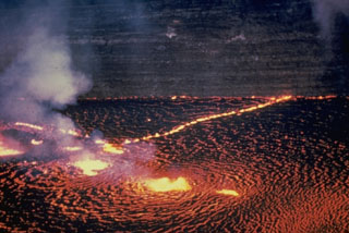 The Halema‘uma‘u lava lake is seen from the east on 31 May 1954. Several areas of vigorous lava fountaining occurred here as well as lower fountaining along nearby fissures. Later in the first day of the three-day-long eruption the fissures extended over the crater wall and to the ENE to produce lava flows on the caldera floor. Thin lava flows exposed in the Halema‘uma‘u pit crater walls appear in the background.
Photo by Jerry Eaton, 1954 (U.S. Geological Survey).
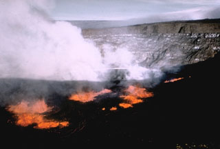 A lava lake formed within Halema‘uma‘u crater on 5 November 1967. In the background of this view from the SE can be seen thin, light-colored lava flows exposed in the crater walls, with the Kīlauea caldera wall above it, and the flank of Mauna Loa in the distance. Lava lake activity continued until 13 July 1968.
Photo by U.S. Geological Survey, 1967.
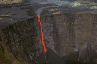 A stream of lava from a vent at Mauna Ulu (above the top of the photo) cascades into Makaopuhi crater during an early stage of the 1969-74 Mauna Ulu eruption. A thick stack of older lava flows that were erupted along Kīlauea's East Rift Zone is exposed in the Makaopuhi crater wall.
Photo by Jim Moore (U.S. Geological Survey).
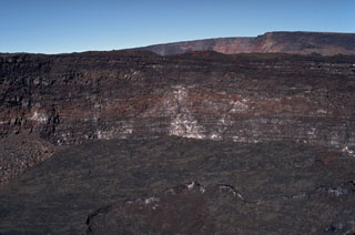 The steep walls of Lua Poholo pit crater, immediately NE of Mokuʻāweoweo caldera, expose a small portion of the accumulation of thin, overlapping lava flows that form Mauna Loa. This view from the NE shows the caldera rim to the upper right. Lava flows from recent eruptions fill crater floor, including the most recent 1984 eruption.
Photo by Paul Kimberly, 1994 (Smithsonian Institution).
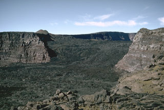 This view looks across Mauna Loa’s South Pit towards Moku’aweoweo caldera in 1966. The lava flows seen here erupted in 1949 within the caldera, then flowed into South Pit after covering the southern caldera floor and continued south for an additional 9 km beyond this crater. The small scoria cone on the horizon was constructed along the main fissure, which fed a lava flow that traveled 11 km down the west flank early in the eruption.
Photo by Richard Fiske, 1966 (Smithsonian Institution).
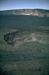 Lua Poholo pit crater is immediately NE of Moku’aweoweo caldera. The crater walls expose a small portion of the massive pile of thin, overlapping lava flows that have formed the summit of Mauna Loa. This 1987 view from the NE shows the western Moku’aweoweo caldera rim. The lava flows covering the caldera floor of the caldera were erupted in 1984.
Photo by Richard Fiske, 1987 (Smithsonian Institution).
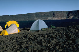 A campsite on the E rim of Mauna Loa's Moku’aweoweo caldera in 1987 has a view of the W rim that rises about 180 m above the lava flows from the 1984 eruption that covered the caldera floor. Lava flows from the 1975 eruption had also almost covered the entire floor. By this time, incremental filling of the caldera had almost halved the maximum recorded caldera depth of 320 m.
Photo by Lee Siebert, 1987 (Smithsonian Institution).
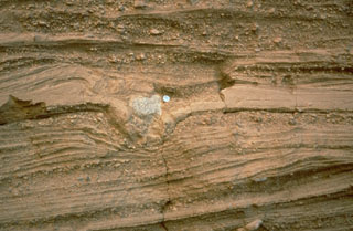 Pyroclastic surge deposits surround the Cerro Colorado maar of the Pinacate volcanic field in NW México. These thin beds (note the coin for scale) were formed by successive explosions that produced pyroclastic surges. The light-colored rock in the center of the photo is a ballistic block that impacted the surface of earlier surge deposits, compressing them and forming a small pit called a bomb sag.
Photo by Richard Waitt, 1988 (U.S. Geological Survey).
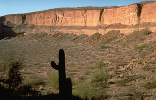 The Cerro Colorado maar, in the Pinacate volcanic field 24 km NE of Pinacate Peak, contains a 1-km-wide crater formed by explosions on a nearly flat surface. Distribution of ejecta by prevailing winds produced a hill on the side of the crater opposite this steep, 110-m-high crater wall. The ejecta include fragments of underlying granitic and metamorphic rocks.
Photo by Richard Waitt, 1988 (U.S. Geological Survey).
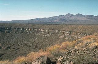 The Pinacate volcanic field covers approximately 55 x 60 km and contains numerous maars and scoria cones. The field is prominent in this arid region of NW México near the head of the Gulf of California. The crater rim across the center of the photo is the 1.6-km-wide Cráter Elegante maar. Pinacate Peak in the distance is at the summit of Santa Clara shield volcano, which contains many scoria cones and lava flow fields.
Photo by Richard Waitt, 1988 (U.S. Geological Survey).
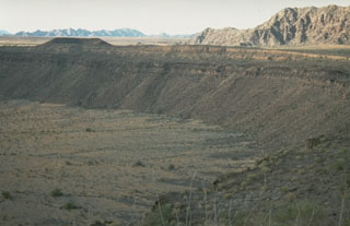 McDougal Crater, one of many Quaternary maars in the Pinacate volcanic field, formed within darker lava flow units near the top of the crater wall. Lighter-colored pyroclastic surge deposits form the crater rim and playa deposits formed on the crater floor. Crystalline rocks of the Sierrita el Temporal range are visible beyond the upper right crater rim to the north.
Photo by Richard Waitt, 1988 (U.S. Geological Survey).
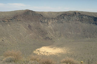 The SE wall of Cráter Elegante reveals a cross-section of a scoria cone that existed prior to explosive formation of the maar. The light-gray remnants of the sill intrusions are visible at the low point of the cone and below its right flank. The vent was located where the SE part of Cráter Elegante is now. The surface of the cone is mantled by pyroclastic surge deposits from the maar-forming eruption.
Photo by Jim Luhr, 1996 (Smithsonian Institution).
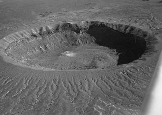 Cráter Elegante, seen here in an aerial oblique view from the NW, is a 1.6-km-wide maar in the Pinacate volcanic field. Within the crater walls are exposed basaltic lava flows, sills, and dikes pre-dating formation of the maar, which are overlain by pyroclastic surge deposits that cover the rim and outer flanks. Lake beds within the maar have been radiocarbon dated at between about 13,000 and 17,000 years, indicating a late-Pleistocene age for the maar-forming eruptions.
Photo by David Roddy, 1965 (U.S. Geological Survey).
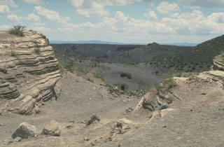 The La Breña-El Jagüey maar complex is one of the youngest features of the Durango volcanic field. This view looks SW from the NE rim of El Jagüey toward La Breña maar and shows the laminated pyroclastic surge beds emplaced during the maar-forming eruptions. El Jagüey and La Breña are two intersecting maars, 700 and 1,400 m wide, respectively.
Photo by Jim Luhr, 1988 (Smithsonian Institution).
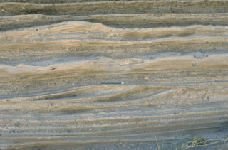 Pyroclastic surge deposits from La Breña maar in México's Durango volcanic field show both laminar and dune bedding. The thin beds (pen in the center for scale) were created by successive explosive eruptions that produced high-velocity pyroclastic surges that swept radially away from the volcano. The direction of movement of the surge clouds was from right to left, as seen from the truncated dune beds on the near-vent side.
Photo by Jim Luhr, 1988 (Smithsonian Institution).
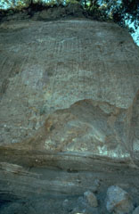 The bedded deposits at the base of this outcrop on the SW flank of Colima near the village of San Antonio are pyroclastic flow and pyroclastic surge deposits from an eruption that was radiocarbon dated to about 4,300 years ago. The thick deposit forming the majority of the outcrop is a debris avalanche deposit produced by collapse of the volcano. Erosion at the base of this deposit has exposed its mottled internal texture, reflecting various lithologic units that were transported without being mixed together.
Photo by Jim Luhr, 1983 (Smithsonian Institution).
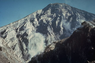 The interior of a stratovolcano is dramatically revealed in a 1-km-wide crater created on the SW flank of Guatemala's Santa María volcano during an eruption in 1902. The 1,200-m-high scarp exposes thin, light-colored lava flows that are interbedded with deposits of fragmented rock produced during growth of the volcano. The 1902 eruption was one of the world's largest during the 20th century.
Photo by Dick Stoiber, 1969 (Dartmouth College).
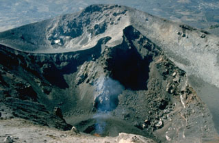 A small spatter cone ejects incandescent lava bombs at the bottom of MacKenney crater in early February 1990. Activity had resumed at Pacaya in early January after a long quiescence following a major explosive eruption 7-10 March 1989. This eruption removed the upper 75 m of MacKenney cone and enlarged the 50 x 75 m crater to the 200 x 350 m seen here.
Photo by Alfredo MacKenney, 1990.
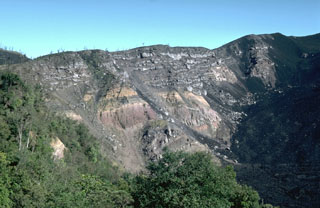 Large-scale collapse of the Pacaya summit sometime between about 1,550 and 600 years ago created a large horseshoe-shaped scarp. Collapse was followed by a large explosive eruption that produced widespread pyroclastic surges. This roughly 150-m-high section of the NW scarp exposes light-colored lava flows overlying pyroclastic deposits of the pre-collapse edifice. Subsequent eruptions have constructed a new cone within the caldera. Lava flows from MacKenney cone (out of view to the right) are slowly filling in the caldera moat.
Photo by Lee Siebert, 1988 (Smithsonian Institution).
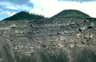 A sequence of thin lava flows forms the upper part of the Pacaya NE crater wall. These basaltic lava flows were erupted during the final stages of an ancestral Pacaya edifice, which collapsed sometime between about 1,550 and 600 years ago to form a large horseshoe-shaped crater. The upper approximately 50 m of the wall is seen in this view with Cerro Grande, an older dome of Pacaya, forming the rounded peak to the right with the Cerro Chiquito cone to the left.
Photo by Lee Siebert, 1988 (Smithsonian Institution).
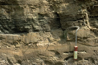 These fine-grained ash layers and coarser laminated scoria-bearing layers were deposited by pyroclastic surges following collapse of the summit of Pacaya. This surge deposit overlies the avalanche deposit and the topography in a 90 degree arc as far as 10 km SW of the summit.
Photo by Lee Siebert, 1988 (Smithsonian Institution).
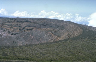 The broad summit of Santa Ana volcano has a 1.5-km-wide crater seen here from the south. The series of bedded phreatomagmatic tephra layers exposed in the crater wall in this photo form the summit region and overlie lava flows exposed lower in the crater walls.
Photo by Dick Stoiber, 1966 (Dartmouth College).
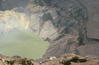 The inner crater of Santa Ana is 500 m wide and is partially filled by a 250-m-wide greenish crater lake in this 1966 photo. Fumaroles are active on the crater wall and in the lake, and abundant sulfur deposits are located on the SW wall (upper left). The acidic crater lake has a pH of about 1, and bathymetric surveys have revealed a maximum depth of 27 m.
Photo by Dick Stoiber, 1966 (Dartmouth College).
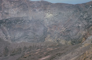 The active Santa Ana crater lies at the SE end of series of four nested summit craters and contains a small lake not visible in this photo. The northern crater wall in the background exposes a series of lava flows and inter-bedded pyroclastic deposits. Several faults are visible in the crater walls, such as the one at the upper left. Later tectonic movements produced a graben in the central part of the crater with displacements of 50-70 m.
Photo by Bill Rose, 1966 (Michigan Technological University).
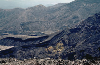 The Rincón de la Vieja SW flank contains a broad area almost entirely devoid of vegetation resulting from eruptions and acid rain. Steady trade winds from the NNE distribute acidic gases from Cráter Activo to the SW.
Photo by William Melson, 1986 (Smithsonian Institution).
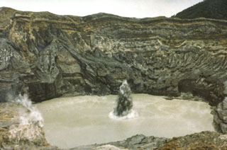 A plume containing ash and mud erupts through the Poás crater lake in July 1977 when phreatic explosions were produced at 25-minute intervals. This activity had begun in May 1977.
Photo by S. Racchini, 1977 (Universidad Nacional Costa Rica, courtesy of Jorge Barquero).
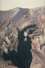 Frequent eruptions have kept the Irazú summit craters devoid of vegetation. The thick dark-gray ash and scoria units that form the crater walls were emplaced during the 1963-65 eruptions.
Photo by Mike Carr, 1982 (Rutgers University).
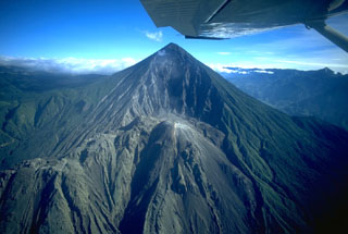 Santa María volcano is seen here in November 1994. The upper SW flank has a 1-km-wide crater formed during a catastrophic eruption in 1902. Two decades later the Santiaguito lava dome began growing at the base of the crater, forming the elongate ridge below the summit and to the left. Since 1922 the Santiaguito dome complex has exhibited frequent explosive activity accompanying episodic periods of dome growth and lava extrusion.
Copyrighted photo by Stephen O'Meara, 1994.
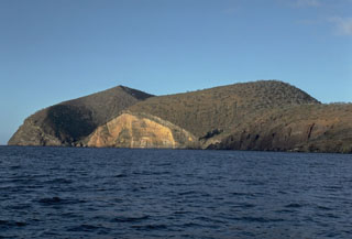 Cabo Cowan is a tuff cone at the NW tip of Santiago Island in the Galápagos Islands. Wave erosion has truncated the flanks of the cone, forming vertical sea cliffs that expose its interior stratigraphy. The cone is located where the NW-trending rift zone along the crest of Santiago shield volcano encounters the sea.
Photo by Lee Siebert, 1978 (Smithsonian Institution).
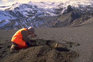 A scientist from the Alaska Volcano Observatory studies tephra from the 1992 eruptions of the Crater Peak vent of Mount Spurr volcano. Three brief explosive eruptions blanketed narrow swaths of the surrounding area with ash. Detailed investigations of deposits are necessary to understand eruption characteristics and magnitude. In this view, about 15 cm of coarse ash and lapilli is exposed in the pit and blocks from the 16-17 September 1992 eruption are scattered across the surface.
Photo by Game McGimsey, 1992 (Alaska Volcano Observatory, U.S. Geological Survey).
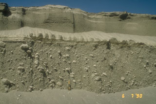 Pyroclastic flow deposits from the 15 April (lower 2/3 of section) and 21 April (upper 1/3 of section), 1990 eruptions of Redoubt in Alaska are exposed in a gully. The shovel at the base of the section provides scale. The larger 15 April pyroclastic flow carried large blocky fragments of a lava dome that had been growing in the summit crater.
Photo by Christina Neal, 1990 (Alaska Volcano Observatory, U.S. Geological Survey).
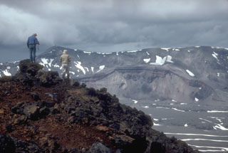 Volcanologists from the U.S. Geological Survey on the rim of the intra-caldera Vent Mountain at Aniakchak look NW towards Half Cone, a prominent feature on the caldera floor and the source of an explosive post-caldera eruption. The NW caldera rim of Aniakchak caldera forms the skyline.
Photo by Christina Neal, 1992 (Alaska Volcano Observatory, U.S. Geological Survey).
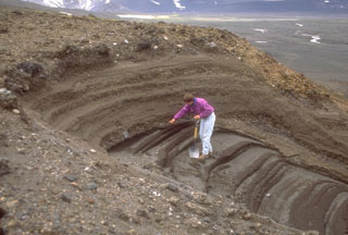 A geologist examines pyroclastic deposits (above hand) from a violent eruption of Half Cone less than 500 years ago. The Half Cone layers overlie dark gray phreatomagmatic deposits from Surprise tuff cone in Aniakchak caldera. The Half Cone eruption produced about 1 km3 of tephra and resulted in truncation of the SE side of the cone.
Photo by Game McGimsey (Alaska Volcano Observatory, U.S. Geological Survey).
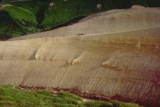 This outcrop exposes a thick pyroclastic flow deposit from an eruption that formed a small caldera on the eastern edge of Black Peak volcano. This major eruption occurred about 4,200 to 4,700 years ago and filled adjacent valleys to depths of up to 100 m.
Photo by Tom Miller, 1985 (Alaska Volcano Observatory, U.S. Geological Survey).
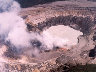 This February 1982 photo of the Poás active crater shows a gas plume rising from fumaroles on the southern crater rim. The northern crater wall in the background exposes pyroclastic deposits from phreatomagmatic and phreatic eruptions.
Photo by National Aeronautical and Space Administration (NASA), 1982.
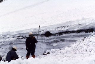 Snowpack on the western flank of Tokachi preserves individual layers of pyroclastic surge and pyroclastic flow deposits from the 1988-89 eruption. Because the eruptions took place during the winter, snowfall proved very useful to scientists in distinguishing the deposits of small-scale eruptions that lasted only a very short time.
Photo by Mario Yoshida, 1989 (Hokkaido University).
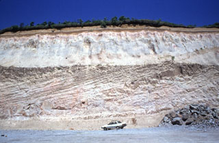 These thick pyroclastic flow deposits were produced during the major eruption that formed the 13 x 15 km Shikotsu caldera. The eruption produced 125 km3 of rhyolite tephra and pyroclastic flows. Pyroclastic flows traveled as far as 40 km, reaching the Pacific coast over a broad area. This outcrop is located 15 km ENE of the caldera.
Photo by Ryuta Furukawa, 1993 (Hokkaido University).
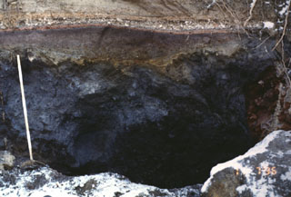 This outcrop, 5 km SW of the summit of Komagatake, shows a cross section of deposits from the 1640 eruption. The dark section at the base is a debris avalanche deposit produced by collapse of the summit. The reddish-gray section above the ruler is a blast deposit related to the collapse. The thin white unit above the blast deposit is a layer of airfall pumice, which is much thicker at other locations closer to the axis of tephra deposition. The top of the section is a pyroclastic flow deposit.
Photo by Mitsuhiro Yoshimoto, 1995 (Hokkaido University).
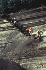 Volcanologists from the Institute of Volcanic Geology and Geochemistry in Petropavlovsk and the New Mexico Institute of Mining and Technology excavate a section through layered tephra deposits from Ilyinsky volcano in southern Kamchatka. Detailed study of the products of individual eruptions are used to determine the timing, frequency, and magnitude of those eruptions. The sequence of tephra layers shown here was deposited by explosive eruptions from Ilyinsky during the last 5,000 years.
Photo by Phil Kyle, New Mexico Institute of Mining and Technology, 1996 (courtesy of Vera Ponomareva, IUGG, Petropavlovsk).
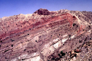 Uplift at Alid has exposed thick sequences of reddish, well-stratified siltstone beds, some very fossiliferous, which accumulated in a tidal or inter-tidal environment. High in the sequence there are some pillow basalts. At the very top of the sequence on the left is a few-meters-thick cover of light-colored rhyolitic Plinian pumice fallout.
Photo by Wendell Duffield, 1996 (U.S. Geological Survey).
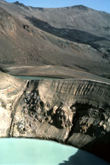 The 200-m-wide Viti maar crater, filled with a turquoise lake, was formed by phreatic explosions following a major Plinian eruption at Askja on 28-29 March 1875. Note the fault cutting the crater wall on the left. The dark lava flow in the background erupted from a vent on the NE caldera wall in 1921 and entered 4.5-km-wide Öskjuvatn lake, out of view to the right.
Photo by Michael Ryan, 1984 (U.S. Geological Survey).
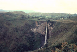 Sipisopiso waterfall, at the northern end of Lake Toba, formed on a cliff in the Middle Toba Tuff (MTT) deposit. The MTT rhyolite ignimbrite (more than 60 km3) was emplaced about 500,000 years ago during the third largest of the four major Toba caldera-forming eruptions. Products of the densely welded MTT eruption are distributed over the northern part of the caldera.
Photo by Bill Rose, 1982 (Michigan Technological University).
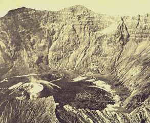 The cone at the lower left on the floor of Raung's summit caldera formed during an eruption in 1913. A lava flow erupted from the cone, extending to the right across the caldera floor. This aerial photo, taken some time before 1926, shows the steep, roughly 500-m-high SW caldera wall in the background.
Photo published in Taverne, 1926 "Vulkaanstudien op Java," (courtesy of Volcanological Survey of Indonesia).
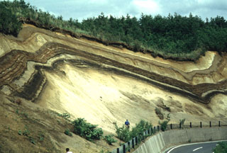 A roadcut west of the Ninokura dam exposes deposits from Towada. The thick light-colored unit at the base is the Hachinohe ignimbrite that formed about 13,000 years ago during the last of a series of explosive eruptions that resulted in the incremental formation of Towada's 11-km-wide caldera. The thinner light- and dark-colored deposits above the Hachinohe ignimbrite were produced by post-caldera eruptions, the most recent of which took place in 915 CE.
Photo by Yukio Hayakawa (Gunma University).
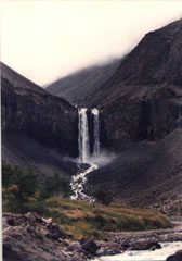 Water draining from Tianchi lake plunges over a mid-Pleistocene trachytic lava flow near the caldera rim on the upper N flank of Changbaishan (Baitoushan) volcano.
Photo by Xiang Lui, 1983 (Changchun University).
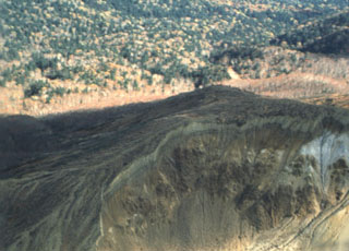 Hydrothermally altered rocks in the crater of Maruyama lava dome are seen in the foreground of this aerial view from the NE. Maruyama, which had a minor phreatic eruption in 1898, is part of the Nipesotsu-Maruyama volcano group, located in central Hokkaido E of Tokachidake volcano. The group is composed of a number of overlapping cones and lava domes along a NW-SE trend.
Photo by Yukio Hayakawa, 1990 (Gunma University).
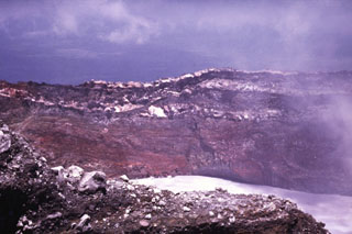 The walls of Cráter Activo expose thick sequences of oxidized and hydrothermally altered pyroclastic deposits and lighter lava flows. Many eruptions from Active Crater have originated from vents beneath the acidic crater lake.
Photo by Guillermo Alvarado (Instituto Costarricense de Electricidad).
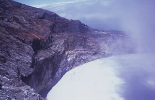 The 700-m-wide Cráter Activo contains an acidic lake that is periodically partially ejected by explosive eruptions and therefore varies in depth. Trade winds from the ENE distribute acidic gas plumes to the SW, preventing vegetation growth.
Photo by Guillermo Alvarado (Instituto Costarricense de Electricidad).
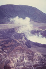 Von Frantzius cone rises beyond the degassing active crater of Poás. This cone was constructed near the northern margin of the inner caldera.
Photo by Guillermo Alvarado (Instituto Costarricense de Electricidad).
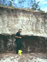 Volcanologist Jim Vallance samples the TB3 (Tierra Blanca 3) deposit, the second oldest of four major deposits associated with the formation of Ilopango caldera. This outcrop is located south of the town of Panchimalco, about 20-30 km SW of the caldera.
Photo by Carlos Pullinger, 1996 (Servicio Nacional de Estudios Territoriales, El Salvador).
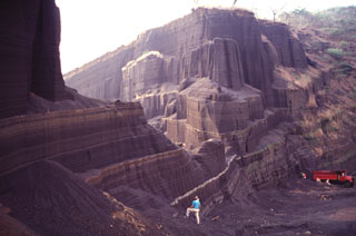 Bedded scoria deposits that formed the flanks of a basaltic scoria cone are exposed in a quarry at Cerro Singüil. This cone is the largest of a small cluster of cones in El Salvador's interior valley, SE of Volcán Chingo. These cones are part of a broad area of monogenetic basaltic volcanism near the Guatemalan border.
Photo by Carlos Pullinger, 1996 (Servicio Nacional de Estudios Territoriales, El Salvador).
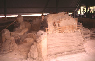 Laminated pyroclastic surge deposits surround the walls of houses buried by an eruption from the Laguna Caldera scoria cone on the lower NW flank of San Salvador. This eruption occurred around 590 CE and buried at least three Mayan homesteads beneath more than 4 m of scoria and ash.
Photo by Giuseppina Kysar, 1999 (Smithsonian Institution).
 Oxidized red scoria deposits are exposed in a quarry on Cerro el Cerrito, a scoria cone on the lower northern flank of San Salvador immediately SE of the town of Quezaltepeque.
Photo by Carlos Pullinger, 1996 (Servicio Nacional de Estudios Territoriales, El Salvador).
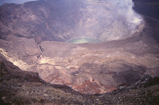 Santa Ana's active crater contains an acidic crater lake within the SE end of a series of four nested craters. This photo is taken from the northern rim of the second youngest crater and shows an older crater floor containing several small phreatomagmatic vents that formed during historical eruptions.
Photo by Carlos Pullinger, 1996 (Servicio Nacional de Estudios Territoriales, El Salvador).
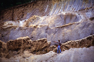 The thick light-colored unit the volcanologist is pointing to is the Arce fall deposit, overlying a paleosol and mafic ash and scoria deposits. This outcrop is about 15 km NW of the caldera rim. The biotite-rich rhyolitic Arce pumice-fall deposit was erupted from Coatepeque caldera about 72,000 years ago and was associated with formation of the SW part of the caldera. Deposits of the 84,000-year-old Los Chocoyos Ash from Atitlán caldera in Guatemala lie about 3 m below the base of the Arce deposit, but are not visible in this photo.
Photo courtesy of Carlos Pullinger, 1996 (Servicio Nacional de Estudios Territoriales, El Salvador).
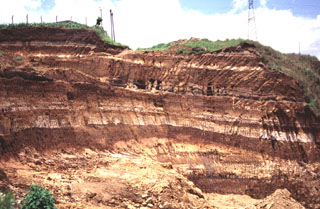 Light-colored rhyolite airfall pumice deposits from Coatepeque caldera are exposed in this quarry 20 km east of the caldera. These deposits were emplaced over much of SW El Salvador, and with the associated pyroclastic flow deposits have a volume of about 56 km3. The earlier biotite-bearing Arce deposits were produced during the largest eruption from Coatepeque about 72,000 years ago and are about 50 cmr thick at the Guatemalan border. The overlying Congo deposits originated during the second largest eruption of Coatepeque.
Photo by Carlos Pullinger, 1996 (Servicio Nacional de Estudios Territoriales, El Salvador).
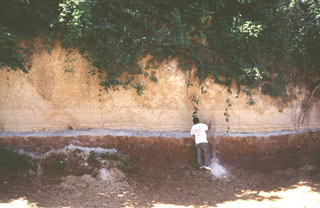 A volcanologist investigates an exposure of the Arce deposits on the eastern flank of Chilamatal caldera, about 10 km ENE of the rim of Coatepeque caldera. The Arce eruption around 72,000 years ago produced about 40 km3 of tephra and was associated with the first caldera-forming event at Coatepeque. The Arce deposits consist of two thick biotite-rich pumice fall deposits, separated by thin tephra deposits containing ash, pumice, and lithics. These ashfall deposits are distributed over much of western El Salvador.
Photo by Carlos Pullinger, 1996 (Servicio Nacional de Estudios Territoriales, El Salvador).
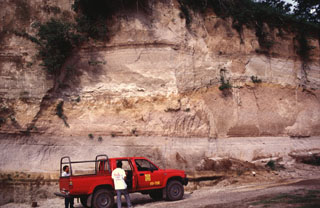 Rhyolite pumice fall and pyroclastic flow deposits from the two caldera-forming eruptions (Arce and Congo) at Coatepeque are exposed in this quarry wall. The lower Arce pumice and overlying pyroclastic flow deposit have a total volume about 40 km3 and were emplaced during the 72,000 BP eruption that formed the NE part of the caldera. The upper deposits (above the undulating brown paleosol in the center of the photo) are from the 16 km3 Congo eruption prior to about 57,000 years ago and were erupted through a caldera lake.
Photo by Carlos Pullinger, 1996 (Servicio Nacional de Estudios Territoriales, El Salvador).
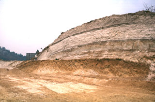 Four major pyroclastic units associated with the incremental formation of Ilopango caldera are exposed in this quarry. The Tierra Blanca (White Soil) unit that was emplaced over much of central and western El Salvador consists of (from bottom to top) the Pleistocene TB4 (the orange-colored unit at the base), TB3, and TB2 units (separated by thin soils), and the Holocene TBJ unit. The latter is called the Tierra Blanca Joven (the young Tierra Blanca) and was erupted about 1,500 years ago. Note the geologist on the left side of the outcrop for scale.
Photo by Carlos Pullinger, 1996 (Servicio Nacional de Estudios Territoriales, El Salvador).
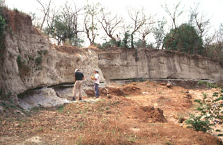 Geologists investigate an outcrop of the Tierra Blanca Joven (TBJ) formation about 10 km SE of Ilopango caldera where it originated. The TBJ was produced during the last of four major explosive eruptions that formed the caldera and deposited pyroclastic flows, ashfall, and pumice across much of central and western El Salvador. The eruption destroyed early Mayan cities and forced their abandonment for decades to centuries. Trade routes were disrupted, and the centers of Mayan civilization shifted from the highland areas of El Salvador to lowland areas to the north and in Guatemala.
Photo by Carlos Pullinger, 1996 (Servicio Nacional de Estudios Territoriales, El Salvador).
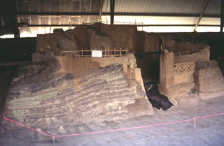 An excavation at the Joya de Cerén archaeological site in the Zapotitán Valley shows pyroclastic surge deposits from the 590 CE eruption of the Laguna Caldera scoria cone against Mayan buildings. The excavation has unearthed several small Protoclassic Mayan homesteads that were buried by this eruption on the northern flank of San Salvador. They contain the remains of uneaten meals left by occupants who evacuated their houses.
Photo by Giuseppina Kysar, 1999 (Smithsonian Institution).
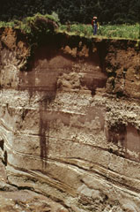 Stream erosion exposes an outcrop of the Upper Toluca Pumice, which originated during the last large Plinian eruption of Nevado de Toluca volcano some 10,500 years ago. This eruption produced a sequence of pyroclastic flow, pyroclastic surge, and ashfall deposits. Note the person at the top of the outcrop for scale. The Upper Toluca Pumice was distributed primarily to the NE and is found over much of the Valley of México.
Photo by José Macías, 1995 (Universidad Nacional Autónoma de México).
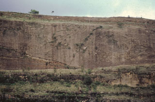 An exposure on the south flank of the Nevado de Toluca shows two debris flow deposits transformed from original flank failures of the volcano during the late Pleistocene. Debris avalanche and lahar deposits cover a broad area of about 500 km2 to the south.
Photo by José Macías, (Universidad Nacional Autónoma de México).
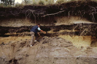 Products of three recent Plinian eruptions of Popocatépetl are seen in this stratigraphic section located near Paso de Cortés at the saddle between Popo and Iztaccíhuatl volcanoes. The thick basal unit was emplaced about 5,000 years ago. It is known as the Upper Pre-Ceramic eruptive sequence and includes pyroclastic flows and secondary lahars that traveled to the south. Volcanologist Claus Siebe is pointing to the overlying 2,500-year-old Lower Ceramic unit, and the 1,100-year-old Upper Ceramic Plinian unit lies at the top.
Photo by José Macías, 1995 (Universidad Nacional Autónoma de México).
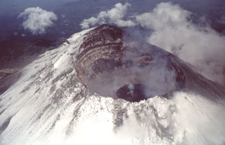 An aerial view of Popocatépetl from the east on 4 July 1997 shows a dark gray lava dome with a strong fumarole emanating from its center. This dome was extruded after an explosive event on 30 June 1997 produced an eruptive column that deposited a thin ash layer on Mexico City. The far crater wall reveals a stratigraphic profile of lava flows and fragmental material forming the upper part of the cone.
Photo by José Macías, 1997 (Universidad Nacional Autónoma de México).
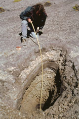 A trench dug on the flank of the Popocatépetl above the tree line at 4 km exposes deposits of a major explosive eruption. Volcanologist Claus Siebe from the National University of Mexico is measuring the thickness of an alternating sequence of ashfall and pyroclastic surge deposits produced during a Plinian eruption of the volcano about 1,100 years ago. Following this major eruption, lahars from accumulated ashfall deposits on the slopes of Popocatépetl and Iztaccíhuatl flooded the Puebla basin.
Photo by José Macías, 1998 (Universidad Nacional Autónoma de México).
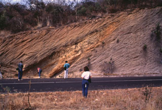 Geologists investigate an exposure in the Popocatépetl southern flank of along the road connecting the towns of Hueyapan and Amayuca in the state of Morelos. The outcrop shows two debris avalanche deposits separated by a yellowish reworked horizon. The deposit to the left corresponds to the youngest avalanche produced by the southern flank failure of the ancient Popocatépetl around 23,000 years ago. Major flanks collapse events have occurred at least three times during the Pleistocene.
Photo by José Macías, 1995 (Universidad Nacional Autónoma de México).
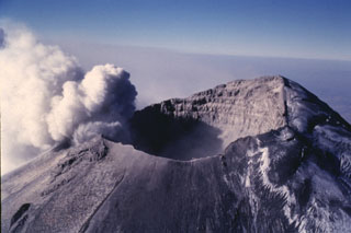 An ash plume erupts from the small vents along the eastern edge of the crater in this 11 March 1996 photo. The plume rises up to the crater rim then is dispersed by the predominant winds to the east, becoming detached from the summit crater after the explosion ends. The glacier on the NW (right) side of the crater is partly covered with dark gray ash from previous eruptions.
Photo by José Macías, 1996 (Universidad Nacional Autónoma de México).
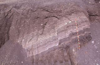 These scoria layers from Santa Ana were transported intact with only slight disruption out to about 30 km from the volcano in the Acajutla debris avalanche. A more than 20-m-thick sequence of inter-bedded tephra layers and thin lava flows within an avalanche hummock is exposed in this quarry in near Highway 2. The red-and-yellow bars on the scale mark 10-cm increments.
Photo by Paul Kimberly, 1999 (Smithsonian Institution).
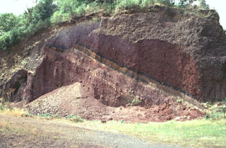 Scoria deposits are exposed in a quarry on the NE flank of Cerro Verde along the road to its summit. Cerro Verde is the largest of a chain of scoria cones on the SE flank of Santa Ana.
Photo by Paul Kimberly, 1999 (Smithsonian Institution).
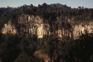 A massive columnar jointed lava flow is exposed in a valley NE of Orizaba volcano. The roughly 530,000-year-old Calcahualco lava flow was erupted during the Torrecillas stage, from the first of three major volcanic edifices forming the volcano. The source vent of this flow is now buried.
Photo by Lee Siebert, 1998 (Smithsonian Institution).
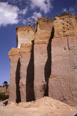 A quarry wall on the lower NW flank of Cofre de Perote volcano exposes a cross-section through part of the Xáltipan Ignimbrite, which erupted about 460,000 years ago and resulted in the formation of Los Humeros caldera. This massive 230 km3 ignimbrite covers a 3,500 km2 area and extends at least 50 km to the coastal plain. The mostly non-welded rhyolitic ignimbrite is overlain by co-ignimbrite airfall tuffs and eight airfall lapilli tuffs.
Photo by Lee Siebert, 1997 (Smithsonian Institution).
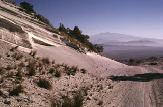 A roadcut through the eastern rim of the Cerro Xalapasco tuff cone exposes pyroclastic-surge deposits. The road provides access to a quarry where perlite (hydrated obsidian) is mined. Cofre de Perote volcano rises on the distant horizon across the Serdán-Oriental basin.
Photo by Lee Siebert, 1998 (Smithsonian Institution).
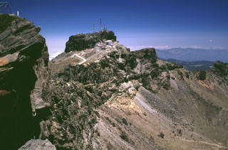 The summit region of Cofre de Perote consists of at least two glacially eroded edifices. Glacial cirques and moraines are found in the summit area. The steep-walled east-facing scarp cutting across the center of the photo that exposes westward-dipping lavas was formed in part by edifice collapse.
Photo by Lee Siebert, 1999 (Smithsonian Institution).
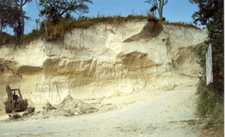 Pyroclastic flow and ashfall deposits from Ilopango caldera, known collectively as Tierra Blanca (White Soil), are found over much of central and western El Salvador. This quarry near the city of Cojutepeque (9 km ENE of the caldera) exposes the Tierra Blanca Joven (TBJ) formation that was produced during the youngest of several Tierra Blanca eruptions about 1,500 years ago. The eruption destroyed early Mayan cities and resulted in their abandonment for decades to centuries.
Photo by Giuseppina Kysar, 1999 (Smithsonian Institution).
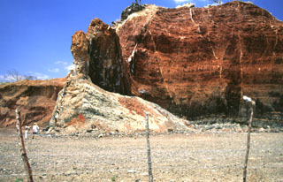 Volcanic dikes of varying orientations were emplaced into oxidized red scoria in a quarried scoria cone near the village of Agua Blanca. Several generations of thin dikes are visible (note people at the lower left for scale). The larger dike supporting the pinnacle near the center is oriented north-south, parallel to the direction of faults defining the Ipala graben.
Photo by Giuseppina Kysar, 1999 (Smithsonian Institution).
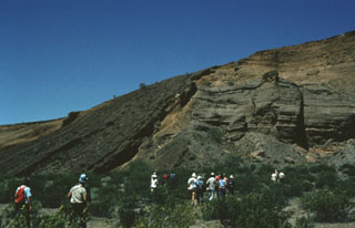 Participants in a geological field excursion examine the stratigraphy within the Cerro Colorado maar. The outcrop exposes a variety of deposits produced by several episodes of phreatomagmatic activity. The south crater walls here reveal layered tuff deposits and material from the collapse of the inner crater wall into the vent. Steeply dipping dark-colored tuff beds (left) can be traced from the crater floor up and over the walls, and then down the outer flanks of the cone.
Photo by Bill Rose, 1978 (Michigan Technological University).
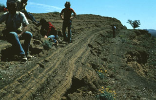 A group of geologists observe bedded pyroclastic surge deposits from the Cerro Colorado maar. Thinly bedded surge units are typical of distal portions of pyroclastic surge deposits, caused by deposition of material from the basal part of the flow.
Photo by Bill Rose, 1978 (Michigan Technological University).
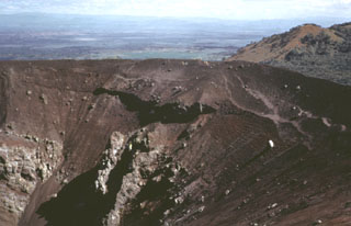 Volcán Tecolote is one of the youngest scoria cones of the Pinacate volcanic field and is located NE of Cráter Elegante. This complex cone contains faults and small craters, opens towards the NW, and was constructed on top of the Mayo cone. Large volcanic bombs, some with cores of older volcanic and non-volcanic rocks, are scattered across the southern and east crater rims and southern flanks. Six basaltic ‘a’a lava flows extend from the base of the cone.
Photo by Bill Rose, 1974 (Michigan Technological University).
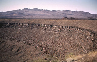 Santa Clara shield volcano, seen on the SW horizon beyond the rim of Cráter Elegante maar, is of late-Pliocene to Pleistocene age. The broad edifice is largely mantled by pyroclastic ejecta and lava flows of the basaltic Pinacate monogenetic volcanic series, which began erupting about 1.2 million years ago. More than 500 scoria cones and associated lava flows have formed across the Pinacate field and extend into the surrounding desert.
Photo by Bill Rose, 1969 (Michigan Technological University).
 Pyroclastic surge deposits exposed in gullies on the flanks of Cráter Elegante in the Pinacate volcanic field of NW México. This photo shows cross bedding produced by particles transported by saltation or dilute suspension in a high-velocity pyroclastic surge. The direction of movement of the surge cloud, seen by the truncation of dune beds on the near-vent side, was from right to left. This type of bedding is common in areas near the rim of the maar.
Photo by Bill Rose, 1997 (Michigan Technological University).
 The steep walls of the 1902 explosion crater at Santa María expose a sequence of alternating thin (1-10 m) light-colored lava flows and brownish-colored block-and-ash flow deposits. Growth of the cone involved the extrusion of lava flows, mostly from the summit vent.
Photo by Bill Rose, 1974 (Michigan Technological University).
 The catastrophic 1902 Santa María eruption formed a massive 1.5-km-wide crater in the SW flank. The upper part of the crater wall, which extends nearly to the summit of Santa María, is seen here from the SW. Guatemala's second largest city, Quetzaltenango, lies in the basin visible to the left, 10 km to the NNE. The 1902 eruption took place after a long period of quiescence that followed construction of the edifice.
Photo by Sam Bonis (Instituto Geográfico Nacional).
 The rock around the Almolonga volcano Zunil geothermal field on the SE flank of Cerro Quemado volcano is extensively hydrothermally altered. The geothermal area is located along the Zunil fault zone, which juxtaposes brownish-red weathered to lightly altered andesite to dacite lava flows with white-to-pink heavily altered and brecciated volcanic rock. Hydrothermal alteration minerals include kaolinite, pyrite, gypsum, and alunite. The NE-SW-trending left-lateral fault zone runs parallel to the valley of the Río Samalá.
Photo by Bill Rose, 1981 (Michigan Technological University).
 Thick units of the 84,000-year-old Los Chocoyos Ash are exposed south of Guatemala City, more than 100 km from its source at Atitlán caldera. Three units are visible here. The pinkish unit across the center of is the oxidized top of the pyroclastic flow deposit. The bottom two white units are the top and bottom halves of the deposit. The two fall deposits above the Los Chocoyos Ash are unit E from Amatitlán caldera and the younger unit C from Volcán de Agua.
Photo by Bill Rose, 1978 (Michigan Technological University).
 The 84,000-year-old Los Chocoyos Ash from Atitlán caldera is exposed in a quarry near San Juan Ostuncalco, west of Quetzaltenango. The white layer at the base is layer H, a rhyolite unit that is one of the largest known Plinian fall deposits in Central America. Despite its relative thinness, it is preserved over the entire Guatemalan highlands. The thicker overlying unit is the pyroclastic flow deposit, part of the Los Chocoyos ash. This massive unwelded pyroclastic flow deposit is up to 200 m thick.
Photo by Bill Rose, 1974 (Michigan Technological University).
 A geologist examines an outcrop of the 84,000-year-old Los Chocoyos Ash near Patzún, about 10 km E of Lake Atitlán. Note the charred log above his head. This pyroclastic flow unit of the Los Chocoyos deposit is up to 200 m thick and is exposed over an area of about 2,000 km2. Individual flow units of the voluminous ignimbrite are sometimes more than 100 m thick. The upper part of the deposit is characteristically salmon-pink in color as a result of oxidation of the cooling flow.
Photo by Bill Rose, 1980 (Michigan Technological University).
 A thick sequence of tephra layers, mostly from Acatenango, is exposed on the northern flank. Yepocapa, the northernmost of the two volcanic centers forming Acatenango, formed between about 70,000 and 43,000 years ago. Its major period of eruptive activity ended about 20,000 years ago, after which the activity of the southernmost center, Pico Mayor, commenced.
Photo by Bill Rose, 1987 (Michigan Technological University).
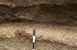 A tephra layer from Acatenango is exposed NE of the volcano along the road between Antigua and Yepocapa. Pottery fragments within the tephra layer were dated between 1,400 and 1,500 CE. Most Holocene eruptions from Acatenango originated from Pico Mayor, the southernmost and highest of the two peaks. The scale bar marks 10 cm intervals.
Photo by Bill Rose, 1978 (Michigan Technological University).
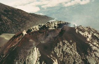 An aerial view of the Fuego summit crater in 1990 shows the products of both effusive and explosive eruptions. The crater walls expose light-colored lava flows and lava agglutinate as well as darker scoria deposits. Historical eruptions have been basaltic in composition, continuing a trend towards more mafic in the Acatenango-Fuego volcanic complex. An Acatenango flank is to the left in this view from the SW.
Photo by Bill Rose, 1990 (Michigan Technological University).
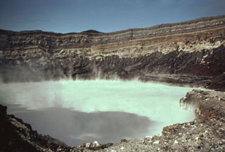 The degassing crater lake at the summit of Poás volcano is seen here in 1982. The 800-m-wide crater lies near the center of the smaller of two calderas at the summit. One of the world’s most acidic natural lakes, the diameter and depth varies with seasonal rainfall and eruptive activity; on occasion the lake has disappeared.
Photo by Bill Rose, 1982 (Michigan Technological University).
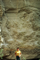 The giant pumice beds at Primavera volcano represent an unusual sedimentation event following formation of La Primavera caldera. Individual pumice blocks from 0.3 to more than 6 m across are enclosed within fine-grained volcanic ash-rich lake sediments. The giant pumice blocks originated by eruption of rhyolitic lava into a caldera lake. The pumice fractured into large blocks that floated to the surface, rafted across the lake, and settled to the bottom after becoming waterlogged. Subsequent deposition of fine-grained lake sediments buried the pumice blocks.
Photo by Jim Luhr, 1979 (Smithsonian Institution).
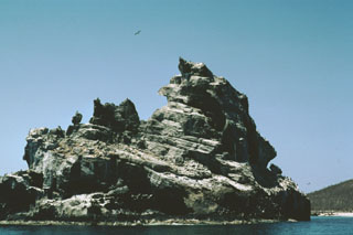 Wave erosion of a tuff cone off the western coast of Isla Isabel has produced the jagged profile of the 100-m-wide southernmost sea stack in the Islotes Las Monas. The three guano-covered cone remnants forming the Islotes Las Monas lie within about 200 m of the eastern coast of Isla Isabel, which can be seen to the right.
Photo by Jim Luhr, 1999 (Smithsonian Institution).
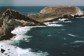 The flat-topped Cerro El Faro cone (upper right) lies across a low isthmus at the southernmost tip of Isla Isabel. It is seen here across the Acantilado Mayor Bay from Cerro del Mirador, the high point of the small 1.5-km-long island. Wave erosion has eroded the flank of Monte Transverso to the left. The two cones are connected by a lava flow.
Photo by Jim Luhr, 1999 (Smithsonian Institution).
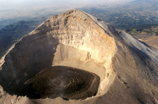 This photo shows the Popocatépetl summit crater with fresh lava visible on 9 December 1997 after rapid lava extrusion during 5-6 December had almost covered the entire crater floor. The high point on the WSW crater rim rises 450 m above the floor of the 700-m-wide crater. The stratigraphy of the upper cone is visible in the far crater wall.
Photo by Hugo Delgado-Granados, 1997 (Universidad Nacional Autónoma de México).
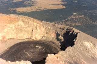 Black lava fills the crater floor of Popocatépetl on 9 December 1997 after rapid lava extrusion on December 5-6 had almost covered the entire crater floor. Circular flow ridges that formed during lava extrusion from the central vent are visible. TV transmission towers at Cerro Tlamacas on the northern flank are seen in the background to the upper right, and at the top of the photo are the light-colored grasslands of Llano Grande at Paso de Cortés, the saddle between Popocatépetl and Iztaccíhuatl volcanoes.
Photo by Hugo Delgado-Granados, 1997 (Universidad Nacional Autónoma de México).
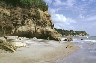 Cliffs along the southern coast of Panamá, west of Panama City, expose ignimbrite deposits from El Valle volcano.
Photo by Lee Siebert, 1998 (Smithsonian Institution).
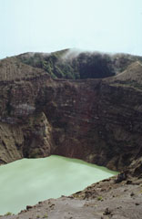 The two main summit craters of Irazú are seen here from the west in 1998. A lake fills the bottom of the main crater (Cráter Principal), with the older Diego de la Haya crater at the top of the photo.
Photo by Paul Kimberly, 1998 (Smithsonian Institution).
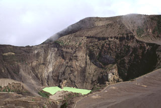 The Irazú main crater is about 700 m wide and 200 m deep. It is seen here in 1998 from the summit, with ash-covered Playa Hermosa (a largely buried older crater) to the lower right, and the edge of Diego de la Haya crater to the upper right.
Photo by Lee Siebert, 1998 (Smithsonian Institution).
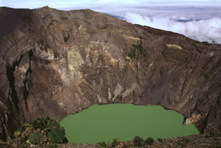 The Irazú summit crater is about 700 m wide and nearly 200 m deep and has been the source of most of Irazú's historical eruptions. Geothermal activity is frequently observed around of the lake, and the water color varies with changing atmospheric conditions.
Photo by Lee Siebert, 1998 (Smithsonian Institution).
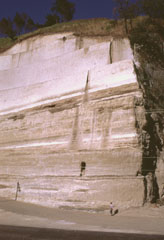 Thick sequences of tephra from Amatitlán caldera are exposed in roadcuts in the Guatemala City area, note INSIVUMEH geologist Otoniel Matías for scale at the lower right. This exposure is located south of the capital city, along the road to Palin. Major explosive eruptions from Amatitlán caldera have been dated to between about 300,000 to less than 23,000 years ago. The northern caldera rim is buried by thick pyroclastic deposits and underlies portions of Guatemala City.
Photo by Lee Siebert, 1999 (Smithsonian Institution).
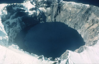 A 750-m-wide crater filled with a lake truncates the summit of Kasatochi. Crater walls rise to a maximum height of 314 m above the lake surface, which is less than 60 m above sea level in this 1961 photo. The volcano is located at the northern end of a shallow submarine ridge trending perpendicular to the Aleutian arc and occupies an island volcano 2.7 x 3.3 km wide.
Photo by Dan Rogers, 1961 (courtesy of Alaska Volcano Observatory, U.S. Geological Survey).
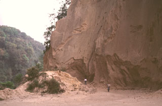 A quarry along the road between Teocelo and Cosautlán de Carvajal exposes thick deposits of the 230 km3 Xáltipan Ignimbrite from Los Humeros volcano. This outcrop lies about 50 km SE of Los Humeros, beyond the Pico de Orizaba-Cofre de Perote range, much of which post-dates the 460,000-year-old ignimbrite. Eruption of the Xáltipan Ignimbrite, which covered an area of about 3,500 km2, resulted in the formation of a 15 x 21 km wide caldera.
Photo by Lee Siebert, 2000 (Smithsonian Institution).
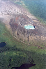 This photo from the E overlooks the Rincón de la Vieja summit cone complex in the Rincón de la Vieja National Park. The turquoise-colored lake is within the Cráter Activo and the darker Laguna Fria is to the lower left. The arcuate, forested ridge to the lower left is the rim of Rincón de la Vieja cone itself. Erosional gullies have formed within tephra deposits across the Cráter Activo and the Von Seebach cone (upper left) flanks.
Photo by Federico Chavarria Kopper, 1995 (courtesy of Eduardo Malavassi, OVSICORI-UNA).
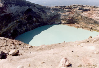 The crater lake of the Cráter Activo of Rincón de la Vieja is seen here on 2 April 1998 from its eastern rim during the 1998 eruption. The eruption began with phreatic explosions during 15-18 February that produced steam plumes up to 2 km above the crater lake, and scorched vegetation on the NE side of the crater. On 16 February a lahar traveled around 12 km down the Penjamo and Azul rivers. Twenty explosions were recognized from seismic records, and additional explosions were recorded in May, June, and September.
Photo by José Enrique Valverde Sanábria, 1998 (courtesy of Eduardo Malavassi, OVSICORI-UNA).
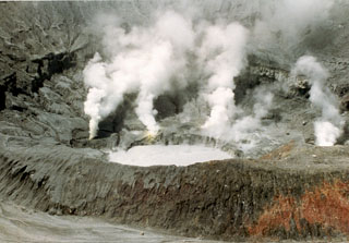 Minor phreatic eruptions ejecting material to heights of several meters were reported in March 1994. Two more phreatic eruptions were reported at the end of April, by which time the crater lake was nearly gone. Intense gas emission in the ensuing months caused health problems and severe economic losses in agricultural areas. Eruptions producing ash plumes that took place on 3 June and 9 July-5 August formed a small new crater. The crater lake (seen here 2 September 1994) returned, and minor phreatic eruptions occurred in October.
Photo by José Enrique Valverde Sanabria, 1994 (courtesy of Eduardo Malavassi, OVSICORA-UNA).
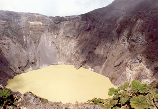 A lake occupies one of the Irazú summit craters (seen here from the southern crater rim in 1996), which has been the source of many recent eruptions. The first well-documented eruption of Irazú occurred in 1723, and frequent explosive eruptions have occurred since. Ashfall from its last major eruption during 1963-65 caused significant disruption to San José and surrounding areas.
Photo by José Enrique Valverde Sanabria, 1996 (courtesy of Eduardo Malavassi, OVSICORI-UNA).
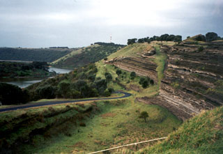 Tower Hill maar, with bedded pyroclastic layers exposed in its wall, is part of the voluminous Newer Volcanics Province, which covers a broad 15,000 km2 area of SE Australia. The volcanic field contains nearly 400 vents, with late-Pleistocene to Holocene eruptions producing scoria cones, maars, tuff rings, and valley-filling lava flows. The most recent eruptions took place at Mount Schank and Mount Gambier.
Photo by Monica Handler, 1995 (Carnegie Institution).
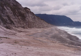 Stratified phreatomagmatic deposits are exposed along a cliff on the eastern coast of Niijima, with the flat-topped Miyazukayama lava dome in the background. The 11-km-long island is comprised of eight rhyolite lava domes clustered in two groups. The Mukaiyama complex at the southern end of the island and Achiyama lava dome at the northern end formed during the 9th century CE.
Photo by Ichio Moriya (Kanazawa University).
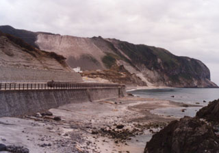 The Mukaiyama lava dome lies at the southern end of the island of Niijima. It formed during a single eruption in July 886 CE beginning in shallow water with the formation of a tuff ring from repeated base surges, followed by a pyroclastic cone and lava domes.
Photo by Ichio Moriya (Kanazawa University).
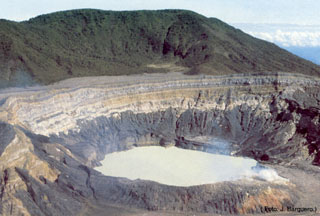 The acidic crater lake at the summit of Poás is seen here from the overlook on the southern crater rim. The von Frantzius cone in the background formed along the northern rim of the innermost of two large nested calderas at the summit. The crater lake has been the source of frequent phreatic eruptions.
Photo by Jorge Barquero, 1985 (Universidad Nacional Costa Rica).
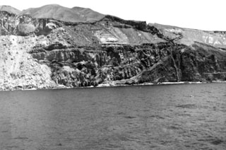
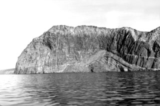 Steep cliffs forming across the southern end of Guadalupe Island expose thick lava flows that buried bedded pyroclastic units to the lower right.
Photo by Al Segel, 1963 (courtesy of Rodey Batiza, University of Hawaii).
 A buried valley-filling lava flow sequence is exposed in the center of the photo in a western cliff face of Guadalupe Island. Pyroclastic deposits from scoria cones are exposed above the flows.
Photo by Al Segel, 1963 (courtesy of Rodey Batiza, University of Hawaii).
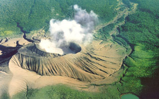 A steam plume rises from Cráter Activo of Rincón de la Vieja, seen here from the south with an acidic crater lake filling the innermost of two nested craters. Frequent eruptions and acid rain have kept the flanks of the cone unvegetated. Remobilization of fresh deposits has produced lahars down the Quebrada Azufrosa to the upper right.
Photo by Federico Chavarria Kopper, 1999.
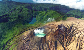 This aerial photo from the north overlooks the Rincón de la Vieja summit cone complex in NW Costa Rica. A gas plume rises from the acidic Cráter Activo lake, and erosional gullies have formed across the flanks. The darker Laguna Fria beyond the Cráter Activo is a non-volcanic lake formed between the vegetated Rincón de la Vieja crater (far-left) and the ridge extending to Santa María to the upper left of the photo.
Photo by Federico Chavarria Kopper, 1996.
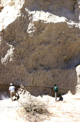 The voluminous La Soledad deposit was erupted in the Zitácuaro-Valle de Bravo volcanic field area about 500,000 years ago and is composed of a complex sequence of block-and-ash and pumice deposits. Geologists in the photo investigate a thick (up to 10 m) pumice deposit that lies on top of a pyroclastic surge layer.
Photo by Lucia Capra, 1993 (courtesy of José Macías, Universidad Nacional Autónoma de México).
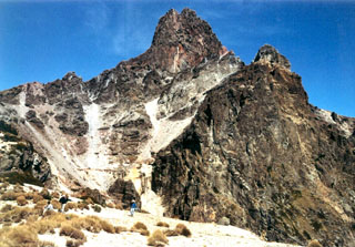 The summit pinnacle of La Malinche is seen here from the south. The summit consists of several lava domes, one of which filled the vent from the last major eruption of the volcano about 3,100 years ago. Note the people in the left foreground for scale.
Photo by Renato Castro, 2000 (courtesy of José Macías, Universidad Nacional Autónoma de México).
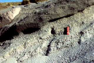 The products of the last major eruption of La Malinche that occurred about 3,100 years ago are exposed around the summit area and consist of a weakly stratified pumiceous ash and fine lapilli layer, along with associated pyroclastic flow and lahar deposits. Lahars originating from La Malinche reached the Puebla basin and contain pottery fragments, indicating that nearby communities were affected by the eruption. The pocket knife provides scale.
Photo by Renato Castro, 2000 (courtesy of José Macías, Universidad Nacional Autónoma de México).
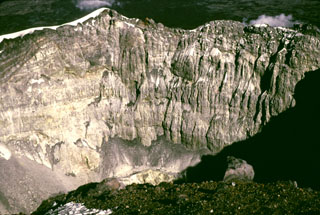 The steep crater wall of Popocatépetl is seen here from the western crater rim 1979 showing the stratigraphy of the upper cone. The low point on the eastern crater rim is about 170 m below the summit.
Photo by Bob Luhr, 1979.
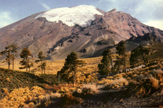 The El Glaciar Norte is located on the northern side of Popocatépetl. Faint climbers' trails can be seen on the lower northern flank heading towards Ventorillo, the peak below the horizon to the right. The popular Las Cruces summit route ascends diagonally below the glacier to the left. The 5,000-m-high El Ventorrillo is the summit of the eroded Nexpayantla edifice, a predecessor to Popocatépetl. Its steep cliffs expose the stratified interior.
Photo by Hugo Delgado-Granados (Universidad Nacional Autónoma de México).
 This aerial view shows the Popocatépetl summit crater in 1996, following the 1994-95 eruptive period. Subsequent activity has been both effusive and explosive, with periodic extrusion and explosive removal of lava domes emplaced on the crater floor. This aerial view is roughly from the north, with the summit out of view to the right.
Photo by Hugo Delgado-Granados, 1996 (Universidad Nacional Autónoma de México).
 A quarry exposes red, oxidized scoria deposits with interbedded lighter lava flow units (possibly due to surface alteration) at Cerro la Leona scoria cone on the northern rim of Coatepeque caldera. The stratigraphy of the adjacent Cerro la Leona and Cerro Cañitas cones on the NE caldera rim were exposed by the caldera ring faults. At least ten other scoria cones on the eastern and southern caldera rims overlap ring faults.
Photo by Lee Siebert, 2002 (Smithsonian Institution).
 The pyroclastic surge deposits in the foreground are exposed in front of Cerro Pinto lava dome. The dome has a glassy and pumiceous outer layer partly overlain by pyroclastic surge deposits and blocks of local bedrock.
Photo by Gerardo Carrasco-Núñez, 2002 (Universidad Nacional Autónoma de México).
 Geologist Todd Housh observes pyroclastic surge deposits in the wall of an abandoned quarry on the north flank of Hoya Estrada maar, directly west of the town of Valle de Santiago. The exposure shows laminar and dune form-bedded surge deposits at the bottom with laminar ashfall layers at the top. The direction that the pyroclastic surges traveled was from right to left.
Photo by Jim Luhr, 2002 (Smithsonian Institution).
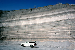 The walls of a quarry on the SW flank of Hoya Estrada maar close to the city of Valle de Santiago show a spectacular sequence of deposits from the maar-forming eruptions. Most of the outcrop consists of gray-colored dominantly planar pyroclastic surge beds. The three prominent light-colored layers are ashfall deposits. The largest ash layer is about 2 m thick just above the middle of the outcrop in this view looking towards the vent.
Photo by Jim Luhr, 2002 (Smithsonian Institution).
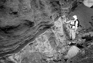 A geologist observes the contact between a basaltic Plinian fallout lapilli unit overlying marine clay. This deposit is part of thick beds of basaltic Holocene tephra originating from an unknown Quaternary volcanic center found near Crow Lagoon, north of Prince Rupert near the southern tip of the Alaskan panhandle. Ballistically emplaced bombs imply a nearby source. The tephra beds are located along the south side of the Khutzeymateen Inlet, about 40 km N of Prince Rupert.
Photo by Jack Souther (Geological Survey of Canada, courtesy of Cathie Hickson).
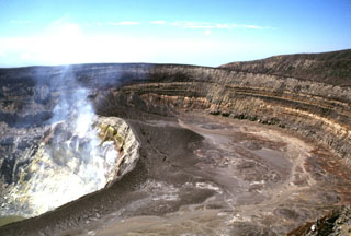 Several nested craters are found at the summit of Santa Ana. Gases rise from fumaroles on the steep NE wall of an inner crater, within a roughly 900-m-wide crater. The 80-m-high crater walls expose tephra layers from phreatomagmatic eruptions. The walls of the two outer craters, which open towards the SW, are at the upper right.
Photo by Lee Siebert, 2002 (Smithsonian Institution).
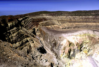 Sequences of phreatomagmatic tephra layers are exposed in the southern and western crater walls of Santa Ana. The hydrothermally altered area to the lower right is the inner crater, which contains an acidic lake not visible in this photo. Four crater walls can be seen in this photo; the two outer walls appear in the center on and below the horizon, beyond the flat rim of the inner crater.
Photo by Lee Siebert, 2002 (Smithsonian Institution).
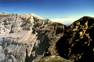 The eastern crater rim of Santa Ana rises more than 100 m above the crater floor. The eastern wall is composed of breccias, scoria units, thin lava flows, and dikes. Thick sequences of lava flows are exposed in the northern and southern crater walls and on the southern side they are overlain by phreatomagmatic tephra layers up to 100 m thick.
Photo by Lee Siebert, 2002 (Smithsonian Institution).
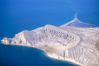 The Plaza de Toros tuff ring on the SE side of Isla San Luis is seen here from the east in 2000. Remnants of dacite lava flows are visible in the upper walls of the crater. Only a third of the tuff ring is still standing; the rest has subsided along normal faults or was eroded by wave action. Longshore currents have redistributed volcanic deposits to produce the tombolo to the upper right that forms the SW tip of the island and is 2 km long at low tide.
Photo by Keith Sutter, 2000.
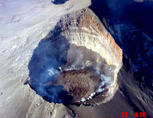 An aerial photograph from the NE on 23 December 2000 looks down into the Popocatépetl crater. Gas rises from the margins of lava emplaced in the summit crater since earlier that month. During December 2000 to January 2001 dome growth was at record-setting rates and amassed the largest active dome ever recorded at the volcano at the time. The previous dome-growth episode had taken place in February 2000.
Photo courtesy CENAPRED, Mexico City, 2000.
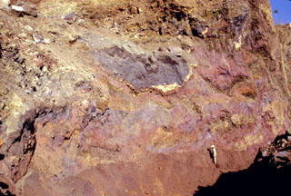 Multi-colored remnants of Santa Ana volcano are exposed in a quarry wall in a hummock of the Acajutla debris avalanche deposit with a geologist to the lower right for scale. This quarry in Cerro el Jicaro, 6 km SE of the city of Sonsonate, displays characteristic textures of debris avalanche deposits. Individual segments are faulted and slightly deformed, but retain their integrity despite being transported about 18 km from the volcano.
Photo by Paul Kimberly, 1999 (Smithsonian Institution).
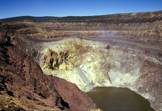 Gases rise from the hydrothermally altered western wall of Santa Ana's inner summit crater above the acidic lake. A steep path down the NE crater wall (far right) provides access to the lake for geochemical sampling. Sequences of phreatomagmatic tephra units more than 100 m thick are exposed in the walls of the outer summit craters.
Photo by Paul Kimberly, 2002 (Smithsonian Institution).
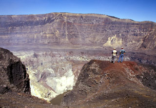 Geologists on the southern rim of Santa Ana's summit crater stand above the hydrothermally altered walls of the more than 100-m-deep inner crater. A near-vertical fault is visible in the far northern wall of the larger crater beyond the crater floor in the center of the photo, above the inner crater. Lava flows exposed in the crater wall are overlain by a roughly 10-m-thick light-brown sequence of phreatomagmatic tephra layers.
Photo by Paul Kimberly, 2002 (Smithsonian Institution).
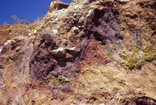 Multi-colored individual units of the Acajutla debris avalanche deposit are offset along normal faults in this view of a quarry wall 6 km SE of the city of Sonsonate. Many blocks are unfractured, and some are shattered blocks with jigsaw textures. About 8 m of the quarry wall is exposed on the right-hand side. The voluminous Acajutla avalanche deposit was produced by late-Pleistocene edifice failure of Santa Ana; this quarry lies about 18 km from the volcano.
Photo by Lee Siebert, 2002 (Smithsonian Institution).
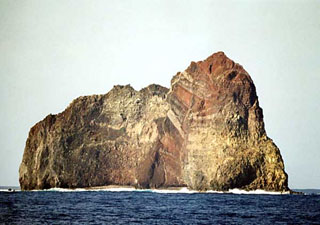 Wave erosion has exposed the spectacular stratigraphy of Sumisujima, a steep-sided pinnacle that is a remnant of the outer southern flank of a submarine caldera 6-9 km wide. Intrusive rocks, dikes, tephra layers, and breccias are visible in this view of the eastern side of the pinnacle. Submarine eruptions have been reported from a number of locations near here, the last of which occurred in 1916. Water discoloration has been frequently observed nearby since the 1970s.
Copyrighted photo by Kenichiro Tani, 2002 (Japanese Quaternary Volcanoes database, RIODB, http://riodb02.ibase.aist.go.jp/strata/VOL_JP/EN/index.htm and Geol Surv Japan, AIST, http://www.gsj.jp/).
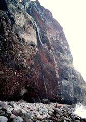 Geologists stand on the narrow cobble beach at the NE base of Sumisujima. Vertical light-colored dikes cut intrusive rocks at the lower right alogn with oxidized tephra layers, breccias, and lava flows forming the pinnacle. The spire is an eroded remnant of the pre-caldera volcano on the outer southern flank of a large submarine caldera. A large segment of the eastern side of the pinnacle previously slumped into the sea.
Copyrighted photo by Kenichiro Tani, 2002 (Japanese Quaternary Volcanoes database, RIODB, http://riodb02.ibase.aist.go.jp/strata/VOL_JP/EN/index.htm and Geol Surv Japan, AIST, http://www.gsj.jp/).
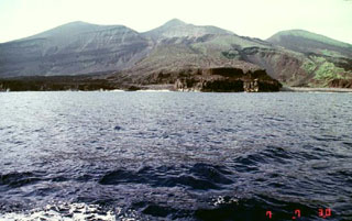 The dark-colored lava flow along the coast in the foreground was emplaced during an eruption that began on 17 August 1939. A new scoria cone (Iwoyama) was constructed in that year at the northern end of the 1902 crater. Two lava flows reached the sea, the first at Hyogowan (the bay to the far right) and the second at Chitose Bay. Two people were killed during the eruption, which ceased at the end of December.
Copyrighted photo by Akira Takada (Japanese Quaternary Volcanoes database, RIODB, http://riodb02.ibase.aist.go.jp/strata/VOL_JP/EN/index.htm and Geol Surv Japan, AIST, http://www.gsj.jp/).
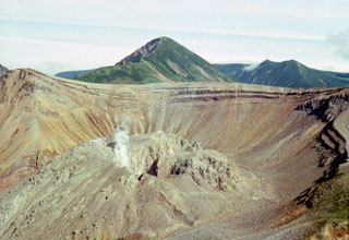 A lava dome partially fills the summit caldera of Berg, with Kolokol in the background to the S. They are part of a group of Holocene volcanoes in central Urup Island that is named after the most prominent cone.
Photo courtesy of Alexandr Rybin (Institute of Marine Geology and Geophysics, Yuzhno-Sakhalin).
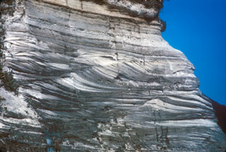 A sequence of pyroclastic surge deposits exposed in a sea cliff on Niijima, in the northern part of the Izu Islands of Japan. These cross-bedded layers were produced during repeated erosion and deposition by multiple pyroclastic surge events. The eruptions accompanied the formation of a lava dome at Mukaijima on the southern part of the island. The flat airfall deposits cap the exposure.
Photo by R.V. Fisher, 1979 (University of California Santa Barbara).
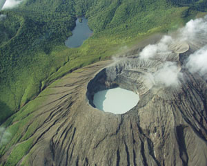 This view from the N looks into the acidic Cráter Activo lake with layered pyroclastic deposits exposed in the SW crater wall. The crater rim of the forested Rincón de la Vieja cone is to the upper left, with the non-volcanic Jilgueros lake at the top.
Photo by Eliecer Duarte (OVSICORI-UNA).
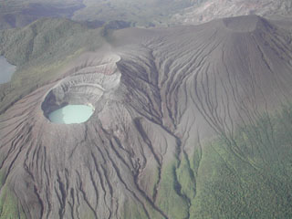 The flanks of Von Seebach cone (upper right) are a result of tephra and acidic gases blown downwind from the lake-filled Cráter Activo (left). Steady trade winds from the NNE distribute gas from Active Crater to the SW, creating the "Dead Zone" that extends down the SW flanks to the upper right.
Photo by Eliecer Duarte (OVSICORI-UNA).
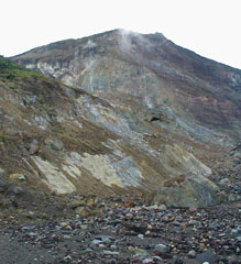 Hydrothermally altered rocks and lava flows are exposed in cliffs on the Irazú upper northern flank. Las Fumaroles (near top center), a thermal area below the cliffs, was the source of an explosive eruption in December 1994 that also produced an avalanche and lahar down the Río Sucio.
Photo by Eliecer Duarte, 2001 (OVSICORI-UNA).
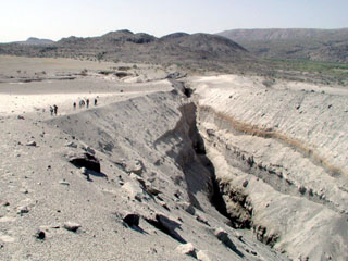 The slopes of Dabbahu volcano in the background are part of a large volcanic massif consisting of obsidian flows, lava domes, cones, and basaltic lava flows constructed on a shield volcano. This view from the N with people for scale shows Da'Ure, a 500-m-long fissure vent formed during the first historical eruption in September 2005. A small dome was formed during the eruption. The central part of the volcano lies farther to the right off the margin of the photo.
Photo by Anthony Philpotts, 2005 (University of Connecticut).
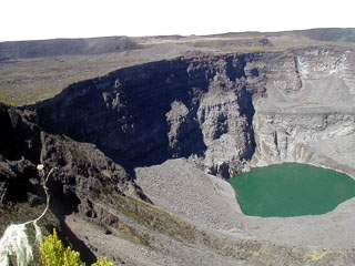 The greenish ~300-m-diameter Chahalé crater lake in the summit caldera complex of Karthala volcano is seen here in August 2003 before an eruption in April 2005. The photo, taken by an automatic camera located at the summit, looks from the NNE towards the SSW. Karthala is the southernmost and largest of the two shield volcanoes forming Grand Comore Island (also known as Ngazidja Island) and contains a 3 x 4 km summit caldera generated by repeated collapse. It has elongated rift zones extending to the NNW and SE.
Photo by Nicolas Villenueve, 2003 (Université de la Réunion).
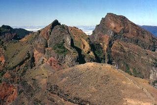 The rugged summit of Pico Ruvio forms the high point of the island of Madeira. This eroded scoria cone complex was erupted during Pliocene-to-Pleistocene rift activity along the axis of the Madeira rift. Dense swarms of dikes, some of which are visible in this image (dark gray bands), are oriented E-W, parallel to the orientation of the rift.
Photo by Paul Bernhardt.
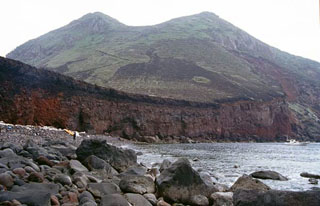 Nishimine, the western peak of Yokoatejima, is seen from the NW with a road visible at the left that reaches the summit crater. Yokoatejima is a small, 3.5-km-long island at the SW end of the Tokara island chain with two peaks, Higashimine to the E and Nishimine to the W. It is a post-caldera cone within a 7 x 10 km submarine caldera. Historical documents at the end of the Edo Period mention ash plumes.
Copyrighted photo by Shun Nakano, 2004 (Japanese Quaternary Volcanoes database, RIODB, http://riodb02.ibase.aist.go.jp/strata/VOL_JP/EN/index.htm and Geol Surv Japan, AIST, http://www.gsj.jp/).
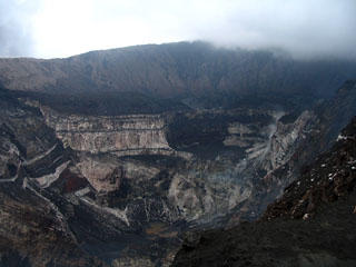 The steep-walled craters of the Marum cone complex at the summit of Ambrym volcano, seen from the east. Ambrym contains a 12-km-wide caldera and is one of the most active volcanoes of the New Hebrides arc. A thick pyroclastic sequence, initially dacitic, then basaltic, overlies lava flows of a pre-caldera shield volcano. Post-caldera eruptions, primarily from Marum and Benbow cones, have partially filled the caldera floor and produced lava flows that ponded on the caldera floor or overflowed through gaps in the caldera rim.
Photo by Karoly Nemeth, 2005 (Massey University).
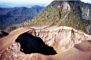 The summit crater of Peuet Sague is part of a large volcanic complex in NW Sumatra. The first recorded historical eruption took place during 1918-21, when explosive activity and pyroclastic flows accompanied summit lava-dome growth. The historically-active crater has typically produced small-to-moderate explosive eruptions.
Copyrighted photo by Michael Thirnbeck, 1997.
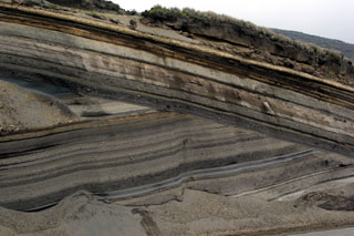 An erosional unconformity cutting diagonally across the center of the photo due to a glacial advance about 20,000-18,000 years ago separates two sequences of late-Pleistocene tephra layers from Ecuador's Chimborazo volcano. A less prominent unconformity below the light-colored tephra layer at the top of the sequence marks a 16,000-14,000 year old glacial advance. This ~12-m-thick exposure lies on the SW flank.
Photo by Lee Siebert, 2006 (Smithsonian Institution).
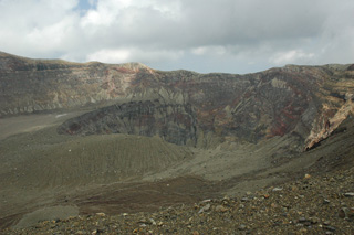 The Santa Ana crater is seen here from the western rim in 2011. Several nested craters have formed across the summit, with a crater lake in the smallest crater in the center of this photo (out of view). Exposed in the crater walls are lava flows and explosive eruption deposits that form the edifice.
Photo by Lis Gallant, 2011.
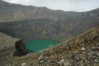 The Santa Ana crater lake is in the smallest and deepest of several nested craters across the summit that formed during successive explosive events, seen here in 2011 from the western side on the terrace level. The acid sulfate-chloride lake has a pH around 1, with an associated subsurface hydrothermal system that releases gases into the water.
Photo by Lis Gallant, 2011.
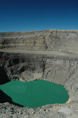 The acidic crater lake of Santa Ana is within the deepest of the nested summit craters, seen here from the S in 2011. The floor of a larger crater is visible across the center of this photo, and both lava flows and deposits from explosive eruptions are exposed in the crater walls.
Photo by Lis Gallant, 2011.
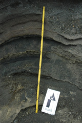 This outcrop within a barranca (ravine) on the western side of the Santa Ana summit area shows explosive deposits from the 2005, 1904, and older eruptions. The different ash and lapilli units have variable grain sizes, an indication of variations in explosivity. The yellow ruler is 72 cm long; photo taken in 2011.
Photo by Lis Gallant, 2011.
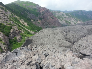 Thick lava flows from Karymsky have been emplaced down the flanks and have partly infilled the Karymsky caldera. The NW caldera wall is seen here in 2014, with oxidized deposits from the older cone exposed.
Photo by Janine Krippner, 2014.
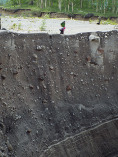 This section within the Sheveluch the block-and-ash flow deposit from 27-28 February 2005 was exposed by the new Baidarnaya river channel along the northern edge of the deposit. The deposit is composed of fragmented lava dome rock and overlies older laminated deposits, seen here in July 2015.
Photo by Janine Krippner, 2015.
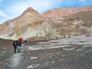 Tourists walk across the Whakaari/White Island crater floor in August 2005. The crater wall behind them is composed of lavas, breccias, and tuff deposits.
Photo by Janine Krippner, 2005.
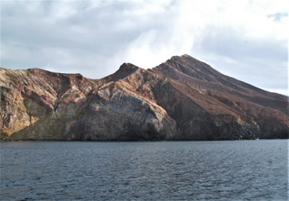 This 22 August 2005 photo shows the E side of the Whakaari/White Island Central Cone showing the exposed stratigraphy of tuff, lava, and breccia units. The gas-and-steam plume rising from the active vent is visible above the flank.
Photo by Janine Krippner, 2005.
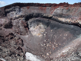 The crater of the Ngāuruhoe scoria cone is seen here from the NW rim on 8 February 2008. The cone formed mainly through a series of Strombolian and Vulcanian eruptions in 1954-55, with the red uppermost scoria unit emplaced in 1974-75.
Photo by Janine Krippner, 2008.


