Global Volcanism Program | Image GVP-09552
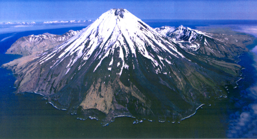
Kanaga is situated within the Kanaton caldera at the northern tip of Kanaga Island. The caldera rim forms a 760-m-high arcuate ridge, which can be seen S and E (left) of Kanaga. The two flows that reach the coast on either side of the sea cliffs in the lower center were produced during an eruptive period from mid-1993 through 1995.
Photo by Chris Nye, 2000 (Alaska Division of Geological & Geophysical Surveys, Alaska Volcano Observatory).
![]() This image is made available as a Public Domain Work, but proper attribution is appreciated.
This image is made available as a Public Domain Work, but proper attribution is appreciated.
Galleries: Stratovolcanoes
Keywords: stratovolcano | island volcano
Kanaga