Global Volcanism Program | Image GVP-10182
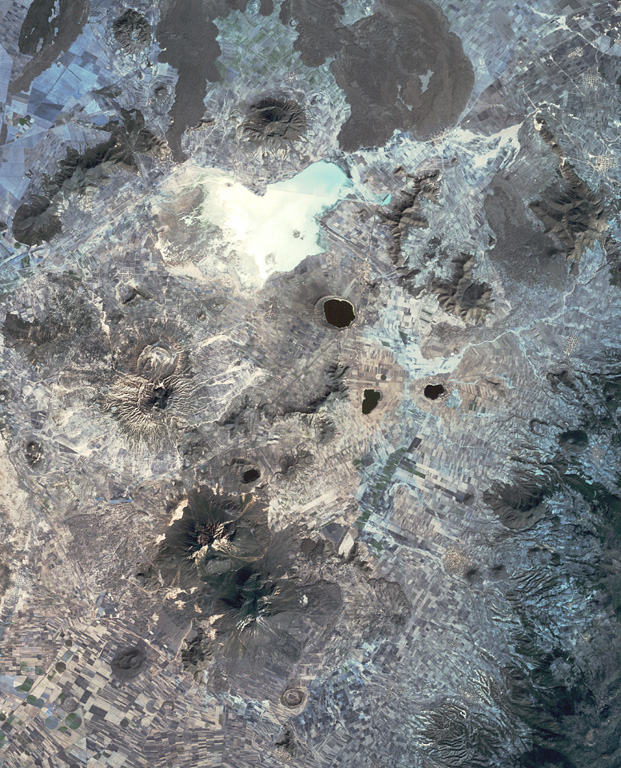
This view of the Serdán-Oriental basin covers about 38 km in a N-S (vertical) direction. The circular peak at the upper center, partially surrounded by young lava flows from Los Humeros caldera, is Cerro Pizarro lava dome. The lake-filled maar to the SSE across the light-colored dry lake basin is Alchichica maar. The erosionally ribbed flanks of Cerro Xalapaxco tuff cone and Cerro Pinto lava dome lie to the SW, and the large forested peaks at the bottom are the the twin Las Derrumbadas lava domes.
NASA Landsat satellite image, 1999 (courtesy of Loren Siebert, University of Akron).
![]() This image is made available under the Creative Commons BY-NC 4.0 license terms.
This image is made available under the Creative Commons BY-NC 4.0 license terms.
Serdán-Oriental