Global Volcanism Program | Image GVP-10277
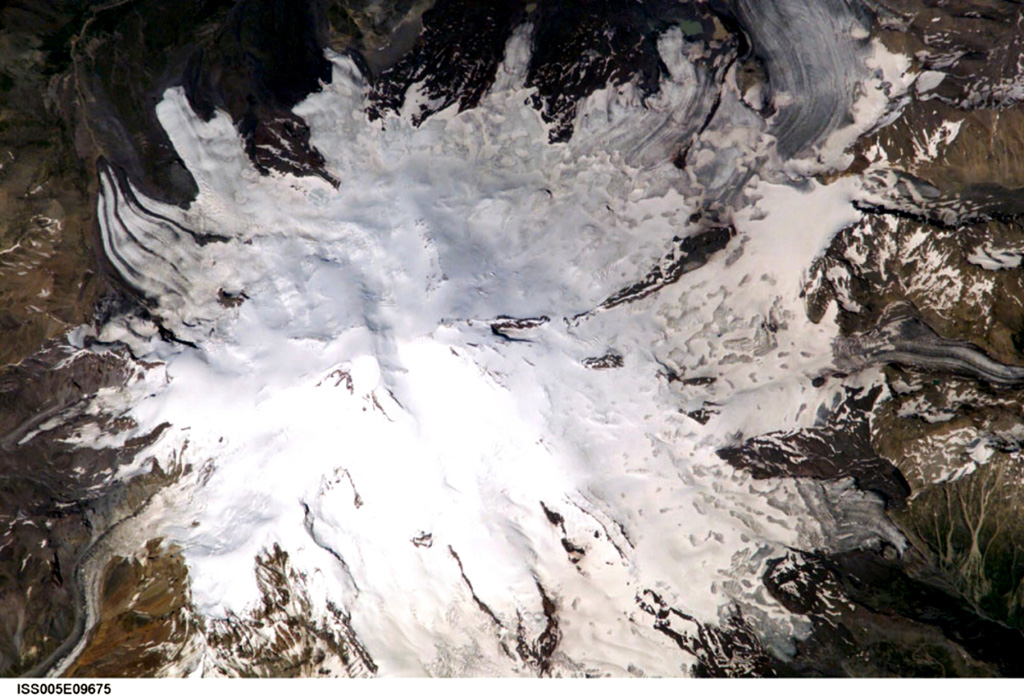
Mount Elbrus, the highest peak of the Caucasus Mountains of SW Russia, contains glaciers on its flanks. Elbrus has two summits separated by a low saddle. Snow-filled craters are visible in this image at both the eastern and western summits. Products of Mount Elbrus cover 260 km2 with its longest lava flow reaching 24 km down the NNE flank. Elbrus has been active into the Holocene. Weak fumarolic activity near the summit continues and hot springs are present on the flanks.
Image courtesy of Earth Sciences and Image Analysis Laboratory, NASA Johnson Space Center, 2002 (http://eol.jsc.nasa.gov).
![]() This image is made available as a Public Domain Work, but proper attribution is appreciated.
This image is made available as a Public Domain Work, but proper attribution is appreciated.
Keywords: stratovolcano

Elbrus