Global Volcanism Program | Image GVP-10496
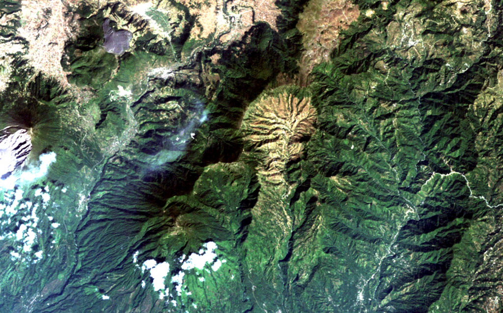
The light-colored, furrowed area at the top-center is the 4-km-wide, 600-m-deep Tzanjuyub caldera, which is breached to the south by the Río Masa. At the SW side of the Pleistocene caldera is Volcán Zunil, which is connected by an irregular ridge to Volcán Santo Tomás, a large eroded stratovolcano above the clouds at the bottom of the image. Santa María volcano (far left-center) lies across the Río Samalá to the east. Solfataras and thermal springs are located on the west side of the ridge between Santo Tomás and Zunil.
NASA Landsat image, 2000 (courtesy of Loren Siebert, University of Akron).
![]() This image is made available under the Creative Commons BY-NC 4.0 license terms.
This image is made available under the Creative Commons BY-NC 4.0 license terms.
Santo Tomás-Zunil