Global Volcanism Program | Image GVP-10497
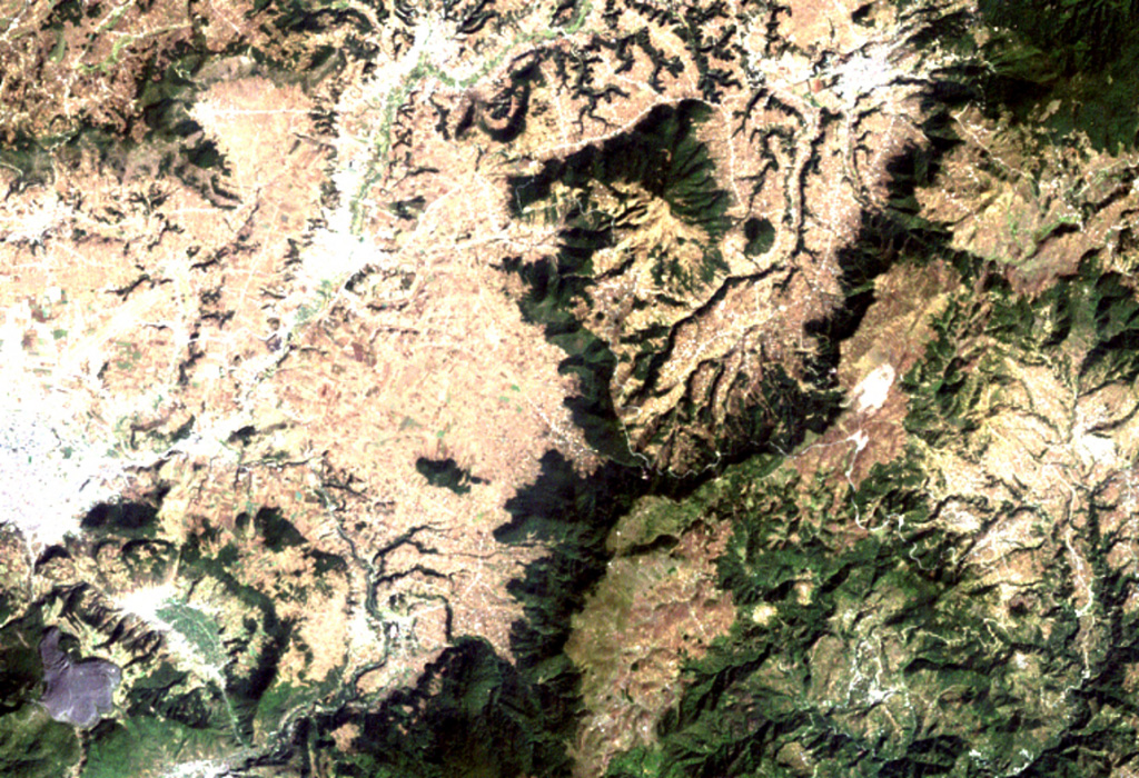
The triangular dark-green area (top-center) is the Cuxliquel lava-dome complex, lying within a semi-arcuate depression near the city of Totonicapán (upper right). The small green circle below and to the right of the larger dome complex is Cerro de Oro, a small symmetrical lava dome. The Río Samalá traces an arcuate path around the Quaternary dome complex beginning on its SE side (center) and progressing around to the north and then to the SW (bottom left). The white-colored area (left-center margin) is the city of Quetzaltenango.
NASA Landsat image, 2000 (courtesy of Loren Siebert, University of Akron).
![]() This image is made available under the Creative Commons BY-NC 4.0 license terms.
This image is made available under the Creative Commons BY-NC 4.0 license terms.

Cuxliquel