Global Volcanism Program | Image GVP-10595
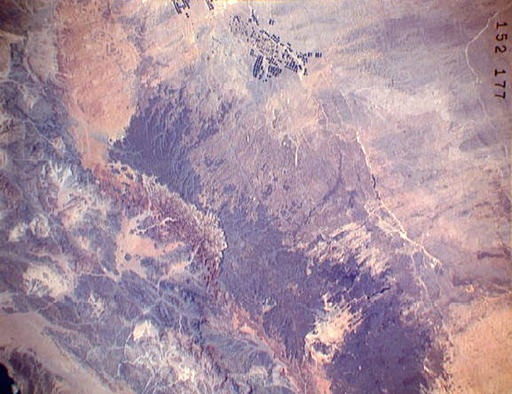
The darker-colored area extending diagonally down the center of this Space Shuttle image is Harrat ar Rahah, the northernmost of a series of Quaternary volcanic fields paralleling the Red Sea coast of Saudi Arabia. The geometrical outlines of the historical town of Tabuk (top center), located on the road leading from Hijr to Damascus, can be seen to the N. There are fewer young volcanoes in Harrat ar Rahah than in other harrats (lava fields) to the S.
NASA Space Shuttle image STS37-152-177, 1991 (http://eol.jsc.nasa.gov/).
![]() This image is made available as a Public Domain Work, but proper attribution is appreciated.
This image is made available as a Public Domain Work, but proper attribution is appreciated.
Galleries: Volcanic Fields
Keywords: volcanic field | lava flow | remote sensing
Harrat ar Rahah-'Uwayrid