Image GVP-10754
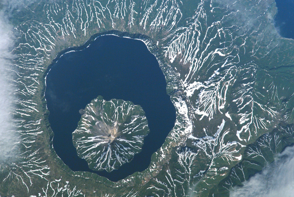
Snow remnants highlight dendritic drainages eroded into pyroclastic flow deposits on the flanks of Tao-Rusyr caldera on Onekotan Island in this NASA Space Shuttle image (with N to the left). The 7.5-km-wide caldera formed about 7,500 years ago during the eruption of 30-35 km3 of tephra, producing one of the largest Holocene eruptions of the Kuril Islands. Subsequently, Krenitzyn Peak was constructed in the NW part of the caldera, reaching a height well above the caldera rim.
NASA International Space Station image ISS005-E-6518, 2002 (http://eol.jsc.nasa.gov/).
![]() This image is made available as a Public Domain Work, but proper attribution is appreciated.
This image is made available as a Public Domain Work, but proper attribution is appreciated.
Galleries: Calderas
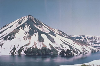
Tao-Rusyr Caldera