Global Volcanism Program | Image GVP-11120
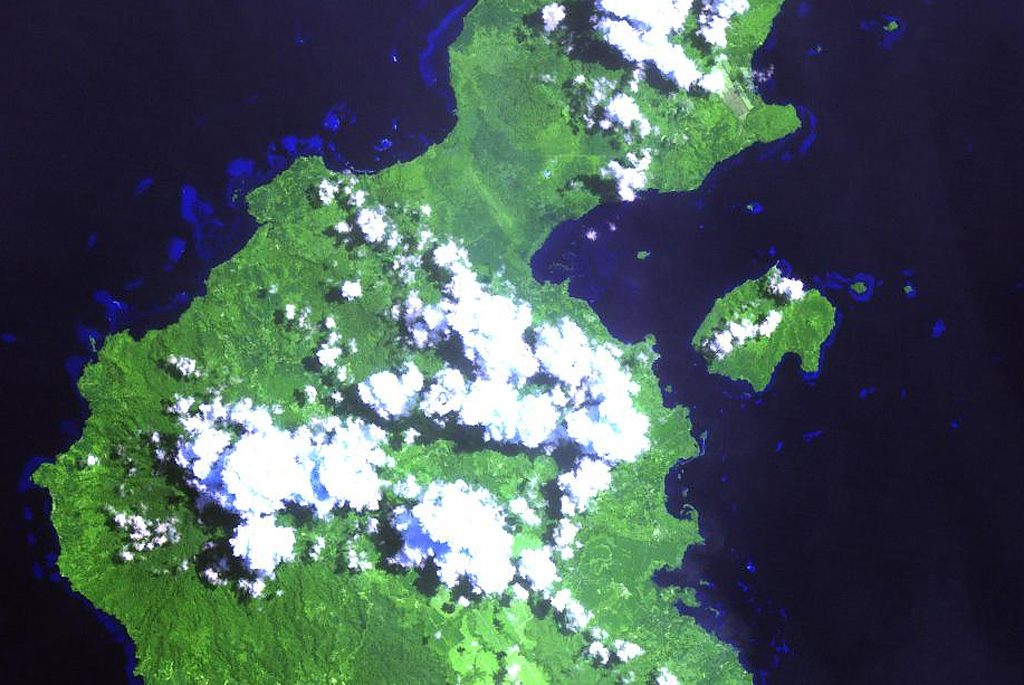
The Garua (Talasea) Harbour volcanic field (upper right center) consists of a group of mostly rhyolitic lava domes and ash cones that ring the harbor on the west and form Garua Island (right center) to the east. Active hot springs ring the shores of Garua Harbour, including a large group of boiling pools, fumaroles, and mudpots located near the Talasea Government Station on the south shore of the bay, directly opposite the western tip of Garua Island.
NASA Landsat image, 2000 (courtesy of Hawaii Synergy Project, Univ. of Hawaii Institute of Geophysics & Planetology).
![]() This image is made available as a Public Domain Work, but proper attribution is appreciated.
This image is made available as a Public Domain Work, but proper attribution is appreciated.

Garua Harbour