Global Volcanism Program | Image GVP-11171
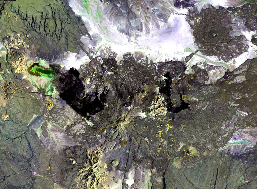
Gabillema is located along the axis of the Addado graben. The summit of the volcano lies below and to the left of the center of this Landsat image. Rhyolitic lava domes are on the flanks of the volcano and a 5 x 17 km basaltic lava field covers the Ado Bad Plain (Ado Lake) N of the volcano, originating from a broad area of fissure vents and spatter cones on the N side.
NASA Landsat image, 1999 (courtesy of Hawaii Synergy Project, Univ. of Hawaii Institute of Geophysics & Planetology).
![]() This image is made available as a Public Domain Work, but proper attribution is appreciated.
This image is made available as a Public Domain Work, but proper attribution is appreciated.
Keywords: remote sensing

Gabillema