Global Volcanism Program | Image GVP-11521
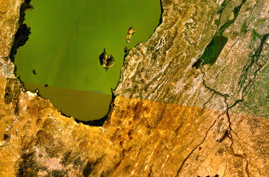
A large area of Holocene cinder cones and lava flows lies immediately east and south of Zway Lake (bottom) and forms islands along its eastern shore in this NASA Landsat mosaic (with north to the top). Faulting along the East Zway segment of the Wonji Fault Belt is seen cutting horizontally across the bottom of the image. The dark-colored Alutu volcanic complex lies the lower left. The 15 x 30 km wide Zway (also spelled Zwai, Zeway, or Ziway) lake occupies the central Ethiopian Rift.
NASA Landsat 7 image (worldwind.arc.nasa.gov)
![]() This image is made available as a Public Domain Work, but proper attribution is appreciated.
This image is made available as a Public Domain Work, but proper attribution is appreciated.

East Ziway