Global Volcanism Program | Image GVP-11925
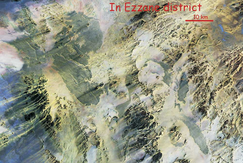
This NASA Landsat Thematic Mapper mosaic shows the In Ezzane volcanic field along the border region of Algeria and Niger. The In Ezzane volcanic field, with lava fields appearing blue-gray in this image, covers about 500 km2 at the eastern end of Hoggar (Ahaggar) volcanic province. This poorly known and isolated volcanic field erupted through basement rocks at the western end of the Saharan meta-craton.
NASA Landsat Thematic Mapper mosaic by Jean-Paul Liégeois (Africa Museum, Belgium).
![]() This image is made available under the Creative Commons BY-NC 4.0 license terms.
This image is made available under the Creative Commons BY-NC 4.0 license terms.
Galleries: Volcanic Fields
Keywords: remote sensing | volcanic field
In-Ezzane Volcanic District