Global Volcanism Program | Image GVP-11953
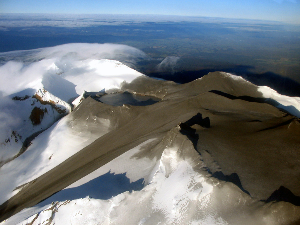
An aerial view of the summit of Ruapehu from the NE on 26 September 2007 show the effect of a brief eruption the previous day. The eruption originated from Crater Lake (left-center), and ejected ash and mud that covered much of the summit area. A large lahar swept down the Whangaehu glacier to the left and a smaller lahar exited the low point on the rim of Crater Lake and descended the narrow gully above the larger lahar.
Photo courtesy of GeoNet, 2007 (Global Volcanism Network Bulletin).
![]() This image is made available under the Creative Commons BY-NC 4.0 license terms.
This image is made available under the Creative Commons BY-NC 4.0 license terms.
Galleries: Stratovolcanoes | Lahars
Keywords: stratovolcano | lahar | crater lake | crater | deposit

Ruapehu