Global Volcanism Program | Image GVP-12042
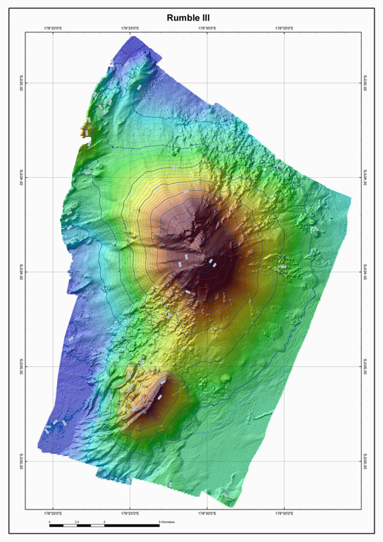
The Rumble III seamount, the largest of the Rumbles group along the South Kermadec Ridge, rises 2,300 m from the sea floor to within about 200 m of the sea surface. Edifice collapse has left a large horseshoe-shaped scar breached to the W. Fresh-looking andesitic rocks have been dredged from its summit and basaltic lava from its flanks. Rumble III has been the source of several submarine eruptions detected by hydrophone signals.
Courtesy of Ian Wright (National Institute of Water and Atmospheric Research (NIWA), Wellington, New Zealand).
![]() This image is made available under the Creative Commons BY-NC-ND 4.0 license terms.
This image is made available under the Creative Commons BY-NC-ND 4.0 license terms.
Keywords: submarine volcano | stratovolcano | remote sensing | technology | DEM | map | bathymetry
Rumble III