Global Volcanism Program | Image GVP-12153
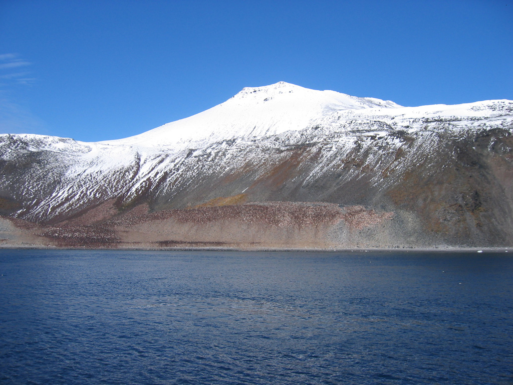
Paulet Island, seen here from the northwest, is a 1.8 x 2.2 km island located east of the tip of Graham Land Peninsula. A basal sequence of horizontal lava flows exposed in steep cliffs is capped by a well-preserved cinder cone complex (top center) with a small distinct summit crater. The darker brownish areas near and above the shoreline at the center of the photo are Adelie penguin colonies.
Photo by Jeff Post, 2007 (Smithsonian Institution).
![]() This image is made available under the Public Domain Dedication CC0 license, but proper attribution is appreciated.
This image is made available under the Public Domain Dedication CC0 license, but proper attribution is appreciated.
Keywords: stratovolcano
Paulet