Global Volcanism Program | Image GVP-12205
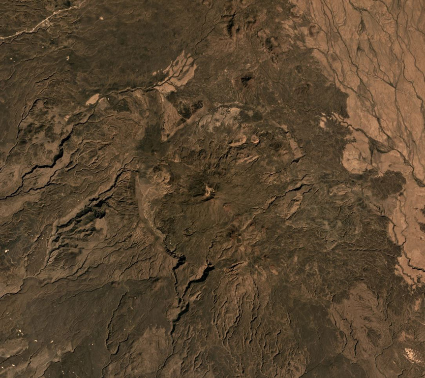
Asavyo (also called Bara’Ale) is at the southern end of the Nabro Volcanic Range between the Danakil Depression and the Red Sea, and is seen in the center of this 2019 Planet Labs satellite image mosaic (N at the top). The 6 x 7.5 km caldera rim is visible here, with a cone in the center that produced lava flows that have infilled the depression.
Satellite image courtesy of Planet Labs Inc., 2019 (https://www.planet.com/).
Copyrighted image used with permission. All Rights Reserved. Contact photographer for any usage requests.
Galleries: Calderas
Keywords: caldera
Asavyo