Global Volcanism Program | Image GVP-12234
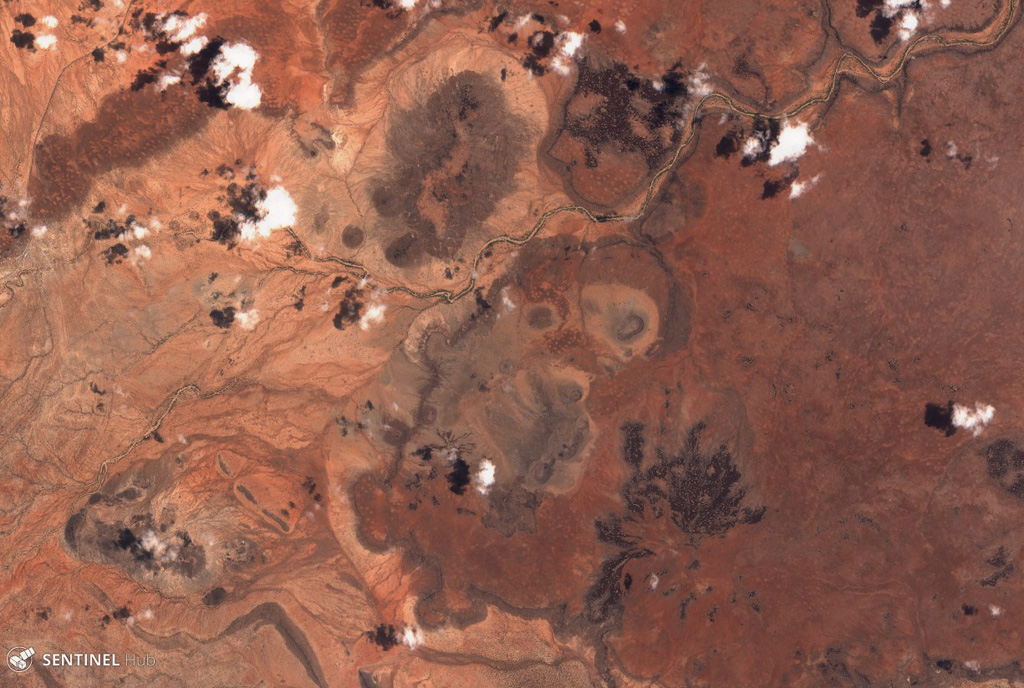
Part of the Segererua Plateau is shown in this 21 September 2019 Sentinel-2 satellite image (N is at the top; the image is approximately 23 km across). The plateau contains lava flows, maars, and craters along an area approximately 50 km in length. Several craters are visible across this image.
Satellite image courtesy of Copernicus Sentinel Data, 2019.
![]() This image is made available under the Creative Commons BY-SA 4.0 license terms.
This image is made available under the Creative Commons BY-SA 4.0 license terms.
Segererua Plateau