Global Volcanism Program | Image GVP-12284
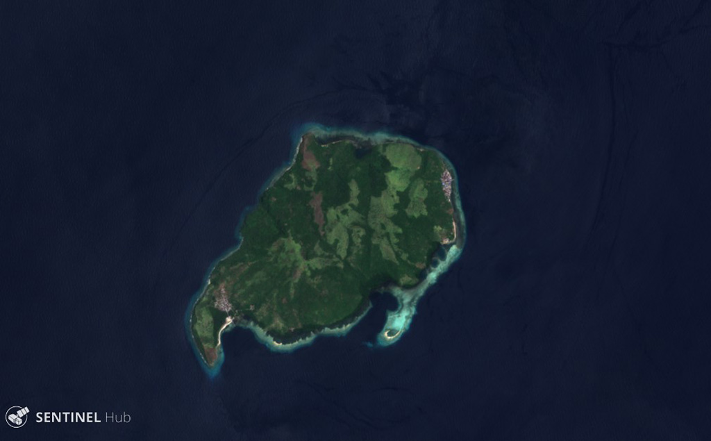
Mare is shown in this 28 September 2018 Sentinel-2 satellite image (N is at the top). It is part of a chain of volcanic islands alongside Halmahera, Indonesia, and is between Tidore to the north and Moti to the south. The maximum diameter of the island is approximately 4 km.
Satellite image courtesy of Copernicus Sentinel Data, 2018.
![]() This image is made available under the Creative Commons BY-SA 4.0 license terms.
This image is made available under the Creative Commons BY-SA 4.0 license terms.
Keywords: island volcano
Mare