Global Volcanism Program | Image GVP-12431
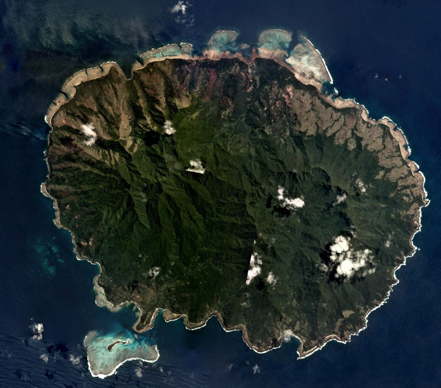
Aneityum Island is approximately 17 km long in the NE-SW direction, shown in this September 2019 Planet Labs satellite image monthly mosaic (N is at the top). Two main eroded edifices form the island, Nanawarez in the E and Inrerow Atamwan to the W, with a large horseshoe-shaped scarp that opens to the SE visible on Nanawarez.
Satellite image courtesy of Planet Labs Inc., 2019 (https://www.planet.com/).
Copyrighted image used with permission. All Rights Reserved. Contact photographer for any usage requests.
Keywords: erosion
Aneityum