Global Volcanism Program | Image GVP-12542
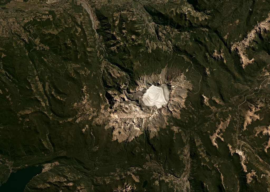
The 4-km-wide Sollipulli caldera contains over 500 m of ice (593 m measured in 2011) and overlaps an older caldera on the left in the center of this Planet Labs satellite image monthly mosaic (N is at the top; this image is approximately 40 km across). Around the caldera rim eruptions have formed lava flows, coulées, and domes, and on the SW rim is the 1-km-wide Alpehué crater. The Alpehué geyser field is on the SW flank near the summit area and recent scoria cones are on the NE flank.
Satellite image courtesy of Planet Labs Inc., 2019 (https://www.planet.com/).
Copyrighted image used with permission. All Rights Reserved. Contact photographer for any usage requests.
Galleries: Calderas
Keywords: caldera
Sollipulli