Global Volcanism Program | Image GVP-12564
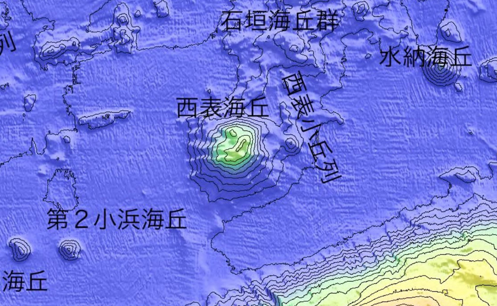
A submarine volcano is located approximately 20 km offshore NNE of Iriomotejima, shown in this bathymetric map by the Japan Coast Guard. On 31 October 1924 an eruption produced a pumice raft that eventually reached Japan.
Courtesy of Japan Coast Guard.
![]() This image is made available under the Creative Commons BY-NC 4.0 license terms.
This image is made available under the Creative Commons BY-NC 4.0 license terms.
Galleries: Submarine Volcanoes
Keywords: submarine volcano | map | bathymetry
Submarine Volcano NNE of Iriomotejima