Global Volcanism Program | Image GVP-12584
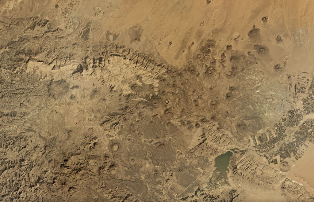
The Jabal Haylan volcanic field comprises scoria cones and tuff rings and associated lava flows across a 75-km-long area, with a portion of the field shown in this Planet Labs satellite image monthly mosaic (N is at the top; this image is approximately 52 km across). The chain crosses a NW-SE-trending fault that with visible offset in this image. Many of the cones and rings have experienced flank collapse, rafting, or erosion, leaving amphitheater-shaped craters. Some tuff rings appear to have lava domes that have formed within the crater.
Satellite image courtesy of Planet Labs Inc., 2019 (https://www.planet.com/).
Copyrighted image used with permission. All Rights Reserved. Contact photographer for any usage requests.
Keywords: tuff ring | volcanic field | scoria cone

Jabal Haylan