Global Volcanism Program | Image GVP-12601
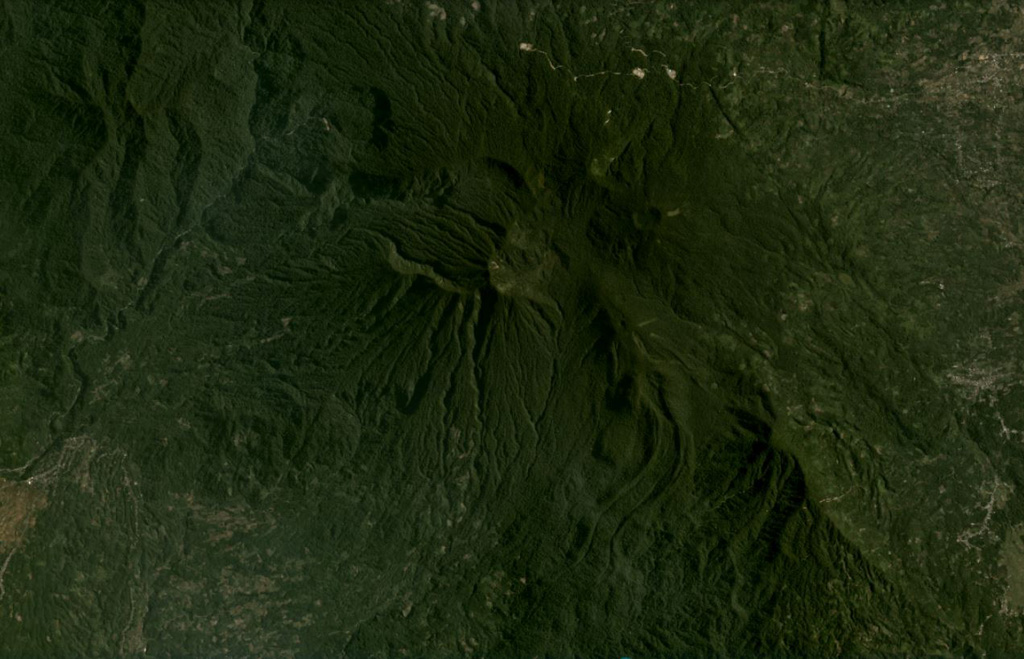
Bukit Daun has a complex summit with several peaks, and a possible landslide scarp on the upper western flank, seen in this August 2020 Planet Labs satellite image monthly mosaic (N is at the top; this image is approximately 22 km across). A crater on the eastern side of the summit area contains Telapak lake and to the south is a lava flow with levees and pressure ridges visible through the vegetation.
Satellite image courtesy of Planet Labs Inc., 2020 (https://www.planet.com/).
Copyrighted image used with permission. All Rights Reserved. Contact photographer for any usage requests.
Keywords: lava flow | scarp | crater | levee
Bukit Daun