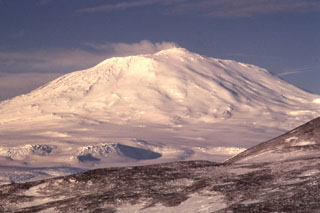
Report on Erebus (Antarctica) — January 1991
Bulletin of the Global Volcanism Network, vol. 16, no. 1 (January 1991)
Managing Editor: Lindsay McClelland.
Erebus (Antarctica) Lava lake activity continues; remote camera documents strong explosion
Please cite this report as:
Global Volcanism Program, 1991. Report on Erebus (Antarctica) (McClelland, L., ed.). Bulletin of the Global Volcanism Network, 16:1. Smithsonian Institution. https://doi.org/10.5479/si.GVP.BGVN199101-390020
Erebus
Antarctica
77.53°S, 167.17°E; summit elev. 3794 m
All times are local (unless otherwise noted)
"A team from New Mexico Tech visited the summit of Mt. Erebus 12-25 January 1991. Activity remained similar to that observed over the last three years. Two small convecting anorthoclase phonolite lava lakes were present, in positions similar to last year's, although minor changes in the size, shape, and positions of the lakes have occurred. The area of exposed convecting lava on the surface of the lakes probably exceeds that observed in December 1989. During a one-day visit on 26 December 1990, a small ash eruption was observed, feeding a cloud that rose several hundred meters above the crater rim. A light dusting of ash was apparent on the snow around the rim in January 1991. These minor ash eruptions appear to be related to vent clearing from the 'Active Vent' adjacent to the lava lakes. This vent has been inactive for the last few years, but was the site of frequent (1-6/day) small Strombolian eruptions from 1972 to 1984. A few fresh (<2 weeks old) bombs were found on the crater rim in January 1991. These are the first new bombs to be found on the rim in three years and suggest an increase in explosive activity. COSPEC measurements of SO2 emissions were about 70 t/d on 13 January, and similar values were measured on five other days.
"In March 1990, a remote video camera operated by R. Dibble (Victoria Univ, New Zealand) recorded a larger-than-normal eruption that temporarily consumed the two lava lakes. Bombs from the eruption were still falling up to 25 seconds after the initial explosion. [Although bombs from this activity are likely to have reached the rim, rapid alteration by the gas plume makes new bombs indistinguishable from older ones within a few weeks.] The camera was removed from the crater rim in December 1990. A 6-station seismic array on Mt. Erebus showed no anomalous activity during 1990."
Geological Summary. Mount Erebus, the world's southernmost historically active volcano, overlooks the McMurdo research station on Ross Island. It is the largest of three major volcanoes forming the crudely triangular Ross Island. The summit of the dominantly phonolitic volcano has been modified by one or two generations of caldera formation. A summit plateau at about 3,200 m elevation marks the rim of the youngest caldera, which formed during the late-Pleistocene and within which the modern cone was constructed. An elliptical 500 x 600 m wide, 110-m-deep crater truncates the summit and contains an active lava lake within a 250-m-wide, 100-m-deep inner crater; other lava lakes are sometimes present. The glacier-covered volcano was erupting when first sighted by Captain James Ross in 1841. Continuous lava-lake activity with minor explosions, punctuated by occasional larger Strombolian explosions that eject bombs onto the crater rim, has been documented since 1972, but has probably been occurring for much of the volcano's recent history.
Information Contacts: P. Kyle, New Mexico Institute of Mining and Technology.

